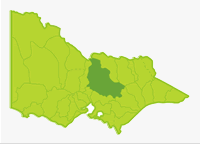
Goulburn
- Acheron River
- Arboretum Dam
- Bartlett Lake
- Big River
- Brankeet Creek
- Cooper Lake
- Corop Lakes
- Creightons Creek
- Crystal Creek
- Cummins Reserve Lake
- Darbyrminga Creek
- Delatite River
- Eildon Lake
- Eildon Pondage
- Enoch Point Creek
- Gaffneys Creek
- Gerar Creek
- Golf Course Dam
- Goulburn River
- Goulburn Weir
- Greens Lake
- Home Creek
- Howqua River
- Hughes Creek
- Jamieson River
- Kalatha Creek
- King Parrot Creek
- Little River
- Loch Garry
- Marysville Lake
- Merton Creek
- Murray River (NSW)
- Murrindindi River
- Nagambie Lake
- Royston River
- Rubicon River
- Seven Creeks
- Snobs Creek
- Steavenson River
- Stewart Creek
- Sugarloaf Creek
- Sunday Creek
- Taggerty Creek
- Tahbilk Lagoon
- Taponga River
- Trawool Reservoir
- Victoria Lake
- Wakiti Creek
- Waranga Reservoir
- Yea River
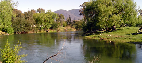
The Basin extends for 200 km from steep hills and mountains in the Hume Range and Great Dividing Range northward through the Murray Plain. There are extensive forests of very tall Mountain Ash and mixed species in the mountains south of Eildon. In this area, the rivers are clear, cold and fast flowing with gravel and rubble substrates and could be described as typical trout streams. There has been a decade of below average rainfall, resulting in well below average stream flows. Large areas of riffles, vital as rearing habitat for fry and juvenile fish, would have been unavailable to biota. In 2006/07 there was a severe bush fire in the catchment of rivers flowing into Lake Eildon. This resulted in loss of bank vegetation, increased sedimentation of the streambed and increased water turbidity. Trout would be the species most sensitive to these environmental changes. However a survey of fish present in alpine streams flowing into Lake Eildon, by the department (2007/08), found that out of 15 sites surveyed, trout were still present at all but one site. The Howqua and Upper Goulburn rivers were in the best condition with good trout populations. This was confirmed by anglers who were fishing these waters in 2008.
Further north the Basin has been cleared for farmland with isolated patches of forest and an area of intensive irrigation and cropping north of Waranga Reservoir. Mean annual rainfall is highest (700-1,400+ mm) in the mountains south of Lake Eildon but decreases northward to 400-500 mm at the Murray River. Lake Eildon captures most of the flow originating in the southern mountains and together with Goulburn Weir, now control the flow in the Goulburn River.
The natural flow regime (52% of annual flow July-September and 5% January-March) has been altered by irrigation releases resulting in lower winter/spring flows (now 33% in July-September) and higher summer flows (now 23% in January-March). This has changed a large section of the Goulburn River downstream of Lake Eildon from a 'native fish water' into a 'tailrace trout fishery'. Surface water quality is good with only slightly increased salinity in the Murray Plain lowland area and some bacterial contamination from livestock and urban wastes. Water quality is excellent for aquatic biota.
Fishing Opportunities and Access Maps
Freshwater Fish in the Basin
Native species
- (Large fish): Bony bream, golden perch, Murray cod, Murray spiny crayfish, freshwater catfish, silver perch, Macquarie perch and trout cod.
- (Small fish): Australian smelt, barred galaxias, blackfish, flathead galaxias, mountain galaxias, Murray River rainbowfish, southern pygmy perch and western carp gudgeon
Introduced species
- Brown trout, European carp, goldfish, eastern gambusia, rainbow trout, redfin, roach, and tench.
Native species in bold are protected in this Basin. Introduced species in bold are declared noxious.
The smaller-sized fish species are not captured by anglers or during most netting or electrofishing surveys in deep water. They are probably more widespread and abundant than surveys indicate.
Management
See Introduction for information on management agencies and programs.
The Victorian Fisheries Authority
- manages stocking, fisheries policy, compliance with fisheries regulations and angler contact
- Fisheries Management Plan (FMP) (a recent project that provides recreational anglers, government agencies and other stakeholders with clear guidance on fisheries management issues with a regional area over a five year period).
Fisheries Victoria in 2009 started to develop the new Goulburn Broken Fishery Management Plan. This new plan will provide for sustainable management of recreational fisheries in the rivers, lakes and impoundments located within the boundaries of the Goulburn Broken Catchment Management Authority for at least the next five years. This plan is expected to be completed in 2010. - Stocking Program (stocking plans for desirable species are based on an approved Victorian Fisheries Authority stocking policy and are reviewed annually via Vic Fish Stock). Eildon Lake, Goulburn River, Bartlett Lake, Greens Lake, Loch Garry, occasionally Victoria Lake, Seven Creeks and Waranga Reservoir, are stocked with native fish. Salmonids are stocked into Arboretum Dam, Bartlett Lake, Cummins Reserve Lake, Eildon Lake, Eildon Pondage, Golf Course Dam, Marysville Lake, and occasionally into Trawool Reservoir. The other rivers carry self-supporting trout populations.
Up-to-date information on numbers and size of each species stocked can be found under Fish Stocking in the Fisheries and Aquaculture section of this website or in the annual Vic Fish Stock Report published by the department. - Family Fishing Lakes Program (an ongoing project of stocking small waters within urban areas with larger trout, for junior and disabled anglers. See Introduction for further information).
The following Family Fishing Lakes; Arboretum Dam, Cummins Reserve Lake, Marysville Dam and Golf Course Dam are stocked with rainbow trout. See details in angling waters. - Victorian Stream Classification (a project that was completed in November 2010, which classifies each water as a native, salmonid or mixed fishery). Classifications relevant to this basin are:
- Trout -
- Goulburn River and tributaries upstream of Molesworth to Eildon.
- King Parrot Creek upstream of Flowerdale.
- Eildon Pondage.
- Delatite, Howqua, Jamieson, Big, Taponga, Rubicon, Acheron, Steavenson rivers and tributaries.
- Murrindindi River upstream from Devlin's Bridge area.
- Goulburn River above Lake Eildon.
- All other Lake Eildon tributaries not mentioned elsewhere.
- Mixed -
- Goulburn River upstream from Yea River to Molesworth Bridge.
- Howqua River downstream from the Mansfield-Jamieson Road Bridge.
- Jamieson River downstream from Jamieson.
- Lake Eildon and Goulburn Weir.
- Yea River downstream of Devlin's Bridge.
- Murrindindi River downstream of Devlin's Bridge.
- King Parrot Creek, downstream of Flowerdale to Strath Creek.
- Hughes Creek upstream of Tarcombe.
- Delatite River downstream of Mansfield-Jamieson Road and Jamieson River downstream of Mitchells Track.
- Native -
- Goulburn River from Yea River to the Murray.
- Seven Creeks from the Goulburn to Galls Gap Bridge.
- King Parrot Creek, downstream of Strath Creek.
- Sunday Creek, Mollisons Creek and tributaries.
- Majors Creek and all other waters downstream of Seymour not mentioned elsewhere.
- Some small headwater streams of the Howqua, Goulburn, Rubicon, Taponga, Acheron, Torbreck and Yea rivers and Hughes Creek in recognition of threatened species (see map).
- Trout -
- Premier Lakes - Five Family Fishing Lakes in the State have been selected as Premier Lakes. They will have easy access for all anglers and be provided with facilities such as toilets, BBQs, picnic tables and playground equipment to encourage families and new anglers to go fishing. They will be stocked with large (>1 kg) rainbow trout, (see Introduction). The Premier Lake in this basin is Eildon Pondage.
- Premier Rivers - Three river sections in Victoria have been selected as Premier Rivers. They have been selected for their existing high recreational fisheries values and will be provided with improved access and other facilities to assist anglers. Information packages will be developed for each river to increase awareness of the fishing opportunities and facilities available, (see Introduction). The Premier River in this Basin is the section of the Goulburn River from Eildon Pondage to Alexandra and from Murchison to Loch Garry.
Department of Sustainability & Environment (DSE)
- the Freshwater Ecology Group carries out fisheries research.
- National Trout Cod Recovery Program (a national project to restore trout cod populations in waters within their natural range). Currently a stocking program of trout cod by DSE into the lower reaches of the Goulburn River and Seven Creeks is showing promising results. Restoration of habitat in Seven Creeks is also occurring.
Goulburn Broken Catchment Management Authority
- is responsible for catchment management and the Victorian River Health Program.
- Victorian River Health Program (an on-going state government initiative to achieve healthy rivers, streams and floodplains). There has been increased environmental flow in some reaches of the Goulburn River under the Environmental Water Reserve Program. Various projects on the Delatite River, upper Goulburn River, Goulburn River downstream of the Pondage, King Parrot Creek, Rubicon River, Seven Creeks, Jamieson River and Howqua River have been completed or are underway. See Angling Waters.
Goulburn Murray Rural Water
- manages irrigation, domestic and stock, and some bulk water supply services also development of Stream Flow Management Plans.
- Stream Flow Management Plans (an ongoing project in which various agencies and water user's develop a flow sharing arrangement which ensures an adequate environmental flow allocation for each river in Victoria). A draft Stream Flow Management Plan has been completed for the Yea River and King Parrot Creek.
Goulburn Valley Water
- manages regional urban water demand.
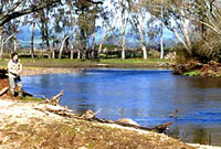
Best Fishing Waters
Lake Eildon | Trout, redfin, Murray cod, golden perch |
Eildon Pondage | Brown trout & rainbow trout, Murray spiny crayfish |
Goulburn River | Brown trout, rainbow trout |
Goulburn River | Murray cod, golden perch, Murray spiny crayfish |
Special Values
Heritage River Areas
The Goulburn River (from Lake Eildon to the Murray River), the Howqua River (from the junction of the north and south branches to Lake Eildon), and the Big River (from the junction of Spring and Oaks creeks to the junction of Fryer Creek and Big River Arm at Lake Eildon), have been listed.
Representative Rivers
Cornella Creek is a Representative River for East Victorian dissected uplands, riverine plains.
Natural Catchment Area
Williams Creek on the Upper Goulburn River has been listed.
Threatened Species
Ten species in this Basin (Murray cod, Macquarie perch, Murray hardyhead, Murray River rainbowfish, trout cod, freshwater catfish, flathead galaxias, barred galaxias, silver perch and Murray spiny crayfish) are threatened species in Victoria. The list of Victorian threatened species, with their national conservation value, scientific names and explanation of their conservation status category, is available on the DSE web site (Department of Sustainability and Environment [DSE] Dec 2007.
Species in bold type and the Lowland Riverine Fish Community of the Southern Murray-Darling Basin are also listed under the Flora and Fauna Guarantee Act 1988. ) and cannot be taken or kept without an order, licence or permit. Such an order by the Governor in Council allows anglers to take Murray cod and Murray spiny crayfish.