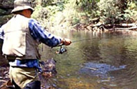
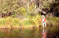
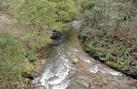
Goulburn - Angling Waters
View Goulburn River Basin in a larger map
The above map is provided by Google. The department accepts no responsibility for its accuracy or content.
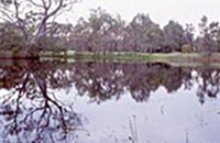
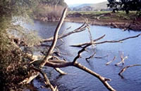
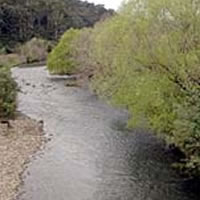
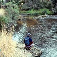
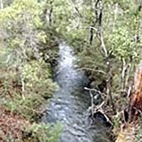
Acheron River, Buxton
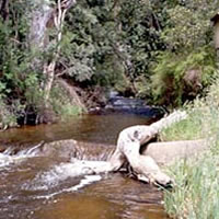
Rises in the Yarra Ranges and flows for 20 km through native forest to Narbethong. This section of the headwaters has a channel width of 3-7 m with fast-flowing water in mostly shallow (30 cm) riffles, some rapids and small pools 70-100 cm deep. Substrate is gravel and rubble. It is very accessible from the Acheron Way, which runs from Warburton to the Maroondah Highway near Marysville. Overhanging bank vegetation restricts access along the river and also some fishing methods such as fly fishing. However the best trout fishing is in this section.
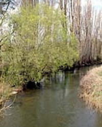
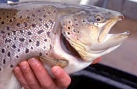
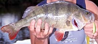
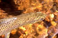
Flows through farmland downstream of Buxton but still has good native riparian vegetation. Channel width is around 8 m becoming 22 m near its junction with the Goulburn River. Substrate is rubble and gravel with some sedimentation in the pools particularly in the lower reaches. There are extensive runs with short riffles and pools and gutters to around 100 cm deep. Contains small brown trout average 160 g upstream of Narbethong, with larger fish to 1.3 kg (av.300 g) downstream of Buxton, also small blackfish, tench, mountain galaxias, barred galaxias and occasional rainbow trout to 450 g. Some large redfin in the lower reaches. Water is usually slightly turbid.
Access to the river downstream of Narbethong is available from several crossroads such as Nichols Road, Passing Road and particularly Dyes Lane where there is a small picnic area (no facilities) and good public access to the river. Not stocked because it has a self-sustaining brown trout population and is also a spawning stream for trout from the Goulburn River. A popular trout water.
Arboretum Dam, Euroa
Family Fishing Lake. Located south of Euroa. Off-road parking but no facilities.
Can drive to waters edge. Grassy banks with scattered eucalypts.
Managed as a Family Fishing Lake and subject to stocking with advanced yearling rainbow trout (see Introduction).
Bartlett Lake, Tatura
A small ornamental lake set in parkland near the primary school. Stocked with golden perch when water conditions are favourable, (no stocking in 2007/08 but listed for 2009). Stocked regularly with golden perch.
Big River, Enoch Point
Flows in a steep, narrow, forested valley into Lake Eildon. Substrate is mostly granite bedrock, with boulders and rubble and some gravel and sand banks in some pools. It has shallow pools (less than 100 cm) and cascades and rapids in the upper reaches. Downstream of Enoch's Point, it becomes a large river (average width 10 m) with pools more than 100 cm deep and with a considerable number of snags present. It has excellent habitat for trout and provides good fishing. Accessible via Enoch Point Road and by forestry tracks with 4WD in dry weather. There is a camping ground at Enoch Point.
Also readily accessible in the lower reaches by road and by boat from Lake Eildon. A popular trout stream and also an important nursery stream for trout from the lake, with brown trout and rainbow trout spawning in the upper reaches. Contains brown trout to 2.2 kg, small rainbow trout (av.200 g), and abundant small redfin near the lake, blackfish, mountain galaxias and roach. Self-sustaining trout population and not stocked.
Some larger fish have high levels of mercury because of past gold mining activities in the catchment. Recommended that larger fish be consumed in moderation.
Brankeet Creek, Merton
Rises in low hills with some forest, but mainly cleared farmland. Riparian vegetation of natives and willows, with areas of cleared banks. Substrate is sand and gravel and some bedrock. A small shallow stream, with pool/riffle structure but low flows in summer. Contains small brown trout, rainbow trout (av.100 g) and roach. Not stocked.
Cooper Lake, Corop
970 ha. 27,304 ML. Boat ramp.
Situated in open farming land southeast of the junction of the Heathcote-Rochester Road with the Midlands Highway. This lake receives surplus water by gravity from the Waranga Western Main channel. Water is returned to the supply system by pumping when needed. However it is has been dry for several years including much of 2008.
When full, boating use is zoned and there is a water skiing area used for competitions. It used to carry European carp to 3 kg, redfin to 800 g, goldfish, Australian smelt, flathead gudgeon, western carp gudgeon and flathead galaxias. Not a popular fishing water.This lake, and nearby Greens Lake on the other side of the Midland Highway, are together known as the Corop Lakes.
Corop Lakes
See Cooper Lake & Greens Lake.
Creightons Creek, Euroa
A small sluggish stream flowing through farmland, mud bottom. Contains brown trout (av.220 g), blackfish, redfin, European carp, Australian smelt, flathead galaxias and southern pygmy perch.
Crystal Creek, Molesworth
Not shown on map.
A small stream flowing through farmland. Becomes very low in summer. A spawning and nursery stream for trout from the Goulburn River but has little angling pressure because access is difficult. Contains brown trout to 700 g, redfin to 300 g and goldfish.
Cummins Reserve Lake, Yea
Family Fishing Lake. Part of the Yea Wetlands. It has a roadside stop, picnic tables and walking tracks. Grassy banks and trees.
Managed as a Family Fishing Lake and when water conditions are favourable, (no stocking in 2008) it is stocked with advanced yearling rainbow trout (see Introduction). May also contain goldfish and European carp.
Darbyrminga Creek, Tallarook
Not shown on map.
A small stream flowing through farmland and Tallarook township, sand and mud bed. Carries a self-sustaining population of rainbow trout (av.300 g). Provides some fishing in the lower reaches in spring.
Delatite River, Merrijig
Rises in steep forest behind Mount Buller and flows in a gravel, silt, and then boulder substrate through Merrijig and into Lake Eildon. Very accessible from public roads. Riparian vegetation is native forest upstream of Merrijig; with cleared banks, willows and some native trees downstream.
The river is 12 m wide at Merrijig with rapids and cascades. Riffles are 30-60 cm deep and there are small pools to 100 cm deep. Abundant trout upstream of Merrijig. Downstream of Merrijig the runs and riffles are deeper 50-70 cm with pools up to 130 cm deep. There is some good fish cover and habitat in this section of the river.
Further downstream towards Lake Eildon, the channel becomes more open and wider, with deeper pools but also some bank erosion, sedimentation and reduced riparian vegetation. Some river improvement work (fencing, stabilisation of banks with vegetation and placement of boulders in the channel) has been carried out as part of the River Health Program. The lower reaches have had low flows for several years and fishing has deteriorated. Normally this reach carries good numbers of larger trout which have moved up from Lake Eildon. The river contains brown trout to 1.4 kg with most fish around 500 g, some rainbow trout to 250 g, small redfin, roach, European carp, goldfish, blackfish, Murray spiny crayfish and Murray cod in the lower reaches. No longer stocked with trout. Ten rock groynes, ten instream boulder fields (to provide fish habitat) and signage, have been installed as part of the Recreational Fishing Grant Program, funded by Recreational Fishing Licence fees.
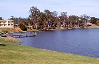
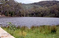
Eildon Lake, Eildon
13,750 ha. 3,390100 ML. Boat ramps, all facilities.
A very deep reservoir (76 m max. depth) on the Goulburn River downstream of its junction with the Delatite River. Most of the extensive shoreline is forested with open farmland around the Delatite Arm and Brankeet Arm (Bonnie Doon). There are few shallow areas. Water level fluctuations can be very large and last for a number of years. There are commercial camping facilities at a number of towns near the lake and camping grounds at a number of widely dispersed sites within the Lake Eildon National Park. Fraser Park has good camping facilities for families and a concrete ramp usable at low lake levels. Book sites in high season. There is also good camping along the western side of the Delatite Arm but no facilities. There are concrete boat ramps at the Eildon Boat Harbour, Jerusalem Creek, Bonnie Doon and on the Delatite and Jamieson Arms. Eildon Boat Harbour has two sections of concrete ramp with a maintained gravel ramp at the bottom, usable at all lake levels. A fee is payable. It is a popular lake for sailing, water skiing, houseboats and fishing. During periods of very low water levels there is no access by boats past the old river bridge into the Big River arm of the lake.
The most common fish caught are brown trout to 3 kg, redfin to 2 kg (av.350 g), rainbow trout to 2 kg, golden perch (av.1.4 kg, max.3 kg) and Murray cod to 4 kg. There are also European carp, blackfish, tench, goldfish, roach and possibly Macquarie perch. Trout spawning in the many rivers flowing into the lake adequately supports the fishery. Annual stocking of rainbow trout and occasionally brown trout recommenced in 2005. Also trout not required for stocking into other waters are released into Eildon Lake. Client groups also stock rainbow trout in some years.
Murray cod and golden perch had been stocked occasionally since 1991 but are now stocked annually. Between 1990 and 1993, 869 adult Macquarie perch were translocated from Lake Dartmouth and 464 ex-brood Macquarie perch from the Snobs Creek Hatchery were stocked in 1991 to 1998.
Trout fishing is best in the winter months with trolling, particularly in the Big River Arm being a popular method for targeting the larger fish. When the water level is high and rising, a wide variety of fishing techniques can also be successful on the freshly inundated river flats. Redfin are the main target species in the summer and are usually taken on worms or yabbies fished on the bottom with a running sinker, or by jigging when a school of fish is located. European carp, roach and tench are a common incidental catch during the warmer months.
Murray cod and golden perch are regularly caught, particularly in the Delatite Arm. The lake is stocked annually with both these species.
30,000 Murray cod fingerlings were released into Lake Eildon in January 2011 with the commencement of an $800,000 project funded by fishing licence fees. The project will see one million cod released over three years, in addition to the 50,000 a year that already being released.
Some larger fish have high levels of mercury because of past gold mining activities in the catchment. Recommended that larger fish be consumed in moderation.
Environmental mercury in fish
The Department of Health has produced a fact sheet for anglers who eat their catch from the southern half of Lake Eildon.
Visit the Environmental Protection Authority Victoria's helpful web page on mercury in fish for more information.
Eildon Pondage
150 ha. 5200 ML. No boating. Has a disabled fishing platform and undercover barbecue. Wading is permitted. Toilets, electric BBQs, picnic shelters, playground, all-access (wheelchair friendly), parking available, walking distance to Eildon shopping centre.
It is recognised as one of the most fished waters in Victoria due to its easy access and large numbers of large brown trout and rainbow trout. It is surrounded by parklands and walking trails. Access signs are located around the lake edge.
The Victorian State Government has committed $3.2 million over four years to improve recreational fishing facilities and infrastructure, as well as promote opportunities for fishing as a family activity. Recognising that recreational fishing is a major social and economic contributor to Victorian communities, the Government aims to boost this popular past-time activity.
As well as providing access for disabled fishers, Eildon Pondage also offers family friendly facilities such as toilets, BBQs, picnic tables and playground equipment. It is a great place for young people and their families to fish, some perhaps for the first time.
The Pondage holds flows released from Lake Eildon for hydroelectricity production and then regulates the amount of water released further downstream into the Goulburn River. Note that water levels can fluctuate due to releases of water from Eildon Lake It has a maximum depth of 10 m as well as extensive shallow flats with aquatic vegetation and a clay, boulder and pebble substrate. There are underwater rock bars and deep holes. Be careful when wading.
Contains brown trout and rainbow trout up to 3.5 kg although larger fish can be taken. Also contains good numbers of Murray spiny crayfish, redfin, Australian smelt and flathead gudgeon.
A very popular fishing area, producing excellent catches of trout, with bait fishermen making up 80% of anglers. Good success with mudeyes and maggots under a bubble float. Spinning with lures and wet fly fishing is also successful with woolly bugger, Goulburn Griffiths and Tom Jones useful flies to try.
Stocked regularly with 2 and 3 year old ex-broodstock brown trout and rainbow trout weighing up to 5 kg each. Also periodically stocked with ready-to-catch advanced yearling (approximately 200 g) rainbow trout. Open all year for fishing.
A floating fishing platform, that rises and falls with changing water levels, has also been installed as part of the Recreational Fishing Grant Program funded by Recreational Fishing Licence fees.
Enoch Creek, Enoch Point
Not shown on map.
A very small tributary of Big River, with low flow during summer. Some bank erosion and sedimentation of pools. Contains brown trout to 350 g and rainbow trout to 150 g. Seldom fished.
Gaffneys Creek, Woods Point
Not shown on map.
A small tributary of the upper Goulburn River and can be reached from the Woods Point Road near Knockwood. Has extreme fluctuations in flow but is an important trout spawning stream for fish from the Goulburn River. Contains brown trout and rainbow trout to 250 g, blackfish to 100 g, redfin, mountain galaxias, barred galaxias and southern pygmy perch. Fish have high levels of mercury because of past gold mining activities. It is recommended that larger fish be consumed in moderation.
Gerar Creek, Merton
Not shown on map.
A small tributary of the Merton Creek. Has a low summer flow but the channel is shaded and retains fish habitat all year. Contains brown trout to 400 g. Worth fishing although access is a problem.
Golf Course Dam, Longwood
Family Fishing Lake. Located in the Longwood Recreation Reserve. Toilets, play area, BBQ
A very small (100 m by 30 m) lake, surrounded by grass and eucalypts. Managed as a Family Fishing Lake and subject to stocking with advanced yearling rainbow trout (see Introduction).
Goulburn River, Seymour - Premier River
The section of the Goulburn River from Eildon Pondage to Alexandra and from Murchison to Loch Garry has been declared a Premier River under the Go Fishing in Victoria initiative. Access will be improved and an information package prepared for each river reach identifying key access points, and the type of fishing experience and facilities that they provide. See Introduction to the Guide for further information on Premier Rivers.
Above Lake Eildon
A wide river (7-10 m) flowing for 50 km from Woods Point to Lake Eildon through forested mountains with cleared areas between Kevington and Jamieson townships. Riparian vegetation is native forest with patches of willows and blackberry in the lower reaches and with considerable bank erosion present in areas of cleared land. Substrate is boulders, rubble and gravel with some sand and silt in deeper water.
It is a typical mountain stream with fast-flowing water, riffles and pools and some habitat. There is considerable water 40-70 cm deep, with shallow pools upstream but over 100 cm deep, downstream. It has a low summer flow and some sedimentation in the pools. Accessible for 26 km from the Jamieson-Woods Point Road up to Knockwood, then by tracks to the upper reaches. Carries abundant brown trout to 1.8 kg (av.220 g), some rainbow trout (av.150 g max.1.5 kg), small blackfish, mountain galaxias, and also roach, European carp and redfin in the lower reaches. Popular fishing methods are bait such as mudeyes and worms; and dry flies, although fishing can be difficult because of overhanging bank vegetation.
This is a popular fishing water with best results during spring to autumn. High concentrations of residual mercury occur in the water and sediments, from past gold mining activities in the headwaters. Fish are likely to be contaminated. Recommended that larger fish are consumed in moderation. Trout spawn in the river and it is believed that there is adequate natural recruitment to maintain the recreational fishery.
The River Health Program has identified the section of river between Jamieson and Woods Point as having high priority for management work (Crown Land Water Frontage Review 2005). Introduced vegetation including willow trees has been removed and there has been extensive replanting of native vegetation to stabilise banks. Other activities, such as fencing to exclude stock from the river bed and banks are occurring. Boulders have been placed in the river bed in some reaches to improve habitat. Tracks for anglers have also been provided. This will result in improved instream habitat for aquatic biota including fish and better fishing prospects for anglers.
The Murray-Darling Basin Native Fish Strategy is also assisting landholders and community groups in the upper Goulburn area, to participate in these activities.
The upper reaches still carry good numbers of fish (angler's reports & department survey) but fish populations would have been affected to some extent by low flows during the extended drought and the effects of the bushfire in 2006/07. This resulted in considerable sedimentation of the channel and high water turbidity after high rain events. Still well worth fishing, although higher turbidity during 2008/09 may make angling more difficult.
Environmental mercury in fish
The Department of Health has produced a fact sheet for anglers who eat their catch from the southern half of Lake Eildon.
Visit the Environmental Protection Authority Victoria's helpful web page on mercury in fish for more information.
Eildon Pondage to Alexandra - Premier River
This section of the Goulburn River is highly regarded as a trout fishing destination and is designated as a Premier River under the Go Fishing in Victoria initiative. It provides exciting sports-fishing opportunities for anglers targeting trout whether bait fishing, castings lures or fly fishing.
The river downstream of the Pondage wall can be dangerous to wade because of sudden rises in water level when water is released downstream. For the safety of anglers, it is closed to fishing for two hundred metres immediately downstream from the walkway over the Pondage Weir release gates to the fishing boundary posts. The river flows through flat farmland and has scattered riparian vegetation of mostly willows, some wattles and river red gums.
Channel width can reach 60-80 m. It has some deep pools below Eildon Pondage then a riffle/pool structure with a substrate of boulders, rubble and gravel with some patches of sand and silt. Flow in this section is highly regulated with flows during September to late April of 5,000-11,000 ML/d resulting in bank full flows of cold (13o C) water. From May to August/September flows decrease, at which time the normal river structure of riffles/pools becomes evident. Contains mostly brown trout to 2 kg and rainbow trout to 1.3 kg; also small redfin, goldfish, tench and European carp.
Trout also move into this section of the river from tributary rivers and downstream from the Pondage. This reach of the river is popular for bait fishing and spinning in the deeper sections and fly-fishing particularly near 'the Breakaway'. It is recognised as one of the best river trout fisheries in Victoria. Good information on fishing the river is available from local tackle shops and for fly-fishing from the Goulburn Valley Fly-Fishing Centre at Thornton. Access is good at a number of road bridges such as at 'the Breakaway', on Breakaway Road or Gilmores Bridge on the Goulburn Valley Highway near Thornton.
Other recognised fishing spots are Rennie, S Bends, Valley, Eildon Water and Point Hill. There is good bank fishing at these locations. Some wading is possible, with care, even during moderate irrigation releases. The river is open to boating and this allows access to all the best fishing locations.
There is a public boat ramp at the Maroondah Highway Bridge at Alexandra and small aluminium boats, canoes or rubber inflatable boats can be launched from the bank and are most suitable because of the areas of shallow riffles. Note that water flow can be quite fast in some locations and appropriate boating experience and care is necessary. Native fish, which require water temperatures of 16-20o C for successful spawning, were previously considered to be lost from this section of the river because of the cold water releases from Lake Eildon. However there are angler reports of golden perch and Murray cod being caught.
In 2009, Fisheries Victoria stocked 2,300 (800 brown and 1,500 rainbow trout) at nine locations along the Goulburn River between the Eildon pondage and Molesworth as part of a three-year stocking and monitoring trial. These fish were released prior to and during the 2009/10 riverine trout season. All stocked trout were of a catchable size (greater than 200 grams) with more than half of these fish weighing between 1 and 3 kg.
There has been considerable river improvement work by Goulburn Broken Catchment Management Authority as part of the River Health Program. Willows have been removed and replaced by native bank vegetation. Fencing has been installed and improved access for anglers provided. Instream boulders and bank protection with rock groynes have improved fish habitat. Some of this work has also been funded through the Recreational Fishing Grant Program by Recreational Fishing Licence fees.
A detailed information package which provides information on angler access, fish species and angling techniques for this section of the river will soon be available as part of the Go Fishing in Victoria initiative. See www agriculture.vic.gov.au/gofishing
Alexandra to Seymour
Boat ramps at Seymour, in the caravan park at Molesworth & on the Killingworth Road near Yea.
The river flows through flat farmland but there is now more continuous deep water with gravel, mud and clay substrates. Riparian vegetation varies from willows to native trees downstream of Molesworth. Flow is still influenced by irrigation releases from Lake Eildon.
Access is more restricted because of private property (please ask permission). However the river can be reached at various road crossings and reserves at Cathkin, Molesworth, on Killingworth Road near Yea, at Ghin Ghin and at the end of Greenslopes Road. Good access along the Trawool-Tallarook Road. Contains good numbers of brown trout to 3.6 kg, rainbow trout to 2.2 kg, European carp, redfin, Murray spiny crayfish, tench, goldfish, eastern gambusia, southern pygmy perch, possibly some Murray cod and golden perch and occasional Macquarie perch around Yea. Note that Macquarie perch are protected and must be released.
Good fishing for trout but numbers of Murray spiny crayfish appear to have decreased. Best fishing from spring to autumn with baits and spinning the most popular fishing methods. Trout enter this section from tributaries and no stocking is undertaken.
Seymour to Goulburn Weir (incl. Nagambie Lakes)
The river is now incised into a wide, cleared floodplain and flows through farmland. Riparian vegetation is mostly willow. Substrate is deposited silts and clays although some bedrock is still present. Water temperatures during summer are still cold 13-20o C. Flow is slower with extensive pools present. Access is restricted because of private property.
Contains mostly redfin to 1.8 kg (av.220 g), some brown trout to 3.6 kg (av.1.5 kg), tench, European carp, goldfish, blackfish and Murray spiny crayfish. Anglers report (2008) occasional Murray cod taken. Main species targeted by anglers are redfin, brown trout and Murray spiny crayfish. Best fishing is in summer when the backwaters warm up.
Native fish appear to be scarce in this section of river and in Nagambie and Goulburn weirs into which the river flows, despite the presence of very good native fish habitat.
A bi-annual stocking of Murray cod and golden perch commenced in 2008. In 2009, a revised 5 year stocking strategy was introduced for the Nagambie Lakes section of this reach. Substantial numbers of golden perch and Murray cod will be stocked annually to enhance populations. A project is also underway to study the impact of high summer flows on the native fish communities (Murray-Darling Basin Native Fish Strategy). For more information about this strategy see the Introduction section of the Guide.
Goulburn Weir to Murray River - Premier River
This section of the Goulburn River is highly regarded for providing exciting and productive fishing for golden perch and Murray cod and the section Murchison to Loch Garryis designated as a Premier River under the Go Fishing in Victoria initiative. It caters for a range of angling methods including bank fishing with bait to casting and trolling spinnerbaits and bibbed lures from small boats.
Flows through flat farmland but has extensive reaches with dense river red gum riparian vegetation, mud and sand bottom. This section of the river is undisturbed and in a natural condition except for the regulated flows and water diversions. There is abundant submerged, fallen timber (snags) which provide excellent habitat for Murray cod, trout cod and golden perch.
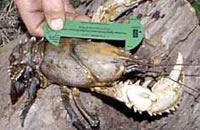
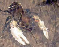
There are extensive areas of deep water, particularly in the 30 km of river downstream of Shepparton, where pools on bends range from 7 to 11 m deep. DSE surveys in the 1990s found no saline pools were forming in these deep pools. The banks are high and launching a small boat can be difficult. Fish species are redfin to 1.3 kg (av. 450 g), European carp, good numbers of Murray cod usually 2-3 kg but up to 30 kg, numerous golden perch to 5.4 kg (av.1.3 kg), abundant Murray spiny crayfish, occasional silver perch, trout cod and freshwater catfish.
A number of other fish have been taken at various times in the river or in adjacent billabongs or backwaters. These are Macquarie perch, bony bream, goldfish, blackfish, brown trout, tench, Murray River rainbowfish, Australian smelt, eastern gambusia, western carp gudgeon and flathead gudgeon. Good fishing for Murray cod and golden perch is reported downstream of Shepparton with abundant undersized cod as well as fish to 30 kg. Trolling and casting spinners is very successful.
Previously stocked annually downstream of Murchison with Murray cod and golden perch. This reach is now apart of the alternate year stocking of the Seymour to Nagambie reach. The alternate year stocking of Murray cod and golden perch between the lower reach (downstream of Murchison) and upstream of Nagambie Weir now takes place. Stocking success of previous years has allowed for the revised biannual stocking plan. This plan is endorsed by the Goulburn-Eildon Region Fisheries Management Plan.
Fourteen reaches in the lower Goulburn River have been identified to receive a legally protected extra 101,000 ML of water for the environment as part of the Environmental Water Reserve Program established under The Water Act 1989. (Explained in the Introduction to the Guide).
Following fish kills in 2004 an independent Environmental Audit of the Goulburn River-Lake Eildon to the Murray River was carried out and completed in 2005. The objective of the Audit is to guide the management of the Goulburn River towards providing a healthier river system.
Between 1993 and 1998, 58,000 trout cod fingerlings were released into the river in the Nagambie/Murchison Area. Monitoring of the recruitment and survival of these trout cod is being conducted by DSE, as part of the National Trout Cod Recovery Program. It appears that trout cod are spawning in the river and the establishment of a self-supporting population is likely. Other waters involved in the Trout cod recovery program are Seven Creeks, Ovens River, upper Mitta Mitta River and the upper reaches of the Murray River.
Three other activities (part of the Murray-Darling Basin Native Fish Recovery Plan), have also been carried out. There has been a study of the movements of fish in the lower Goulburn River to determine the amount of movement of native fish from the Murray River into the Goulburn River.
The impact of summer flows on native fish communities further upstream in the Goulburn River has been examined. The ecological condition and health of the Goulburn River valley has been assessed at a number of sites as part of the Sustainable Rivers Audit.
A detailed information package which provides information on angler access, fish species and angling techniques for this section of the river will soon be available as part of the Go Fishing in Victoria initiative. See www agriculture.vic.gov.au/gofishing
Research:
Trout spawning and rearing habitats in the Goulburn River
Goulburn Weir
The dam wall is located on the Goulburn River approximately 10 km north of the township of Nagambie. Water is banked up, creating a large lake, called the Goulburn Weir. This lake extends upstream for approximately 4 km, then water floods out into numerous permanent backwaters of varying surface area, which extend upstream for another 6 km before the main channel of the Goulburn River is reached. The largest and most upstream backwater is called Lake Nagambie.
All these bodies of water are connected and fish can freely move throughout the complex.
Water for offstream use is diverted by two outlet canals (Cattanach and Stuart Murray canals) located near the dam wall of Goulburn Weir.
The stocking site for the release of Murray cod and golden perch is in the main channel of the river, 10 km south of Nagambie township, close to the Mitchelton Winery. Murray cod from this site can move upstream in the river and downstream into the complex of backwaters (including Lake Nagambie), the Goulburn River channel and also into Goulburn Weir. All this area can be reached by boat and is fishable. Fish species and fishing prospects for this whole area are described in Lake Nagambie.
Greens Lake, Corop
65 ha. 785 ML. Boat ramp, toilets.
A shallow lake in open country which together with Lake Cooper, is known as the Corop Lakes. It is accessible from the Midland Highway east of Corop. Contains abundant European carp and redfin, generally to 1 kg, but occasionally to 2.5 kg, Murray cod, golden perch, goldfish and tench. Fishes best in the spring to autumn period and a boat is needed for best results. Stocking with golden perch (commenced 2007) after water conditions improved significantly and there is now a good fishery for this species. Regularly stocked with golden perch and Murray cod.
Home Creek, Yarck
A small sluggish creek flowing through farmland, mud and sand bed. Contains a few rainbow trout av. 350 g, some blackfish, brown trout to 2 kg and European carp. Provides some fishing during the spring. Not stocked.
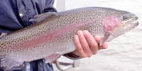
Howqua River, Jamieson
The river rises in steep forest then flows through a wider cleared valley into Lake Eildon. River width is 8-10 m upstream at Sheepyard Flat and from 8-20 m downstream. Riparian vegetation is native forest upstream, with blackberry, willow and some native vegetation downstream in the farmland.
There is some bank erosion in the lower reaches. Substrate upstream is rock, rubble and gravel with rapids, cascades, shallow riffles and pools. Access to good camping areas (no facilities) and fishing water from Merrijig to Sheepyard Flat via the Grammar School Road. This area is popular for camping and fishing trips. A walking track from Running Creek to Tobacco Flat for angler access has been opened. However there are numbers of river crossings with no bridges, which makes passage difficult during high flows.
There is also vehicle access for 6 km upstream from Lake Eildon. Contains good numbers of brown trout and rainbow trout to 1.8 kg, with most fish less than 350 g. Also blackfish, abundant European carp, roach, mountain galaxias, flathead gudgeon and small redfin in the lower reaches. No longer stocked with trout because the population is self-sustaining.
There has been extensive removal of willows and re-vegetation along the banks as part of the River Health Program. Blackberries have been removed, banks stabilised and riparian vegetation restored as part of the Recreational Fishing Grant Program funded by Recreational Fishing Licence fees.
This river was not severely affected by the drought or the 2007 bushfire and continues to provide good fishing.
Hughes Creek, Avenel
There is a rock-ramp fishway at Avenel gauge.
Rises in hilly farmland then flows through flat farmland downstream of Avenel. Riparian vegetation is sparse and absent in many sections. In the upper reaches near Tarcombe, the creek is up to 19 m wide, with predominantly shallow water 20-45 cm deep and a few pools to 90 cm. Low flows during summer expose sand substrate and sand banks. There is little instream habitat or fish cover present and considerable erosion and sedimentation has occurred.
The creek then flows through a gorge with granite boulders, cascades, rapids and plunge pools. At Avenel (below the gorge) the creek is 7-20 m wide with areas of gravel, rubble and sand substrate and with most water less than 100 cm deep.
Downstream of Avenel to the Goulburn River, the river has riparian vegetation of eucalypts, and a sand and clay substrate with some woody habitat. Contains some brown trout, abundant blackfish, mountain galaxias, southern pygmy perch and some Macquarie perch. Stocked with 1610 trout cod in 1987 to 1988/89 and in 1990/91 but few have been captured and they are now considered to be extinct in this creek. Redfin, goldfish and tench are abundant near its junction with the Goulburn River.
Almost all the creek has unsuitable habitat for trout and they are no longer stocked. Reported to be some fishing for large brown trout, in the large plunge pools in the hilly granite country in the extreme upper reaches. The remainder of the creek is not worth fishing. No further stocking of trout or native fish because of a scarcity of suitable fish habitat.
In 2010 a breakthrough was achieved by aquaculture scientists from the department at Snobs Creek when they successfully bred large numbers of Macquarie perch in captivity for the first time.
This breakthrough will greatly assist the recovery of Macquarie perch in its natural range, given declines in its distribution and abundance.
In 2010, Fisheries Victoria released 2,800 fingerlings into the Ovens River 2,800 between Myrtleford and Wangaratta.
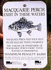
The Macquarie perch is a valued recreational fish in Victoria that can only be taken from a few waters in accordance with strict catch limits and an annual three-month closed season (refer to the Victorian Recreational Fishing Guide).
Macquarie perch cannot be kept if caught from this waterway and must be returned to the water immediately.
Jamieson River, Jamieson
Flows in forested hills for most of its length with only the lower 16 km through farmland where it is easily accessible. Riparian vegetation is native forest upstream and some willows and poplars downstream. Access upstream is restricted to several tracks.
This is a typical mountain stream with an average width of 10 m and with riffles, runs and pools, gravel bed. Contains brown trout and rainbow trout av. 200 g but larger fish present, mountain galaxias, a few small redfin and blackfish in the lower reaches. A self-sustaining trout population and no longer stocked.
There has been extensive removal of willows and re-vegetation along the banks as part of the River Health Program. The headwaters had very low flows during the drought years and were also affected by the bush fire in 2006. A presence/absence survey by the department (2007/08) found that trout were still present. The Jamieson River just upstream of Lake Eildon was still turbid after rain in mid 2008, and it is likely that some sedimentation of the channel has occurred.
Kalatha Creek, Glenburn
Not shown on map.
A small tributary of the Yea River, containing small brown trout and blackfish.
King Parrot Creek, Strath Creek
Flows in a narrow valley to Flowerdale with forest upstream then scattered farmland and hobby farms. Downstream of the Strath Creek Road turn-off, it flows through farmland in a wide valley to the Goulburn River. Width is 6-8 m. Riparian vegetation downstream of the forest is tea-tree, wattle and some red gums.
Substrate is gravel and some rubble upstream with mostly bedrock in the middle reaches and then rock and rubble downstream. It has riffles to 20 cm deep and pools to 50 cm in its upper reaches. The remainder of the river has extensive riffle/runs up to 50 cm deep. Pools are 100 cm deep in the middle reaches and 100-200 cm deep downstream of Strath Creek.
There is a picnic reserve at the Goulburn Valley Highway but no facilities. Contains excellent habitat, for small-sized fish upstream and larger fish downstream. Very accessible in its upper reaches and popular for fishing and picnicking. However much of the lower reaches are surrounded by private property with access only at a few reserves or road crossings. Contains mostly brown trout to 900 g (av.200 g), some rainbow trout, abundant blackfish to 120 g, eastern gambusia, Australian smelt and some Macquarie perch to 1.5 kg (av.320 g), downstream of Flowerdale. A recent survey by
DSE found juvenile Macquarie perch, indicating some recruitment occurring. Note that the taking of Macquarie perch is prohibited.
The lower reaches near the Goulburn River provide good trout fishing when the Goulburn River is high, cold and clear, during irrigation releases. This is a major spawning area for brown trout from the Goulburn River and it is not stocked. Flow has been very low during the drought period, with possibly some adverse affect on fish stocks.
A draft Stream Flow Management Plan is being developed (2009). See Goulburn-Murray Water website for details.
Community groups and landholders are being encouraged to participate in river improvement work such as revegetation of banks and fencing out of stock as part of the Murray-Darling Basin Native Fish Strategy.
Little River, Taggerty
Shallow stream rising in forested hills and then flowing through farmland, gravel bed. Contains small brown tout to 650 g (av.150 g) and a few rainbow trout. No longer stocked.
Loch Garry, Shepparton
680 ha. 7,040ML.
This shallow waterway in open country is an abandoned former course of the Goulburn River and water level is maintained by flooding from the Goulburn River. It is accessible off the Shepparton-Nathalia Road near Bunbartha. There are grassy flats on the eastern side which are suitable for camping but there are no facilities. Dry in 2008.
When filled it contains redfin to 1.8 kg (av.500 g), European carp, goldfish, tench, possibly freshwater catfish, golden perch, western carp gudgeon, Murray River rainbowfish, eastern gambusia and Australian smelt. It is best fished from February to June after flood events. A boat is preferable but there is some scope for bank fishing. Stocked with golden perch when water level is favourable. However golden perch appear to migrate into the Goulburn River during flood events. No stocked in 2008. More information on Fish Stocking can be found on this website .
Marysville Lake, Marysville
Family Fishing Lake.Toilet block, electric BBQ and walking access around the lake.
A small ornamental lake set in parkland in the middle of the town. Managed as a Family Fishing Lake and subject to stocking with advanced yearling rainbow trout (see Introduction). In November 2009, the water quality was deemed to be unsuitable and 200 ready-to-catch golden perch were released as a one-ff alternative stocking.
Merton Creek, Merton
Not shown on map.
This is the largest creek of a group of streams above Bonnie Doon. It flows mainly through farmland. Most of the creek is not readily accessible and the pools have silted-up. Contains small brown trout, blackfish and redfin. It is poor trout water and is no longer stocked.
Murray River (NSW)
See Murray River
Murrindindi River, Yea
Rises in forest then flows through farmland. A typical mountain stream in the headwaters, with a boulder, gravel and sand substrate. Contains brown trout and rainbow trout to 700 g, (av.200 g), Macquarie perch, blackfish and Murray spiny crayfish. European carp and redfin are present in the lower reaches. Trout are usually in good condition. Not stocked with trout because the population is self-sustaining. Stocked in the 1990s with Macquarie perch, which have now spread downstream to the Goulburn River junction. Macquarie perch are protected and must be returned to the water if captured.
Nagambie Lake, Nagambie
1,120 ha. 25,000 ML. Only one public boat ramp, (launching permit required from the local council) recreation area, toilets, caravan park at Chinamans Bridge, water skiing.
This is a shallow backwater on the Goulburn River surrounded by open farmland. Access is a problem for shore fishermen because most of the lake is surrounded by private property.
The lake is the largest of a series of backwaters of the Goulburn River, located several kilometres upstream from Goulburn Weir. Contains redfin to 800 g, tench, European carp, goldfish, brown trout, rainbow trout, blackfish, occasional golden perch, Australian smelt, flathead galaxias, occasionally trout cod and freshwater catfish, and abundant Murray spiny crayfish. Predominant fish caught by anglers are European carp, redfin, very occasional golden perch and good numbers of Murray spiny crayfish. Numbers of redfin have increased during the last few years (2006-09). Water temperature rarely exceeds 20o C during summer because of releases cold water from Lake Eildon into the Goulburn River.
Large numbers of golden perch were stocked between 1984 and 1990 but angler catches remained poor. Stocking of Murray cod and golden perch in the Goulburn River further upstream are likely to improve angling throughout the Goulburn Weir/ Lake Nagambie system.
In 2009, The Nagambie Lakes system was restocked with approximately 250,000 Murray cod and golden perch. Similar numbers of fish will be released into these waters in the following four years. These stockings are expected to greatly improve recreational fishing opportunities in the future.
Royston River, Rubicon
A shallow, fast-flowing stream in forested hills. It has a steep gradient with waterfalls, riffles and cascades. The channel is well shaded by native riparian vegetation. Channel width is up to 12 m with water depths of 20-60 cm in riffles and pools to 80 cm deep. Accessible from a parallel road and is a productive water although fish tend to be rather small. Contains mostly brown trout to 600 g (av.70 g), occasional rainbow trout and blackfish. Water from a dam upstream is diverted in a channel to a hydroelectric power station at Rubicon. There is a camping reserve (Kendalls & Boys) upstream, but with no facilities, except a pit toilet.
Rubicon River, Thornton
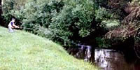
Popular fly fishing water.
Rises in forested hills with a steep gradient in the headwaters. Riparian vegetation is re-growth forest, with some blackberry. Upstream of the junction of Royston River, the river is 6-10 m wide with mostly shallow water less than 45 cm deep and pools to 60 cm, boulder and rubble bottom. Downstream of Rubicon it flows in cleared farmland with willow and blackberry as riparian vegetation. It has shallow riffles with some deeper pools to 250 cm, rubble, gravel, clay and sand bottom. Access is difficult upstream of Rubicon because of the closed catchment area above the Royston Hydroelectric Power Station.
There can be low flows in the river when the power station is not operating. Carries a large population of brown trout to 2.5 kg (av.400 g), particularly around the Tumbling Waters Park, some blackfish, redfin, rainbow trout and barred galaxias. A spawning river for trout from the Goulburn River and is a popular angling water, with good fishing in the early part of the season. Catches decline during summer. Good fishing for large brown trout in the lower reaches when the Goulburn River is flowing cool, clear and high. Not stocked with trout because there is a self-sustaining population. A two year creel survey was undertaken in 2002 and 2003. The Goulburn Broken Catchment Management Authority has carried out river improvement work upstream of Tumbling Waters.
Fish habitat has been improved through the introduction of various in-stream structures, new fencing has been erected, riparian zone revegetation works have been carried out, angler access through Crown frontage reserve improved, and signage installed along 4 km of the Rubicon River between the Taggerty-Thornton Road and the power line utility track; as part of the Recreational Fishing Grant Program funded by Recreational Fishing Licence fees.
Seven Creeks, Euroa
A vertical slot fishway has been installed at the Euroa Weir at Euroa.
The creek rises in hills at Creek Junction and flows for 20 km, past the township of Strathbogie to Polly McQuinns Dam. It then flows through a flat plateau of granite country for 6 km to the junction of Watchbox Creek then another 1 km to Gooram Falls. Downstream of these rock falls, the creek flows for another 3 km to Galls Gap Road Bridge then another 17 km to Euroa and on to the Goulburn River. The 10 km section of creek downstream of Polly McQuinns Dam was stocked by locals pre 1970s with trout cod which resulted in the establishment of the only self-supporting population in Victoria at that time.
This is one of the rivers in Victoria selected for the recovery of trout cod under the National Trout Cod Recovery Program. Activities specific to Seven Creeks include restocking with trout cod from the Murray River for four years, erosion control, fencing off the banks and resnagging with logs and branches. There was also a survey by DSE of the quality of instream and riparian (bank) habitat; numbers of trout cod and macroinvertebrates prior to the habitat rehabilitation works. This was followed by assessment of the effectiveness of the habitat improvement and/or changes in river morphology in increasing the numbers of trout cod. Seventy trout cod were tagged and data loggers were installed in the creek to record information from the tagged fish. The objectives were to determine fish movement into degraded sections as well as the importance of water flow and temperature to fish movements.
Note that the taking of Macquarie perch in Seven Creeks is prohibited. Trout cod is also a protected species and taking, or attempting to take, including catch and release, is prohibited.
Upstream of Polly McQuinns Dam
A small creek (1-4 m wide) flowing through farmland but with good riparian vegetation. Most of the channel is 20-85 cm deep with occasional deeper pools. Substrate is mainly sand with some rubble in the riffles. Very accessible. Contains Macquarie perch, abundant blackfish, some brown trout, southern pygmy perch, western carp gudgeon and Murray spiny crayfish. Fishing is permitted in Polly McQuinn's Dam but anglers would only catch blackfish and a few brown trout.
Polly McQuinns Dam to Gooram Falls
All fishing is prohibited in this section below the wall of Polly McQuinns Dam.
Flows through cleared farmland with little riparian vegetation. Access through private property. The creek consists of numbers of small, deep pools (av. 230 cm deep) with low banks and granite rock outcrops downstream to Watchbox Creek. There is then another 1 km of shallow water with sand substrate to Gooram Falls. Contains trout cod, some Macquarie perch, abundant blackfish, southern pygmy perch, occasional brown trout, occasional redfin, and mountain galaxias.
Gooram Falls to Gall Gap Road Bridge
Trout cod occur in this section and it is closed to all fishing.
The channel immediately below the falls is 5-14 m wide, with riffles 10-30 cm deep and some pools 100-130 cm deep. Substrate is gravel and rubble in the riffles and sand in the pools. It becomes a wider, shallow (20-60 cm deep) creek further downstream, with sand substrate. Some instream habitat results in gutters and channels with water up to 60 cm deep, in the sand substrate.Contains blackfish, a few brown trout, redfin, European carp and trout cod.
Gall Gap Road Bridge to Euroa
Fishing permitted from here downstream. Flows through farmland with riparian vegetation of eucalypts, sand bottom. Contains blackfish, occasional trout cod, European carp, redfin, some brown trout and occasional golden perch.
Euroa to Goulburn River
Flows through flat farmland and has become narrow, fast and deep, with a mud and sand bed. Access is very restricted because of private property. Contains blackfish to 220 g, occasional golden perch, goldfish, eastern gambusia, Australian smelt, flathead galaxias, very occasional trout cod and European carp. Stocked regularly with golden perch. Small shallow creek and not worth fishing.
Snobs Creek, Eildon
Not shown on map.
A small stream with a steep gradient, flowing from forested hills, then into the Goulburn River about 3 km downstream of the Eildon Pondage. Good forest riparian vegetation upstream. Substrate is fine silt, sand and gravel upstream of the waterfall (Snobs Creek Falls) and boulders and gravel downstream. Accessible from a parallel road. Contains small brown trout upstream and larger brown trout near the Goulburn River, also mountain galaxias. A small section of the creek running through the Snobs Creek Hatchery is closed to fishing.
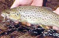
Steavenson River, Buxton
Popular fly fishing water and heavy fishing pressure.
Good access by road to Steavenson Falls at Yellow Dog Picnic area. At this location below the falls, the river flows through a fern gully and forest. The channel is 4-5 m wide, with extensive shallow riffles 10-30 cm deep, cascades and rapids and pools to 70 cm.
Substrate is rubble and gravel with good snags. Flows through farmland in the lower reaches. It is a narrow, shallow river at Marysville with extensive shallow riffles and rubble substrate. Channel width has increased to 10 m at Buxton with pools 70-110 cm deep and rubble and sand substrate. This locality has good instream habitat and bank cover for trout. Contains mostly brown trout average 220 g and some rainbow trout, also mountain galaxias. Has a self-sustaining trout population and is not stocked.
Stewart Creek, Seymour
Not shown on map.
A small tributary of Hughes Creek located 12 km east of Seymour. Contains small brown trout.
Sugarloaf Creek, Broadford
A sluggish-flowing creek with low summer flow, sand bed. Contains brown trout average 350 g and redfin to 1.8 kg (av. 200 g) in the lower reaches. Worth fishing only between Broadford and Seymour. Not stocked
Sunday Creek, Broadford
A long creek flowing beside the Hume Freeway. Flow is controlled by releases from the Sunday Creek Reservoir in the headwaters. Upstream of Clonbinane, it flows through farmland with little riparian vegetation. Channel width is 4-11 m with extensive riffles 10-30 cm deep and pools usually 40-60 cm but occasionally to 120 cm. Rubble and gravel substrate.
Downstream from Broadford, channel width is 5-11 m with good riparian vegetation, turbid water with a sluggish flow and extensive pools to 200 cm deep. There is excellent fish habitat in this section with some snags present. Carries brown trout upstream, blackfish, mountain galaxias, redfin and goldfish in the lower reaches. There is some brown trout fishing upstream and good redfin fishing near the Hume Freeway crossing. No adequate survey of fish populations has yet been carried out. Reported to have once carried Macquarie perch.
Taggerty Creek, Buxton
Not shown on the map but a tributary of Steavenson River.
A major tributary, up to 6 m wide with water depths to 60 cm. It is accessible by road from Marysville. Provides some fishing for small (av.220 g) brown trout and rainbow trout. Has a self-sustaining trout population and is not stocked.
Tahbilk Lagoon, Mitchellstown
Not shown on map.
This lagoon of the Goulburn River is located just downstream of the Major Creek junction. Contains goldfish, European carp, flathead galaxias, eastern gambusia, golden perch, redfin, freshwater catfish, tench and flathead gudgeon. It is surrounded by private property and access is difficult. Not recommended as an angling water.
Taponga River, Enoch Point
A fast-flowing tributary of the Big River upstream of Lake Eildon. Runs through steep forest, gravel substrate. Access is difficult except in the lower reaches. Contains abundant rainbow trout to 220 g, a few large brown trout in April May, also small blackfish. Self-sustaining trout population, and therefore not stocked.
Trawool Reservoir, Trawool
8 ha. Managed by DSE Parks. No facilities
A small domestic storage in which a brown trout stocking trial has recently commenced (2005) since access has been re-opened.
Access is by 4WD vehicle or a 2 km walk if the gate is locked. The gate is opened approximately October to April/May.
Victoria Lake, Shepparton
13 ha.
This is situated on the fringe of the town and is set in parkland adjacent to the Goulburn River. There is good access around the lake and a commercial caravan park and all facilities are available. Used to contain mainly redfin to 1.8 kg, also European carp, golden perch, goldfish, Australian smelt, flathead gudgeon and eastern gambusia; but has been dry 2006/08. Was previously stocked regularly with golden perch but future fisheries management is under consideration.
Wakiti Creek, Wyuna
Not shown on map.
An anabranch of the Goulburn River flowing through flat farmland, mud substrate. Access is limited by private property. Stops flowing during summer. Contains mainly redfin to 1.3 kg, European carp, goldfish and occasional Murray cod. Also flathead gudgeon, western carp gudgeon, Murray River rainbowfish and eastern gambusia.
Waranga Basin, Rushworth (Also called Waranga Reservoir)
5,850 ha. 411,000 ML. Boat ramp, caravan park, toilets.
An irrigation storage in flat open country filled via channel, with water diverted from Lake Nagambie. It therefore has a very variable water level. Contains European carp, redfin average 1 kg and up to 2 kg, golden perch, occasional brown trout, Australian smelt, flathead gudgeon and numerous Murray spiny crayfish. Bank fishing is usually unproductive except near the inlet channels. Stocked previously with golden perch and Murray cod, however DSE surveys suggest that these have not been successful in establishing a fishery; possibly because fish can migrate out into the irrigation channels Stocked with Murray cod in 2008 but stocking in 2009 suspended pending management review.
Yea River, Yea
Rises in the Toolangi State Forest and flows 20 km through forest in hilly terrain, to Glenburn. This section is very accessible from the Melba Highway although there are few reserves, and access requires walking through the forest to the river. Channel width is 6-11 m with shallow riffle/runs to 40 cm deep and small pools mostly around 100 cm deep. Substrate is rubble, rock and mud in the pools. Good blackfish habitat with some snags and a stable channel.
Flows through hilly-farmland to Devlin Bridge with rubble and rock substrate. This section is difficult to access because of private property and no access roads. Downstream, it flows in a wide valley through farmland and is accessible at several road crossings, (Stuarts Road, Lang Road). Width increases to 12 m with extensive runs 50-80 cm deep and gutters and pools to 200 cm. Substrate is mostly sand with some silt and gravel. Riparian vegetation is wattle, some blackberry and scattered river red gums. It has good instream snags in some areas.
Contains brown trout to 600 g, abundant blackfish to 300 g, redfin to 350 g, mountain galaxias, Australian smelt, occasional Macquarie perch to 450 g, European carp, goldfish, eastern gambusia, southern pygmy perch and occasional rainbow trout. Stocked from 1983-93 with 52,700 Macquarie perch fingerlings. DSE surveys (1990-93) found very few Macquarie perch present. It is not currently stocked.
A draft Stream Flow Management Plan for the Yea River is being developed (2008).