Loddon and Campaspe Rivers
Loddon River
The Loddon River is Victoria's second-longest river, running from the Great Dividing Range in the south to the Murray River in the north. The middle section of the river has many small anabranches that carry water away from the river onto the wider floodplain. Three main man-made storages, Cairn Curran, Tullaroop and Laanecoorie reservoirs, regulate water to the Loddon River. Below Laanecoorie Reservoir, the flow is regulated by the operation of weirs at Bridgewater, Serpentine, Fernihurst (Loddon Weir) and Kerang.
In the Central Highlands, the Loddon River transitions from a highland clear headwater to a lowland, meandering turbid river lined by eucalypts. Several locations offer boating access, such as Serpentine Rd at Bridgewater and Ankers Causeway at Laanecoorie Reservoir. Near Newstead, Bridgewater and Serpentine, river access, fishing platforms and facilities are available and family friendly. Camping is also available alongside the river at Newbridge.
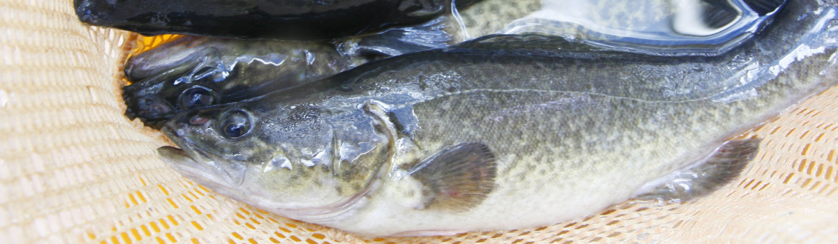
The Loddon River is within the natural range of Murray cod and golden perch. Extensive VFA stockings supplement any natural recruitment, with trophy specimens available among the many year classes of fish. Redfin are also prevalent in the system. Lure casting or bait fishing from small tinnies, car toppers, kayaks or the shore are perfect. The middle reaches have deep holes that can hold very good fish.
Downstream of Laanecoorie, around Newbridge and near Serpentine are among the more productive places to fish along the Loddon, particularly for Murray cod. Many fishers enjoy success fishing from kayaks, however bank access is solid in many of these areas, too.
Click the link for more information on Loddon River boat ramps.
Campaspe River
The Campaspe River has its source in the Wombat State Forest on the western slopes of Mt Macedon and meanders predominantly north-west. Natural inflows in the catchment are harvested into Lake Eppalock, located near the townships of Axedale and Heathcote, not far from Bendigo. Below Lake Eppalock, the major in-stream storage is the Campaspe/Elmore Weir, built to divert water to the Campaspe Irrigation District. The flow below Lake Eppalock is mostly influenced by releases from the storage and is based on the needs of downstream irrigators.
The Campaspe River is a charming mid-sized stream, perfect for tinnys, kayaks, and shore-based fishing. Upstream from Kyneton, the river is small and shallow, flowing through farmland. Below Kyneton, the river flows through volcanic country with extensive visible rock formations and has good pools closer to Lake Eppalock. There is a small reservoir located upstream of Lake Eppalock near Woodend. However, it has little effect on flow in the upper reaches of the river. Upstream of Lake Eppalock, the river flows through sloping farmland with deeper riffles and pools. There is abundant habitat and plenty of in-stream cover for fish. Brown and rainbow trout are caught in this stretch from self-sustaining populations.
The closer you get to Lake Eppalock, the more prevalent golden perch and Murray cod become as the river transitions. Around Kyneton, access is available to approximately 3 kilometres of river around the township. Here, you can enjoy a relaxed and easy atmosphere for picnicking and fishing.
Immediately below Lake Eppalock at the spillway is a popular spot for families with access to the bank and some deep pools. Park up near the water tower and walk down the access road alongside the spillway. Most fish caught here are small redfin, but it can be a great spot for youngsters with plenty of shade – especially useful in the warmer months. Further downstream, access to the river is good around Axedale and at English's Bridge near Goornong, where deep pools and plenty of snags can produce nice-sized cod. Large numbers of Murray cod are stocked in this stretch of river, as well as golden perch.
The river widens above Campaspe Weir near Elmore, with various access points along the shore and catches of Murray cod and golden perch on offer in the deeper water. The wide banks here mean walking up and down certain stretches of river can be possible. The camping area at Aysons Reserve, Burnewang, is popular among families and is a good central point to explore this stretch of river. Below Campaspe Weir the river is shallow and there are frequent irrigation diversions through to Rochester. The Rochester Weir, just north of the township, again provides deeper water and productive fishing. The local angling club has also created better access for kayaks around the town itself thanks to a recreational fishing licence fees-funded grant.
Below Rochester Weir the Campaspe tracks north about 40km, and mostly runs parallel with the Midland Highway meaning access is never far away. Closer to Echuca the deeper the pools become, with plenty of snags throughout. The Campaspe meets the Murray river near the Victoria Park boat ramp at Echuca, meaning the lowest reaches are accessible to boat-based fishers and fish can freely move between both river systems.
Follow the links for more information on Campaspe River boat ramps.