Werribee
- Cherry Lake
- Colbrook Reservoir
- Darlingsford Lake
- Djerriwarrah River
- Exford Weir
- Kororoit Creek
- Lerderderg River
- Melton Reservoir
- Navan Park Lake
- Pykes Creek
- Werribee River
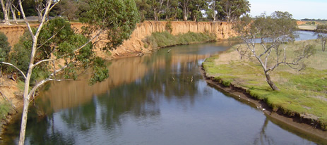
This relatively small catchment features one major river system (the Werribee River) which rises in moderate to steep, granitic and sedimentary, forested-country in the northern area of the Basin and flows south-east to Port Phillip Bay. The southern area is flat terrain of finely textured unconsolidated soils with volcanic rock and the major land use is grazing and broad acre cropping. Annual rainfall is 700-1,000 mm in the headwaters of the Lerderderg River, but only averages 400-600 mm/year in the rest of the catchment.
This results in low flows in many of the waterways during summer. The flow regimes of rivers in the Basin are highly regulated and water is diverted for irrigation and domestic use. Most angling occurs in the Werribee and Lerderderg Rivers. There is lake fishing only in Pykes Creek Reservoir and Melton Reservoir. Lake Merrimu and Djerriwarrah Reservoir are domestic water supplies and closed to fishing. Some waters in this Basin are commercially fished for eels.
Freshwater Fish in the Basin
Native species
- (Large fish): Short-finned eel and river blackfish.
- (Small fish): Australian smelt, common galaxias, congoli, flathead gudgeon, mountain galaxias, pouch lamprey, shorthead lamprey, trout galaxias, southern longfin goby, and southern pigmy perch.
Introduced species
- Brown trout, eastern gambusia, European carp, goldfish, redfin, roach and tench.
Native species in bold are protected in this Basin. Introduced species in bold are declared noxious.
The streams have populations of native and introduced fish with brown trout and river blackfish predominant in the upper forested reaches, and with redfin, roach, tench, goldfish and European carp becoming more common downstream. Short-finned eels are present throughout the catchment and Australian smelt and common galaxias are abundant in suitable areas.
Management
See Introduction for information on Management Agencies and Programs.
The Victorian Fisheries Authority
- manages stocking, fisheries policy, compliance with fisheries regulations and contact with anglers.
- Fisheries Management Plan (FMP) (a recent project that provides recreational anglers, government agencies and other stakeholders with clear guidance on fisheries management issues with a regional area over a five year period).
A FMP for waters within this Basin has been completed and was declared in November 2009. It can be viewed on the website. Fisheries Victoria Management Report Series.Port Phillip and Western Port Management Plan. No. 69. November 2009. - Stocking Program (stocking plans for desirable species are based on an approved Victorian Fisheries Authority stocking policy and are reviewed annually via Vic Fish Stock). In this Basin, Colbrook Reservoir is the only stocked water as all the rivers carry self-sustaining populations of fish and stocking is not considered necessary.
Up-to-date information on numbers and size of each species stocked can be found under Fish Stocking in the Fisheries and Aquaculture section of this website or in the annual Vic Fish Stock Report published by the department. - Family Fishing Lakes Program (an ongoing project of stocking small waters within urban areas with larger trout, for junior and disabled anglers – see Introduction for further information. The waters in this basin are Darlingsford Lake and Navan Park Lake.
- Premier Lakes Program (five Family Fishing Lakes in the State have been selected as Premier Lakes. They will have access for all anglers and be provided with facilities such as toilets, BBQs, picnic tables and playground equipment to encourage families and new anglers to go fishing. They will be stocked with large {>1kg} rainbow trout – see Introduction for further information) The Premier Lake in this Basin is Lillydale Lake.
- Victorian Stream Classification (a project that was completed in November 2010, which classifies each water as a native, salmonid or mixed fishery). Classifications relevant to this basin are:
- Native- Kororoit Creek
- Mixed- all other waters
Port Phillip and Westernport Catchment Management Authority
- is responsible for catchment management.
Melbourne Water
- manages drainage, waterways, floodplains, and urban water supply and the River Health Program.
- Victorian River Health Program (an on-going State Government initiative to achieve healthy rivers, streams and floodplains). Major activities are erosion control, bed and bank stabilization, willow and weed removal, fencing and replanting banks on the Werribee River.
Gippsland and Southern Rural Water
- manages rural water diversion for irrigation/stock use and the development of Stream Flow Management Plans.
- Stream Flow Management Plans (an ongoing project in which various agencies and water user's develop a flow sharing arrangement which ensures an adequate environmental flow allocation for each river in Victoria). There are none at present in this Basin.
Melbourne Water ,Western Water & Central Highlands Water
- manage urban water.
Key Fisheries
| Water | Target Species |
|---|---|
| Lerderderg River upstream of Blackwood | Abundant small brown trout |
| Werribee River downstream of Melton Reservoir | European carp, redfin, eel |
| Werribee River estuary | Black bream |
Special Values
Heritage River Areas
The banks and bed of the Lerderderg River between the downstream edge of Roach Road crossing and the point where the river crosses the boundary of the southern extremity of Lerderderg State Park has been listed as a Heritage River Area.
Representative Rivers
The Lerderderg River, at O'Briens Crossing, has been listed as a Representative River of West Victorian dissected uplands, volcanic plains.
Ramsar Sites
(wetland of international significance - Convention on Wetlands, Ramsar, Iran 1971)
The western shoreline of Port Phillip Bay, which is the receiving body for all water flowing out of this Basin.