Ovens - Angling Waters
View Ovens River Basin in a larger map (opens new window).
The above map is provided by Google. The department accepts no responsibility for its accuracy or content.
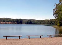
Anderson Lake, Chiltern
Family Fishing Lake 2 ha. Off-road parking, picnic tables.
Located in a park on the east of the town, with an adjacent caravan park. It is managed as a Family Fishing Lake and stocked with advanced yearling rainbow trout and golden perch for special events (see Introduction). It was stocked with Murray cod in 2004 and will be regularly stocked with golden perch from 2008 onwards.
Barambogie Reservoir, Chiltern
0.4 ha.
A domestic water supply for Chiltern, surrounded by pine and native forest. Not a recognised angling water and seldom fished. No longer stocked.
Barwidgee Creek, Myrtleford
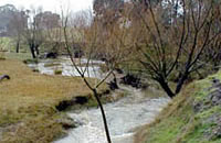
Flows from forested country then through farmland to join the Ovens River between Myrtleford and Gapstead. A shallow stream with fine gravel and sand bed. Never surveyed but reported to carry mostly brown trout to 700 g, some rainbow trout to 350 g, blackfish and some small redfin. Has a low flow during summer-early autumn and not worth fishing at this time. No longer stocked.
Black Range Creek, Edi
A small creek flowing through forest and farmland, gravel bed. Low flow in summer and sedimentation, results in the creek becoming a series of pools during summer and not worth fishing at this time. Contains brown trout to 700 g, some rainbow trout to 350 g, and blackfish. Carries only a few fish.
Boggy Creek, Whitfield
A small creek flowing through forest and farmland, gravel bed. Suffers from bank erosion, sedimentation and little riparian vegetation. Contains brown trout to 550 g, some small blackfish and small redfin downstream. Also Australian smelt, mountain galaxias and southern pygmy perch. Best time to fish is from first autumn rains to early summer as flow is low during summer. Not stocked.
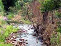
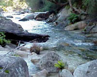
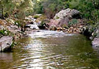
Buckland River, Porepunkah
Flows in forest in the upper reaches then forest and farmland downstream. The river upstream is 5-8 m wide with extensive shallow areas less than 20 cm deep. It also has channels to 50 cm deep and occasional pools to 100 cm, rock and gravel substrate. The lower reaches (Harris Lane) are wide and shallow with little instream habitat or fish cover. The substrate is unstable sand and there has been some sedimentation.
The lower reaches of the river were dredged for gold and more recently gravel was extracted. Flows are excellent during May-November but below Buckland Junction, can be low during February-March because of irrigation water diversions. Contains brown trout av. 230 g, some rainbow trout to 300 g, blackfish to 160 g and small redfin in the lower reaches. Also Australian smelt, mountain galaxias, Murray spiny crayfish and southern pygmy perch.
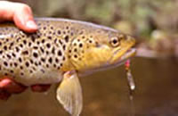
Larger brown trout to 2 kg, (most 450-750 g) are present in deeper water in the middle reaches. An accessible and popular trout fishing water with best catches late evening and night. Not stocked.
Fires (2006/07) occurred in the upper catchment followed by heavy rain. This resulted in massive scouring out of the channel with significant lowering of the level of the stream bed. The channel is gradually recovering (2008) and some trout are now being caught by anglers.
Buffalo Creek, Myrtleford
A small creek rising in forested mountains near Mt Buffalo then flowing through farmland. In the lower reaches it has a width of 4-8 m with mostly shallow runs 20-50 cm deep and deeper pools and gutters to 100 cm. Severe bank erosion in the lower reaches.
Substrate of rubble and gravel in the riffles, with coarse sand in the pools. The main riparian vegetation is blackberry. Contains some brown trout to 30 g in the lower reaches. Much of the creek is within the Mt. Buffalo National Park. It was stocked with trout cod in 1990-93 for conservation of this species.
Buffalo Lake, Dandongadale
341 ha. 24,060 ML. Boat ramp, picnic area.
A deep storage surrounded by cleared land. Subject to wide fluctuations in water level. Was emptied in 2006/07. Has never lived up to expectations as a producer of fish, but before draining it contained brown trout to 2 kg, rainbow trout to 500 g, reasonable-sized redfin some to 1 kg, goldfish, golden perch, some Macquarie perch and possibly an occasional trout cod.
Macquarie perch and trout cod had previously been stocked/translocated in the lake. Macquarie perch from the lake have moved upstream into the upper Buffalo River above Abbeyard. Trout spawn in the Buffalo River and Yarrarabula Creek above the lake and provide ample recruitment for those species. Species most often caught are redfin, trout and some golden perch. Regularly stocked with golden perch when the water level is satisfactory (not stocked in 2008). A stocking of Murray cod has been approved and scheduled for 2009.
Buffalo River, Dandongadale
Above Lake Buffalo
Flows through forest and cleared farmland, gravel and rock bed. Accessible from a road running up the valley. Some sedimentation and low flow during summer with the upper reaches drying up in severe droughts. Contains mostly brown trout to 2 kg (av. 450 g), abundant blackfish, redfin, rainbow trout, possibly trout cod, goldfish, mountain galaxias, Murray spiny crayfish and the occasional Macquarie perch in the deeper pools. Trout spawn in the river and are therefore not stocked.
Macquarie perch were stocked from 1987-1991. Trout cod were stocked from 1991-93. Note that golden perch stocked into Lake Buffalo since 2002 may move up into the upper Buffalo River. There has been no other stocking of any fish into the upper Buffalo River pre 2008.
Macquarie perch are currently totally protected in these waters. If caught they must be returned to the water.
Below Lake Buffalo
Flows through farmland. A wide river (24-33 m) with riffles 20-40 cm deep and extensive runs 50-70 cm deep. There are also extensive pools 80-210 cm deep. Rubble and gravel substrate upstream and sand and gravel downstream near Myrtleford.
A very accessible river and has areas of very good fish habitat. Contains brown trout and rainbow trout to 1.3 kg (av.450 g), abundant redfin to 1.5 kg, two species of blackfish, Murray cod, goldfish, European carp, eastern gambusia, Murray spiny crayfish and trout cod which have moved into this river from a stocking in the Ovens River as part of the Trout Cod Recovery Program (details given in the Introduction to the Guide)
May also contain occasional Macquarie perch and golden perch, which have moved upstream from the Ovens River, and from a stocking in Buffalo River in 2004.
Stocked with 104,200 Murray cod fingerlings (av. length 25 mm) from 1986-91. A department survey in 1992 captured 13 Murray cod 15-19 cm in length. At the same time anglers were catching similar-sized Murray cod on bait and spinners. No longer stocked with trout because the population is self-sustaining. Not recently stocked with native fish.
Catani Lake, Mount Buffalo
18 ha. 554 ML.
A high altitude lake located on Mount Buffalo, within the Mount Buffalo National Park. Surrounded by snow gums and alpine vegetation and usually freezes over during winter. Contains brown trout to 350 g. It has a self-sustaining population with trout spawning in Eurobin Creek. Not stocked.
Catherine River, Mount Cobbler
A good trout stream flowing through forested mountains, gravel bed. Surrounded mostly by Crown Land and has numerous deep pools, although it does have a low flow during summer. Accessible only from a walking track which starts at the junction with the Buffalo River. Contains mostly brown trout to 1.6 kg (av.300 g), some rainbow trout to 350 g and blackfish to 100 g. Trout from the Buffalo River also spawn in this creek and there is no stocking.
Cobbler Lake, Mount Cobbler
4 ha. 74 ML.
A shallow lake located in thick forest and accessible by a steep, dry weather road from the headwaters of the Rose River. Contains a few small brown trout, which spawn in small feeder streams flowing into the lake. Not stocked.
Dandongadale River, Dandongadale
A narrow river flowing in a deep valley, through dense forest, rock and gravel bed. It has a small catchment area of mostly Crown Land and has low flows during summer. Access requires walking along a track which starts from the road bridge near the junction of the Rose River. Extensive areas of dense bank vegetation of blackberry and other weeds which can restrict fishing activities. Limited angling pressure. Contains small brown trout and rainbow trout (av.220 g) upstream; with larger brown trout to 1.4 kg (av.400 g) in the lower reaches, also abundant blackfish, redfin, mountain galaxias and possibly Macquarie perch and trout cod.
Stocked with Macquarie perch 1992-93 and with trout cod in 1993-94. Both these species are unlikely to be present but are protected and if caught, must be returned to the water.
Eldorado Dredge Holes, Eldorado
Located in the Reedy Creek catchment.
A number of holes created by gold dredges, which operated in the area until the 1950s. They floated in large specially dug holes and operated by digging away the dirt at one side of the hole, extracting the gold and depositing the spoil at the other side of the hole, literally 'chewing' their way across the valley. This has resulted in much of the Ovens River flood plain being unconsolidated, relatively unstable and prone to erosion. One dredge is still preserved at Eldorado as a monument to the mining era.
The holes contain European carp, goldfish and redfin. One was stocked with Murray cod in the early 1990s but apparently this was not successful. Under consideration for a stocking of golden perch.
Fosters Dam, Glenrowan
Family Fishing Lake. Toilet, shelter shed, BBQ and off-road parking.
Not shown on map.
A very small lake (80 m diameter) fringed by eucalypts. Located on the Old Hume Highway, 500 m north of the town. Stocked with advanced yearling rainbow trout in the 2nd and 3rd term school holidays as part of the Family Fishing Lakes program (see Introduction).
Fifteen Mile Creek, Wangaratta
Flows from forest then through farmland. Substrate is gravel upstream but sand and mud in the lower reaches. River width is from 3-7 m and it is deeply entrenched in the lower reaches with vertical, unstable, clay banks and some sedimentation.
There are extensive, very shallow riffles (less than 30 cm deep) separated by deep pools (>150 cm). Summer flows can be quite low resulting in loss of habitat in the riffles. Contains mostly brown trout to 800 g, numerous rainbow trout to 200 g in the upper reaches and abundant blackfish of both species to 90 g. Also contains redfin to 80 g, European carp, mountain galaxias, southern pygmy perch, goldfish, western carp gudgeon, Murray spiny crayfish and yabbies. Trout are restricted to areas of better habitat, mostly upstream. Not stocked. A difficult stream to fish.
A survey in 2005 found that trout numbers had declined from that present in 1997. However successful spawning had occurred, despite the existing low flows and drought conditions. The wild trout population is expected to recover, without stocking, when higher flow conditions return.
A project, of revegetation, fencing, sand extraction, exotic weed and willow control has commenced as part of the River Health Program. A recent assessment of the creek by North Central Catchment Management Authority concluded that the sediment load in this creek, contributed a high level of sedimentation into the Ovens River upstream of the Heritage Section of that river.
Fletchers Dam, Beechworth
1.6 ha. Picnic areas.
An old mining dam surrounded by pine forest and situated 7 km south-east of Beechworth. Contains goldfish and small redfin. Was stocked unsuccessfully with trout in 1979.
Happy Valley Creek, Myrtleford
A small creek, flowing through farmland and joining the Ovens River below Myrtleford. Sand substrate. Contains some brown trout to 640 g, and some blackfish and redfin. There is a self-sustaining population of trout and fish from the Ovens River also spawn in this water. Not stocked. The River Health Program includes willow removal, revegetation and fencing, reduction in bank erosion and in channel sedimentation.
Harrietville Dredge Hole, Harrietville
Picnic facilities, BBQ, shelter shed and off-road parking.
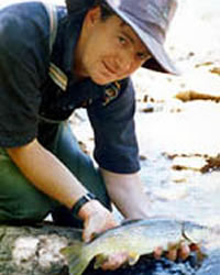
A large hole on the flood plain of the Ovens River left at the end of gold dredging operations. Easily reached from the town and includes a BBQ area, walking tracks, swimming access and a floating pontoon. Has a small boat ramp on the southern shore. Previously stocked with golden perch and Murray cod. Surveyed in 2006 and found to contain Murray cod to 1.75 kg, golden perch to 600 g, freshwater catfish and tench. Murray cod to be stocked 2009 and future stocking of golden perch is being considered. Freshwater catfish are protected.
Hurdle Creek, Wangaratta
Flows through forest and farmland, sand bed. Joins the King River below Moyhu. The stream has become silted-up in the middle and lower reaches because of forestry activities and bank erosion. Flow is low during summer. Cannot sustain high fishing pressure. Contains abundant blackfish to 220 g, redfin to 200 g in the lower reaches and a few brown trout and rainbow trout from a self-sustaining population. Not stocked.
Kerferd Lake, Beechworth
24 ha. 984 ML. It is the water supply for Beechworth and boating and swimming are prohibited.
A shallow lake surrounded by forest. Contains redfin, tench, goldfish, golden perch, trout cod and a small self-sustaining population of brown trout. Trout stocking in the past has been unsuccessful. More recent stockings of golden perch are yielding fish up to 1 kg. Further stocking of golden perch has been suspended indefinitely.
The department has developed a project to stock trout cod fingerlings into Lake Kerferd over a four year period, to establish a trial recreational trout cod fishery. The first stocking of 300 trout cod fingerlings occurred in February 2008 and it is hoped that the fishery will be open to the public in 2011/12 (depending on the success of stocking). The project will assist in implementing the department's objective of maintaining a high quality natural resource base for the long term by providing the opportunity for recreational anglers to experience and enjoy trout cod fishing.
A research and monitoring program will be developed to determine stocking success, angler catch rates, attitude and satisfaction with the project and general awareness of and support for broader conservation initiatives for trout cod.
King Lake, Rutherglen
2 ha. Adjacent caravan park, picnic facilities.
An ornamental lake set in Rutherglen Park within the town. Was stocked with trout but because of poor results, a change was made to golden perch. Stocked regularly with golden perch.
King River, Cheshunt
Rises in forested mountains east of Mount Buller and flows 30 km to Lake William Hovell. It then flows through farmland for 70 km to the Ovens River at Wangaratta.
Upstream of Lake William Hovel
Flows in natural forest. Fast-water, riffles, runs and pools, gravel, rubble and rock substrate. Access to the river just upstream of Lake William Hovell requires walking in from the Upper King River Road. Access to the upper reaches near Mount Buller requires 4WD then walking along the river. Brown trout to 1.2 kg (av.200 g) are the most abundant species, with some rainbow trout to 420 g, abundant small blackfish, redfin, goldfish and mountain galaxias. There could be some Macquarie perch, from translocation of this species into Lake William Hovell. The alpine spiny crayfish (Euastacus crassus) may occur in the headwaters.
Not stocked with trout upstream because of a self-sustaining population, which provides good fishing for trout.
This section was burnt out in the 2006/07 fires and also suffered from low flows during the drought years, followed by some big rain events.
Lake William Hovel to Wangaratta
The river flows in gentle hill terrain to Mohyu then in a wide flat valley to Wangaratta. In the upper and middle reaches the river flows in a wide channel with low banks, and extensive exposed gravel and rubble banks along the sides of the channel. At Edi the river is up to 30 m in width (av. 20 m) with extensive riffles 30-50 cm deep and numerous pools 140-180 cm deep. Substrate is rubble and gravel. Nearer to Wangaratta at Oxley, the channel is narrower with sand substrate and exposed sand banks on the inside of bends. Water depth has increased with extensive runs 40-80 cm deep and pools 130-200 cm deep.
There is scattered native riparian vegetation along the river. Access is excellent with easy walking along the banks and in the channel. The section of river from Lake William Hovell, to Edi contains abundant brown trout to 1 kg, some rainbow trout, abundant twospine blackfish to 80 g, trout cod, mountain galaxias, and undersized Murray spiny crayfish. Occasional goldfish, redfin and European carp may also occur.
The lower reaches (downstream from Edi) contain brown trout, European carp, redfin to 1 kg, abundant two-spined blackfish, goldfish, occasional golden perch, Murray cod to 15 kg and trout cod. Last stocked with brown trout in 1998. The river contains a self-sustaining population of brown trout.
Stocked with Murray cod in 2004. Trout cod have moved into the King River from recent stocking of this species in the Ovens River, as part of the Trout Cod Recovery Program.
Activities under the River Health Program include removal of willows and re-vegetation of banks at two locations between Lake William Hovell and Whitfield.
Moodemere Lake, Wahgunyah
14 ha. 7,319 ML.
A natural shallow basin surrounded by farmland and forest. Filled by overflow from the Murray River. It is a popular picnic area and carries redfin to 1.8 kg and goldfish. Fishes best during rising water.
Morses Creek, Bright
Flows through forest and farmland, and into the Ovens River at Bright, gravel bed. A narrow creek with good riparian vegetation. Catchment has been modified by mining and forestry, resulting in some sedimentation. Contains rainbow trout to 350 g upstream and brown trout to 1.4 kg downstream, also abundant blackfish and some redfin. Important spawning and nursery stream for trout from the Ovens River.
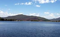
Mulwala Lake, Yarrawonga
4,590 ha. 117,500 ML. Boat ramps, picnic areas, caravan parks and accommodation in Yarrawonga and Mulwala towns. Also called Yarrawonga Weir. New South Wales Water.
This is a shallow lake (6-8 m deep) surrounded by forest and farmland. The lake, formed by a dam on the Murray River, is 9 km in length and 2 km in width. Substrate is mud and a significant feature is the abundance of submerged logs and standing timber, which creates excellent habitat for Murray cod.
The lake became a New South Wales water in September 2004. A NSW fishing licence is required. Fisheries regulations, stocking and fisheries management are now the responsibility of the NSW DPI.
The lake was drained between May and August of 2002 for work on the weir wall but remnant pools in the old riverbed, plus a temporary fisheries closure, protected fish stocks. Since then there has been some fluctuation in water level because of drought conditions. The present policy of the Murray Darling Basin Commission is that the lake will be kept at a lower level to reduce losses in evaporation. There is a lift for fish installed on the downstream side of the wall. Fish moving upstream enter a submerged wire cage. The cage and the water level are then raised within the 'elevator shaft' to the water level of the Lake, allowing the fish to swim out and move upstream. Fish such as Murray cod, golden perch and silver perch readily enter the cage and move upstream.
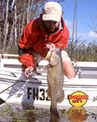
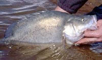
Lake Mulwala offers excellent fishing and boating and is regarded by many as the best Murray cod fishery in Australia. Contains Murray cod to 100 cm in length, trout cod, golden perch, blackfish, tench, European carp, goldfish, Australian smelt, eastern gambusia and Murray River rainbowfish. Redfin used to be common but are now rare. The occasional silver perch is caught. The lake also contains Murray spiny crayfish.
Best fishing time for Murray cod is February to May when water temperatures are above 12º C. Trolling of lures is the most popular fishing method although bait fishing gives good results. Murray cod like to rest next to logs and snags, so lures and baits must be worked close to the snags. Golden
perch will take lures either trolled or by casting, as well as baits such as shrimps, worms and yabbies.
Check with local bait tackle shops for fishing information and techniques. At a fishing competition for Murray cod held in December 2007, lures were the most productive fishing method followed by bait. Best baits were worms followed by yabbies, shrimp then Bardi grubs.
Murray River (NSW)
See The Murray River
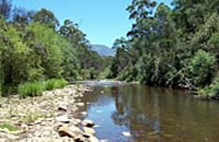
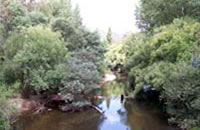
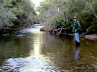
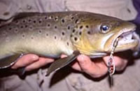
Ovens River, Wangaratta
Rises near Mount Hotham and flows for 130 km to Lake Mulwala. Flows through a small area of forest at Harrietville then through pine plantations near Bright/Porepunkah but most of its length to Wangaratta is through farmland. Downstream of Wangaratta it flows through farmland and then through red gum forest for several kilometres, before reaching Lake Mulwala. The river can be divided into two main sections, upstream and downstream of Myrtleford. Upstream, it is a clear, fast flowing river with coarse substrate providing good habitat for salmonids.
Downstream the substrate becomes sand, the water turbid, and deeper, providing more suitable habitat for native fish. Most of the catchment has been highly modified and cleared with resulting extensive bank erosion, although remedial works have been carried out. Historically there was extensive gravel extraction upstream of Myrtleford.
Despite being an un-regulated river upstream of Myrtleford and draining a large catchment, most of the river upstream of Wangaratta is quite shallow with most pools usually less than 130 cm deep and large areas of shallow riffles 30-60 cm deep, during summer.
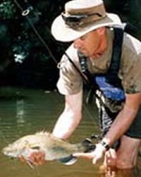
Access is good and it is a popular angling water for trout upstream of Myrtleford and for Murray cod, golden perch and redfin downstream of Wangaratta.
The Ovens River was selected to be stocked with trout cod over a 5 year period, as part of the National Trout Cod Recovery Program (conservation stocking). Activities include restocking of trout cod upstream of Wangaratta for 4 years, with stock assessment in the 5th year. (Other rivers in Victoria which are part of this Recovery Program, are Seven Creeks, Goulburn River and the upper Mitta Mitta River. The upper Murray River, which is also part of the Recovery Program, is being managed by NSW). The result has been excellent, with a large population of 'self sustaining' trout cod distributed throughout the length of the Ovens River and into the King and Buffalo Rivers. The species is now commonly caught by anglers but is still protected and must be released unharmed.
The Ovens River was undamaged by the 2006/07 fires, however it was subjected to extensive periods of low flow during the past drought years. Fish populations are still in good condition.
There has been extensive river improvement work in the Ovens River, under the River Health Program. Locations targeted are the Heritage River section, between Wangaratta and Myrtleford, and tributaries Happy Valley, Deep, Barwidgee, Hodgsons and Burgoigee Creeks. Activities include the removal of seeding willow trees and revegetation of the banks with native species. There are also actions to manage bank erosion and reduce sedimentation. Revegetated areas and remnant native vegetation have been fenced off to protect them from stock. Nine reaches of the river have been listed as Environmental Water Reserves and are now receiving improved flow regimes through changes in off-stream water diversions (see Introduction to the Guide for additional explanation).
Activities under the Murray-Darling Native Fish Strategy which are specific to the Ovens River include, river improvement works by catchment management authorities; support for local communities and landholders to continue river improvement activities in the Ovens River and its tributaries, Reedy Creek, Devils Creek and Morses Creek. There has also been an evaluation of the ecological condition and health of the Ovens River Valley (Sustainable Rivers Audit) at a number of sites. There has also been a geomorphic assessment of the river between Myrtleford and Wangaratta to provide base line information and to identify any constraints which may affect habitat rehabilitation activities.
Upstream of Bright
The river rises near Harrietville then flows for 35 km through patches of forest, unimproved farmland and pine plantations. The channel is 8-15 m wide with numerous shallow riffles 30-50 cm deep and pools less than 80 cm deep with a boulder and rubble substrate. It has clear, fast-flowing water and good habitat for small trout. Contains abundant brown trout to 1.3 kg (av.350 g), abundant small rainbow trout (av.75 g), two-spined blackfish, some redfin, tench and mountain galaxias. Flows close to the road and access is good.
A Stream Flow Management Plan is being prepared (2008) for the upper Ovens River. This will develop a flow sharing arrangement for all water users, and allocate an appropriate environmental flow for the river.
Bright to Myrtleford
Flows for 30 km through pine plantations and farmland. Good access at Porepunkah but restricted access downstream where it flows through farmland. Width varies from 10-16 m at Porepunkah to 42 m wide (av.25 m) at Myrtleford. There are extensive riffles and runs at Porepunkah (20-50 cm deep) with pools to 100 cm deep, and gravel and rubble substrate. At Myrtleford, there are extensive runs 40-60 cm deep and riffles with high water velocity, but most of the river has water deeper than 100 cm with the majority of pools 200-230 cm deep, and some pools over 350 cm deep.
Substrate is gravel, rubble, rock and some sand. All these conditions create excellent habitat for trout in this section of the river. Contains brown trout to 1.3 kg, some rainbow trout, abundant small blackfish, trout cod, redfin, and mountain galaxias. Contains a self-sustaining trout population and has not been stocked since 1996. Trout cod have moved into this area from stocking downstream.
Myrtleford to Wangaratta
This 40 km length of river flows through farmland with good riparian vegetation of red gums. It is accessible from a number of cross roads. The lower reaches near Wangaratta are navigable by small boats provided they can be launched from the bank. River width varies from 20-50 m. Water depth of pools averages 130 cm with only a few deeper holes to 200 cm. There is considerable water 40-75 cm deep. Substrate is rubble, gravel and sand near Myrtleford, becoming sand and gravel towards Wangaratta.
Contains brown trout to 850 g, some rainbow trout, trout cod, two-spined blackfish, river blackfish, redfin, mountain galaxias, Australian smelt and some small Murray cod downstream of Whorouly. Also possibly some golden perch.
Trout cod were stocked from 1997 to 2001 and again in 2006 (Trout cod Recovery Program). Anglers report that they are now abundant and widely dispersed throughout the lower reaches of this section of the river. Trout cod are protected under the Flora and Fauna Guarantee Act 1988 and must be released unharmed.
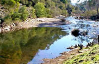
Downstream of Wangaratta
The 25 km section of river downstream of Killawarra (Spring Creek D8) to Lake Mulwala on the Murray River is nominated as a Heritage River.
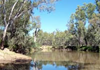
The river flows through farmland and then red gum forest downstream of Peechelba. Channel width at Peechelba is 33-40 m, with extensive areas of water 100-220 cm deep, and gutters and holes over 350 cm deep. Substrate is sand and clay. There is some instream habitat, also gravel and sand banks along the sides of the channel. This section is very accessible by small boats, however the lower reaches near Lake Mulwala have anabranches and backwaters, which can be confusing to navigate. Boats can be launched at Bundalong.
The lower reaches are in a very natural condition and it is a pleasant area to fish. Contains some redfin, numerous Murray cod, some golden perch particularly near Lake Mulwala, also Murray spiny crayfish and trout cod. Other species are European carp, some blackfish, tench, eastern gambusia, goldfish, Australian smelt, southern pygmy perch, western carp gudgeon and Murray River rainbowfish. Murray cod are self-sustaining in Lake Mulwala and the Ovens River. Golden perch are stocked into Lake Mulwala by NSW and they move up into the Ovens River.
Last stocking of golden perch into the Ovens River was in 1995. Note that a fisheries survey pre- 2002, found that the Murray spiny crayfish were mostly undersized with very few legal-sized crayfish available to anglers.
Rose River, Dandongadale
Rises in mountainous forests then flows through farmland in a gravel and rock bed. There is some sedimentation of the channel and it can become a series of pools in dry years. Accessible along its length from a nearby road and it is a popular fishing water. However anglers report that dense bank vegetation of blackberry is common and can make access to the water difficult. Contains brown trout to 2 kg and rainbow trout to 1 kg in the headwaters, with some larger fish downstream. Also contains two-spined blackfish, redfin and mountain galaxias. Stocked prior to 1995 with Macquarie perch fingerlings and trout cod fingerlings. Last stocked with brown trout in 1995. A self-sustaining population exists.
The catchment was burnt out by the 2006/07 bushfires. A survey at one site (Upper Rose River Road) in October/November 2007 by the department, took no fish. It may be some time before fish populations recover.
Sambell Lake, Beechworth
Family Fishing Lake
6 ha. 861 ML. Boat ramp, picnics, barbecues.
This is the drowned site of abandoned gold diggings and is situated in a park in the middle of the town. Contains mainly redfin to 900 g, blackfish, golden perch and tench. An earlier trout cod population is no longer present in this water. Managed as a Family Fishing Lake and stocked annually with golden perch and advanced rainbow trout (see Introduction).
William Hovell Reservoir, Cheshunt
113 ha. 13,720 ML. Boat ramp, picnic facilities.
A small steep-sided storage on the King River that supplies irrigation water for the King and lower Ovens River valleys. Camping is not permitted. Boating is allowed but there is a maximum limit on motor power of 7.5 kw (10 hp). Contains abundant redfin to 1.5 kg (av.400 g), brown trout to 1 kg, (av.450 g), some large blackfish and possibly some Macquarie perch although no recent records.
The top end of the reservoir is the most productive for trout, especially in the winter-spring season, when it is refilling. The lake is self-sustaining for trout with ample spawning occurring upstream. Between 1988 and 1994 three hundred and fourteen adult Macquarie perch were translocated from Lake Dartmouth to Lake William Hovell. Fishing results are erratic, with anglers reporting (2007/08) good fishing for European carp, redfin and trout followed by periods when few fish were taken.
In 2010 a breakthrough was achieved by aquaculture scientists from the department at Snobs Creek when they successfully bred large numbers of Macquarie perch in captivity for the first time.
This breakthrough will greatly assist the recovery of Macquarie perch in its natural range, given declines in its distribution and abundance.
In 2010, Fisheries Victoria released 2,800 fingerlings into Lake William Hovell.
The Macquarie perch is a valued recreational fish in Victoria that can only be taken from a few waters in accordance with strict catch limits and an annual three-month closed season (refer to the Victorian Recreational Fishing Guide).
Macquarie perch cannot be kept if caught from this waterway and must be returned to the water immediately
Wooragee Creek, Beechworth
A small stream flowing through forest and farmland. Carries brown trout to 400 g and some blackfish. Not worth fishing during summer because of low flows. No longer stocked with trout.