Mitta Mitta
- Banimboola Creek
- Bundarra River
- Cobungra River
- Dart River
- Dartmouth Lake
- Dry Forest Creek
- Gibbo River
- Hume Lake
- Jim and Jack Creek
- Little Snowy Creek
- Livingston Creek
- Mitta Mitta River
- Morass Creek
- Murray River (NSW)
- Omeo Lake
- Sandy Creek
- Sandy Creek Reservoir
- Snowy Creek
- Tallangatta Creek
Mitta Mitta River
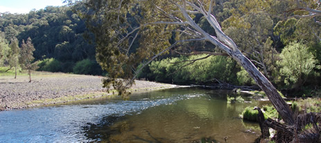
The Basin is mostly steep mountains or hills with extensive forest covering about 70% of the area. The upper reaches of the Mitta Mitta River, including its tributaries, drain from the High Plains through deeply dissected forests. The Mitta Mitta River then flows for 70 km through forest, Lake Dartmouth and then a wide valley to Lake Hume. Most of the waterways are in good to excellent condition. Some sections of river bank have been cleared of native vegetation and/or damaged by stock but habitat for aquatic biota is generally very good throughout the Basin.
Lake Dartmouth, situated in the middle reaches of the river and in the centre of the Basin, controls all river flow downstream to Lake Hume. Most of the Basin has a mean annual rainfall over 700 mm with rainfall increasing with elevation to 2,400 mm at Mt. Bogong.
Two lakes (Hume and Dartmouth) are noted fishing waters providing angling and other recreational activities. Lake Hume provides all-year-round fishing for a wide variety of species. Two rivers (Bundarra and Cobungra) are well known brown trout streams. There is good access by conventional vehicles to the two lakes, the lower reaches and some sections of the upper reaches of the Mitta Mitta River but other locations may require 4WD vehicles or walking. There is limited access to many of the smaller creeks in this Basin.
The extensive period of drought resulted in low flows in some streams but anglers report fish populations still present with successful angling results (2008).
Fishing Opportunities and Access Maps
Freshwater Fish in the Basin
Native species
- (Large fish): Murray cod, golden perch, *Macquarie perch, Murray spiny crayfish, trout cod, #silver perch.
- (Small fish): Australian smelt, blackfish, *climbing galaxias, flathead galaxias, mountain galaxias and southern pygmy perch.
Introduced species
- Brown trout, rainbow trout, European carp, goldfish, redfin and eastern gambusia.
Native species in bold are protected in this Basin. Introduced species in bold are declared noxious.
# silver perch may be taken only from Lake Hume and *Macquarie perch only from Lake Dartmouth. Both species are protected in all other waters.
* climbing galaxias are native to coastal catchments. They are believed to have entered the northern catchments via the Snowy River Scheme.
The alpine spiny crayfish may occur in the headwaters at high altitude.
Management
See Introduction for information on management agencies and programs.
The Victorian Fisheries Authority
- manages stocking, fisheries policy, compliance with fisheries regulations and angler contact.
- Fisheries Management Plan Fisheries Management Plan (FMP) (a recent project that provides recreational anglers, government agencies and other stakeholders with clear guidance on fisheries management issues with a regional area over a five year period).
A FMP has been declared for waters within this Basin. Fisheries Victoria Report Series. North East Fishery Management Plan. No 48. August 2007. - Stocking Program (stocking plans for desirable species are based on an approved Victorian Fisheries Authority stocking policy and are reviewed annually via Vic Fish Stock). Hume Lake receives golden perch, brown trout, rainbow trout and occasionally Murray cod. The lower Mitta Mitta River was stocked with Murray cod in 2008. Trout cod have been stocked into the upper Mitta Mitta River. All the rivers carry self-sustaining populations of trout.
Up-to-date information on numbers and size of each species stocked can be found under Fish Stocking in the Fisheries and Aquaculture section of this website or in the annual Vic Fish Stock Report published by the department. - Family Fishing Lakes Program (an ongoing project of stocking small waters within urban areas with larger trout, for junior and disabled anglers, see Introduction). None established in this Basin.
- Victorian Stream Classification (a project that was completed in November 2010, which classifies each water as a native, salmonid or mixed fishery). Classifications relevant to this basin are:
- Trout -
- All other rivers and creeks upstream of the Murray Valley Highway.
- Mitta Mitta River from Lake Dartmouth to Omeo Highway Bridge.
- Mixed -
- Lake Hume, Lockhardt, Sandy, Shady creeks.
- Mitta Mitta River (Big River) and tributaries between the Hinnomunjie Bridge crossing and Lake Dartmouth.
- Lake Dartmouth and Toke, Murtagh, Soldier, Shady creeks.
- Gibbo River from Lake Dartmouth to Corryong Road Bridge.
- Mitta Mitta River downstream of Omeo Highway Bridge near Tallandoon.
- Trout -
Department of Sustainability & Environment (DSE)
- the Freshwater Ecology Group carries out fisheries research.
- National Trout Cod Recovery Program (restoration of this species in Victorian waters) Trout cod have been stocked into the Mitta Mitta River upstream of Lake Dartmouth.
North East Catchment Management Authority
- is responsible for catchment management and the Victorian River Health Program.
- Victorian River Health Program (an on-going state government initiative to achieve healthy rivers, streams and floodplains). Several projects continue on Little Snowy Creek at Eskdale, Livingstone Creek, Bundarra River, Cobungra River and the lower reaches of the Mitta Mitta River. See details in the Angling Waters.
Goulburn Murray Rural Water
- manages irrigation, domestic and stock, and some bulk water supply services, also development of Stream Flow Management Plans.
- Stream Flow Management Plans (an ongoing project in which various agencies and water users develop a flow sharing arrangement which ensures an adequate environmental flow allocation for each river in Victoria). No stream flow management plans have yet been developed for waters in this Basin. However an environmental flow is maintained in the Mitta Mitta River downstream of Dartmouth Dam.
North East Water
- manages urban water demand.
Best Fishing Waters
| Water | Target Species |
|---|---|
| Cobungra River | Brown trout |
| Lake Dartmouth | Brown trout |
| Mitta Mitta River upstream and downstream of Lake Dartmouth | Brown trout |
| Lake Hume | Golden perch, brown trout, redfin, Murray cod |
Special Values
Heritage River Area
Mitta Mitta River from Glen Valley to Lake Dartmouth.
Representative Rivers
The Upper Big River (above Glen Valley) and Snowy Creek (below Granite Flat) are listed as Representative Rivers of East Victorian dissected uplands.
Natural Catchment Areas
Mount Tabor Creek and Banimboola Creek
Special Values
Threatened Species
Six species in this Basin (flathead galaxias, Macquarie perch, trout cod, Murray cod, silver perch and Murray spiny crayfish) are threatened species in Victoria. The list of Victorian threatened species, with their national conservation value, scientific names and explanation of their conservation status category, is available on the DSE web site, (Department of Sustainability and Environment [DSE] Dec 2007).
Species in bold type are also listed under the Flora and Fauna Guarantee Act 1988) and cannot be taken or kept without an order, licence or permit. Such an order by the Governor in Council allows anglers to take Murray cod, Murray spiny crayfish from any water; and Macquarie perch only from Lake Dartmouth; and silver perch only from Lake Hume.