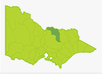
Broken
- Amaroo Lake
- Benalla Lake
- Boosey Creek
- Broken Creek
- Broken River
- Holland Creek
- Kialla Lakes
- Loombah Weir
- Lowanna Lake
- McCall Say Weir
- Lake Mokoan
- Mooroopna Reserve
- Murray River (NSW)
- Lake Nillahcootie
- Ryans Creek
- Tungamah Weir Pool
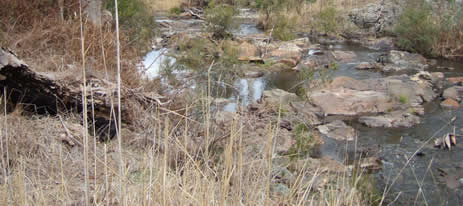
Holland Creek
This is a small Basin with one main river (Broken River) draining from steep forested hills south of Benalla and then flowing through flat farmland to the Goulburn River at Shepparton. Downstream of Benalla, the Broken Creek branches off from the Broken River and flows to the Murray River near Barmah. The flat farmland which makes up most of the Basin has several areas of gentle sloping hills of sedimentary and granitic rocks and one small area of volcanic rock north of Shepparton.
The soils through which the waterways flow are composed of finely textured unconsolidated deposits resulting in mud and sand substrate in the rivers. Gravel and rubble substrates are restricted to the upper reaches of the Broken River. Mean annual rainfall decreases northwards from 700-1,000mm in the mountains around Lake Nillahcootie to 400-500 mm towards the Murray River. Although the major waterways have good riparian vegetation, instream snags and fish cover in permanent pools, they can suffer from low flows during the non-irrigation period and a lack of flooding during spring (as a result of flow regulation) which inhibits spawning of native fish. Some reaches have bank erosion and sedimentation. Salinity is low but water quality for aquatic life is moderate in most waters.
Lake Nillahcootie stores most of the run-off from the higher rainfall area resulting in low winter flows in parts of the Broken River and Broken Creek. However supply of irrigation water during summer ensures good flows at this time. The result is that main rivers and fish populations in this Basin have not been adversely affected by the drought.
The central area is used for grazing and mixed cereals with a large area of intensive irrigation and cropping in the north between Shepparton and Cobram on the Murray River. The lower reaches of Broken Creek flow through red gum woodland (Barmah Forest). Despite the extensive farmland throughout the Basin there is good riparian vegetation of mature red gums along the larger waterways. Surface water is fresh. There are high levels of turbidity in Broken Creek.
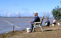
Fishing Opportunities and Access Maps
Freshwater Fish in the Basin
Native species
- (Large fish): Murray cod, bony bream, golden perch, Murray spiny crayfish, freshwater catfishand Macquarie perch.
- (Small fish): Australian smelt, blackfish, flathead galaxias, flathead gudgeon, mountain galaxias, Murray River rainbowfish, southern pygmy perch and western carp gudgeon.
Introduced species
- Brown trout, European carp, goldfish, eastern gambusia , rainbow trout, redfin and tench.
Native species in bold are protected in this Basin. Introduced species in bold are declared noxious.
Management
See Introduction for information on management agencies and programs.
The Victorian Fisheries Authority
- manages stocking, fisheries policy, compliance with fisheries regulations and angler contact.
- Fisheries Management Plan (FMP) (a recent project that provides recreational anglers, government agencies and other stakeholders with clear guidance on fisheries management issues with a regional area over a five year period).
Fisheries Victoria in 2009 started to develop the new Goulburn Broken Fishery Management Plan. This new plan will provide for sustainable management of recreational fisheries in the rivers, lakes and impoundments located within the boundaries of the Goulburn Broken Catchment Management Authority for at least the next five years. This plan is expected to be completed in 2010. - Stocking Program (stocking plans for desirable species are based on an approved Victorian Fisheries Authority stocking policy and reviewed annually via Vic Fish Stock). Nillahcootie Lake, Kialla lakes, Broken Creek and Broken River are stocked with native fish. Salmonids are stocked into Mooroopna Recreation Reserve Lake, Hollands Creek and Ryans Creek.
Up to date information on numbers and size of each species stocked can be found under Fish Stocking in the Fisheries and Aquaculture section of this website or in the annual Vic Fish Stock Report published by the department. - Family Fishing Lakes Program (an ongoing project of stocking small waters within urban areas with larger trout, for junior and disabled anglers. See Introduction for further information). Mooroopna Recreation Reserve Lake has been designated as a Family Fishing Lake and will be stocked with rainbow trout. See details in angling waters.
- Victorian Stream Classification (a project that was completed in November 2010, which classifies each water as a native, salmonid or mixed fishery). Classifications relevant to this basin are:
- Trout - Ryans Creek upstream of McCall Say Weir and between Loombah Weir and Ryans Creek township. Upper Hollands Creek.
- Mixed - Lake Nilahcootie, lower Hollands Creek, lower Ryans Creek below and including Loombah Weir, Baddaginnie Creek, Broken River south of Benalla.
- Native - Ryans Creek between McCall Say and Loombah weirs and all other waters including Broken River north of Benalla.
Goulburn Broken Catchment Management Authority
- is responsible for catchment management and the Victorian River Health Program.
- Victorian River Health Program (an on-going state government initiative to achieve healthy rivers, streams and floodplains).There has been increased environmental flow in some reaches of the Broken River under the Environmental Water Reserve Program. A fishway has been constructed at Casey's Weir on the Broken River. Various other projects to improve the health of the Broken River have been completed. See Angling Waters. A 'Demonstration Reach' has been set up in Hollands Creek by DSE.
Goulburn Murray Rural Water
- manages irrigation services, domestic and stock services and some bulk water supplies; also development of Stream Flow Management plans.
- Stream Flow Management Plans (an ongoing project in which various agencies and water user's develop a flow sharing arrangement which ensures an adequate environmental flow allocation for each river in Victoria). None yet developed in this Basin.
Goulburn Valley Water
- manages urban demands in all areas except a section of the Broken River including Benalla, which is managed by North East Water.
Best Fishing Waters
| Water | Species |
|---|---|
Nillahcootie Lake | Redfin golden perch, occasional Murray cod |
Broken River Casey's Weir | Murray cod, golden perch |
Broken Creek downstream of Nathalia | Murray cod, some golden perch |
Special Values
Ramsar Sites
(wetlands of international significance, Convention on Wetlands. Ramsar. Iran.1971)Barmah State Park and its associated waterways and wetlands, (Barmah Lakes, Murray River from Tocumwal to Barmah and the lower 5km reach of the Broken Creek) are listed as wetlands of international significance.
Threatened Species
Six species in this Basin (freshwater catfish, flathead galaxias, Macquarie perch, Murray cod, Murray River rainbowfish, and Murray spiny crayfish) are threatened species in Victoria. The list of Victorian threatened species, with their national conservation value, scientific names and explanation of their conservation status category, is available on the DSE web site (Department of Sustainability and Environment [DSE] Dec 2007).
Species in bold type and the Lowland Riverine Fish Community of the Southern Murray-Darling Basin are also listed under the Flora and Fauna Guarantee Act 1988. ) and cannot be taken or kept without an order, licence or permit. Such an order by the Governor in Council allows anglers to take Murray cod and Murray spiny crayfish.