Locations
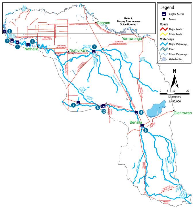
1. Rice's Bridge Barmah
Rice’s Bridge Barmah: The road to this site is accessible in a 2WD vehicle in any weather condition, however the access and parking at this site should only be attempted in a 2WD vehicle in dry weather conditions. There is a dirt boat ramp that should only be attempted in a 2WD vehicle in dry weather conditions. The bank slope and bank access to the water is moderate. There is camping available, but there are no facilities available. The turnoff to this site is located 58km from Benalla along the Benalla-Tocumwal Road. Then you will need to take the Katamatite-Nathalia Road for 45.3km, followed by the Murray Valley Highway for 2.7km, Barmah-Shepparton Road for 24.1km, Murray Street for 700m and the Moira Lakes Road for 6km
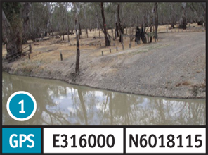
2. Kennedy's Weir
Kennedy’s Weir: The road to, and parking at this site, can be done in a 2WD vehicle in any weather condition. The bank slope is moderate and the access to the water is also moderate. Picnic tables are available. The turnoff to this site is located 58km from Benalla along the Benalla-Tocumwal Road. Then you will need to take the Katamatite-Nathalia Road for 45.3km, followed by the Murray Valley Highway for 2.7km, Barmah-Shepparton Road for 14.1km, James Bridge Road for 3.7km and Kennedy Road for 4.5km.
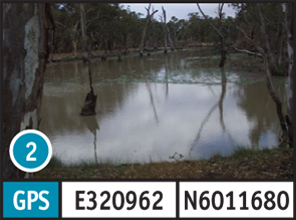
3. James Bridge
James Bridge: The road to this site is accessible in a 2WD vehicle in any weather condition, however access and parking at this site should only be attempted in a 2WD vehicle in dry weather conditions. The bank slope and access to the water is moderate. There is camping available, but there are no facilities available. The turnoff to this site is located 58km from Benalla along the Benalla-Tocumwal Road. Then you will need to take the Katamatite-Nathalia Road for 45.3km, followed by the Murray Valley Highway for 2.7km, Barmah-Shepparton Road for 14.1km, James Bridge Road for 1.9km, Hardings Road for 400m and an unnamed road for 300m.
4. Bourke's Weir
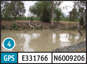
Bourke’s Weir: The road to, and parking at this site, can be done in a 2WD vehicle in any weather condition. The bank slope and access to the water is moderate. There is camping available and also picnic tables. The turnoff to this site is located 58km from Benalla along the Benalla-Tocumwal Road. Then you will need to take the Katamatite-Nathalia Road for 45.3km, followed by the Murray Valley Highway for 2.7km, Barmah-Shepparton Road for 6.8km, Murray Road for 3.0km and an unnamed road for 200m.
5. Dip Bridge
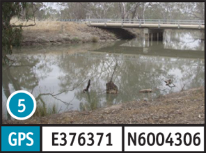
Dip Bridge: The road to, and parking at this site, can be done in a 2WD vehicle in any weather condition. The bank slope and access to the water is moderate. There are no facilities at this site. The turnoff to this site is located 58km from Benalla along the Benalla- Tocumwal Road. Then you will need to take the Katamatite-Nathalia Road for 7km.
6. Lake Benalla
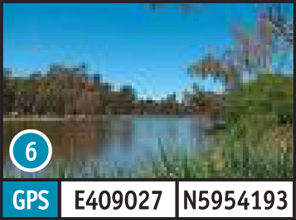
Lake Benalla: The road to, and parking at this site, can be accessed in a 2WD vehicle in any weather condition. The bank slope is flat and the bank access to the water is good. There is a fireplace/BBQ available at this site. The turnoff to this site is located in the centre of Benalla.
7. Main Eastern Channel
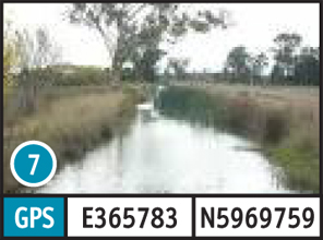
Main Eastern Channel: The road to, and parking at this site, can be accessed in a 2WD vehicle in any weather condition. The bank slope is steep and the access to the water is good. There are no facilities available at this site. The turnoff to this site is located 51km from Benalla along the Midland Highway.
8. Gowangardie Weir
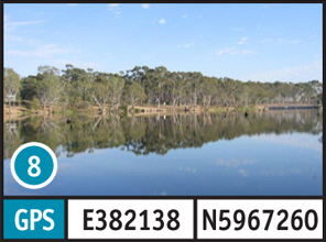
Gowangardie Weir: The road to this site is accessible in a 2WD vehicle only in dry weather conditions, however access and parking at the site can be done in a 2WD vehicle in any weather condition. The bank slope is steep and the access to the water is moderate. There are no facilities available at this site. The turnoff to this site is located 35km from Benalla along the Midland Highway. Then you will need to take an unnamed Road for 800m.
9. Casey's Weir
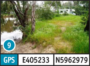
Casey’s Weir: The road to, and parking at this site, can be done in a 2WD vehicle in any weather condition. The bank slope is steep and the access to the water is moderate. There are facilities available at this site. The turnoff to this site is located 9.5km from Benalla along the Midland Highway. Then you will need to take an unnamed road for 100m.
10. Dookie Bend
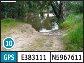
Dookie Bend: The road to, and parking at this site, can be done in a 2WD vehicle in any weather condition. There is a dirt boat ramp that should only be used by 4WD in any weather condition. The bank slope is moderate and the access to the water is poor. Picnic tables are available. The turnoff to this site is located 30km from Benalla along the Midland Highway. Then you will need to take an unnamed road for 170m.