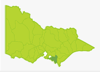
South Gippsland (West)
- Bass River
- Berrys Creek
- Elizabeth Creek
- Korumburra Reservoirs
- Lance Creek
- Leongatha Reservoirs
- Little Bass River
- Poowong Reservoir
- Pound Creek
- Powlett River
- Saltwater Creek
- Screw Creek
- Swan Lake
- Tarwin River East Branch
- Tarwin River West Branch
- Watkins Creek
- Wild Dog Creek
- Wilkur Creek
South Gippsland basin has been divided into east and west sections for clearer map display.
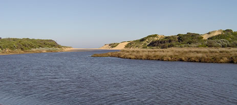
This section of the Basin is almost entirely cleared farmland with very small patches of forest North West of the Bass River and in the upper reaches of the Tarwin River West Branch. The terrain is all steep hills except in the central area including the catchments of the Powlett River and the lower Tarwin River, which is flat farmland with unconsolidated soils. A dune complex exists south of Andersons Inlet. Mean annual rainfall is from 700-1,000 mm and catchment yields are high (250-300 ML/sq.km.) resulting in a reliable flow regime in the rivers.
The Tarwin River is the largest river and has the best fishing with brown trout in the upper reaches, river blackfish in the west branch and estuary perch in the lower reaches. The other rivers have limited fishing value. There is a good population of the threatened Australian grayling in the upper reaches of the Tarwin River West Branch. There are only two larger estuaries (Tarwin and Powlett Rivers) and these contain similar estuarine fish species to those in the eastern section of Basin 27. Some waters in this Basin are commercially fished for short-finned and long-finned eel.
Freshwater Fish in the Basin
Native species
- (Large fish): Australian grayling, estuary perch, long-finned eel, river blackfish and short-fin eel.
- (Small fish): Australian smelt, climbing galaxias, common galaxias, congoli, flathead gudgeon, mountain galaxias, pouch lamprey, shorthead lamprey, southern pygmy perch and trout galaxias.
Introduced species
- Brown trout, European carp, goldfish and redfin.
Native species in bold are protected in this Basin. Introduced species in bold are declared noxious.
Management
See Introduction for information on Management Agencies and Programs.
The Victorian Fisheries Authority
- manages stocking, fisheries policy, compliance with fisheries regulations and contact with anglers.
- Fisheries Management Plan (FMP) (a recent project that provides recreational anglers, government agencies and other stakeholders with clear guidance on fisheries management issues with a regional area over a five year period).
A FMP for waters within this Basin has been completed and was declared in July 2008. It can be viewed on the website. (West Gippsland Fishery Management Plan No. 56) - Stocking Program (stocking plans for desirable species are based on an approved Victorian Fisheries Authority stocking policy and are reviewed annually via Vic Fish Stock). In this Basin, all the rivers carry self-sustaining populations of fish and stocking is not considered necessary.
Up-to-date information on numbers and size of each species stocked can be found under Fish Stocking in the Fisheries and Aquaculture section of this website or in the annual Vic Fish Stock Report published by the department. - Family Fishing Lakes Program (an ongoing project of stocking small waters within urban areas with larger trout, for junior and disabled anglers – see Introduction for further information). None are established in this Basin.
- Victorian Stream Classification (a project that was completed in November 2010, which classifies each water as a native, salmonid or mixed fishery). Classifications relevant to this basin are:
- Trout - Franklin, Agnes and Tarra rivers and Merriman Creek and tributaries upstream of the South Gippsland and Hyland Highways. Tarwin east and west Branch and tributaries north of the South Gippsland Highway. Hyland Reservoir.
- Mixed - Bass, Tarwin and Powlett rivers south of South Gippsland Highway.
- Native - East South Gippsland south of South Gippsland Highway including Wilsons Promontory. Jack and Albert rivers and tributaries.
Port Phillip & Westernport and the West Gippsland Catchment Management Authorities
- Are responsible for catchment management and the Victorian River Health Program in the Bass River catchment and the rest of the Basin respectively.
- Victorian River Health Program (an on-going State Government initiative to achieve healthy rivers, streams and floodplains). Major activities are removal of willow and pest plants and the protection of banks by fencing, re-establishing native vegetation and engineering works when necessary.
Gippsland & Southern Rural Water
- manages farm and irrigation water diversion and development of Stream Flow Management Plans.
- Stream Flow Management Plans (an ongoing project in which various agencies and water user's develop a flow sharing arrangement which ensures an adequate environmental flow allocation for each river in Victoria). There are none planned or operating in this Basin at present.
Westernport Water and South Gippsland Water
- manage urban water diversion west and east of Wonthaggi respectively.
Best Fishing Waters
| Water | Target Species |
|---|---|
Tarwin River - West Branch | River blackfish |
| Tarwin River estuary | Estuary perch |
| Powlett River | Black bream, estuary perch |
Special Values
Threatened Fish Species
The Australian grayling is listed as a threatened species in Victoria. (Department of Sustainability and Environment [DSE] Dec. 2007). A list of Victorian threatened species together with scientific names of species, a definition of the terms used and their national status is available on the DSE web site.
Species in bold type are also listed under the Flora & Fauna Guarantee Act 1988. These species cannot be taken or kept within Victoria without an appropriate written order, licence or permit.