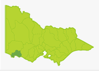
Portland
- Aringa Reservoir
- Arrondoovong Creek
- Branxholme Reservoir
- Bridgewater Lakes
- Camp Creek
- Condah Lake
- Darlot Creek
- Eumeralla River
- Fitzroy River
- Moyne River
- Shaw River
- Surprise Lake
- Surrey River
- Tower Hill Lake
- Yambuk Lake
Almost the entire Basin is a flat plain of volcanic rock and finely textured unconsolidated deposits, with a coastal strip of dune complex. Land use is grazing and broad acre cropping. There are quite large scattered areas of mixed species low forest west of Macarthur. These occur on the upper half of the Surrey River, the headwaters of the Fitzroy River and in the middle reaches of Darlots Creek around Lake Condah.
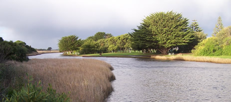
Mean annual rainfall is lowest (600-700 mm) in the northeastern half of the Basin and higher in the south (700-1,000 mm). There are five small waterways (each around 4 km long) draining the Basin. Each river has some estuarine water, which provides most of the fishing. River blackfish, redfin and short-finned eel are the predominant angling species in the fresh water. Brown trout are scarce or absent in most rivers. Some waters in this Basin are commercially fished for short-finned eel.
Freshwater Fish in the Basin
Native species
- (Large fish): Estuary perch, river blackfish, and short-finned eel.
- (Small fish): Australian smelt, common galaxias, congoli, easterndwarf galaxias, flathead gudgeon, mountain galaxias, pouch lamprey, shorthead lamprey, trout galaxias, southern pigmy perch and Yarra pygmy perch.
Introduced species
- Brown trout, goldfish, eastern gambusia, rainbow trout, redfin and tench.
Native species in bold are protected in this Basin. Introduced species in bold are declared noxious.
Features of the fish populations are the scarcity of introduced fish, the wide distribution of Yarra pygmy perch (5 rivers) and the presence of eastern dwarf galaxias in at least two rivers. Of the 14 native species in fresh water, 9 move into estuarine water at some time in their life cycle.
Management
See Introduction for information on Management Agencies and Programs.
The Victorian Fisheries Authority
- manages stocking, fisheries policy, compliance with fisheries regulations and contact with anglers.
- Fisheries Management Plan (FMP) (a recent project that provides recreational anglers, government agencies and other stakeholders with clear guidance on fisheries management issues with a regional area over a five year period).
A FMP for waters within this Basin has been completed and was declared in October 2006. It can be viewed on the website. Fisheries Victoria Report Series. Glenelg Hopkins FisheryManagement Plan. No. 42. October 2006. - Stocking Program (stocking plans for desirable species are based on an approved Victorian Fisheries Authority stocking policy and are reviewed annually via Vic Fish Stock). In this Basin, Aringa Reservoir and the Moyne River are the only waters being stocked with trout.
Up-to-date information on numbers and size of each species stocked can be found under Fish Stocking in the Fisheries and Aquaculture section of this website or in the annual Vic Fish Stock Report published by the department. - Family Fishing Lakes Program (an ongoing project of stocking small waters within urban areas with larger trout, for junior and disabled anglers – see Introduction for further information). There are none in this Basin.
- Victorian Stream Classification (a project that was completed in November 2010, which classifies each water as a native, salmonid or mixed fishery). Classifications relevant to this basin are:
- Trout- Aringa Reservoir.
- Native- all other waters.
- Mixed- Moyne River.
Glenelg Hopkins Catchment Management Authority
- is responsible for catchment management and the River Health Program.
- Victorian River Health Program (an on-going State Government initiative to achieve healthy rivers, streams and floodplains). Major activities are erosion control, bed and bank stabilization, willow and weed removal, fencing and replanting banks.
Gippsland and Southern Rural Water
- manages rural water diversion for irrigation/stock use and the development of Stream Flow Management Plans.
- Stream Flow Management Plans (an ongoing project in which various agencies and water user's develop a flow sharing arrangement which ensures an adequate environmental flow allocation for each river in Victoria. There are none in this Basin.
Wannon Water
- manages urban diversion and supply.
Best Fishing Waters
| Water | Target species |
|---|---|
| Aringa Reservoir | Brown trout, rainbow trout |
| Yambuk Lake & Fitzroy River estuary | Estuarine species |
Special Values
Representative Rivers
Camp Creek is listed as Representative River for volcanic plains, coastal plains.
Threatened fish Species
The easterndwarf galaxias and Yarra pygmy perch are listed as threatened species in Victoria. (Department of Sustainability and Environment [DSE] Dec. 2007). A list of Victorian threatened species together with scientific names of species and a definition of the terms used and their national status is available on the DSE web site.
Species in bold type are also listed under the Flora & Fauna GuaranteeAct 1988. These species cannot be taken or kept within Victoria without a written order, licence or permit issued by the Director-General.