Otway - Angling Waters
View Otway Basin in a larger map (opens new window).
The above map is provided by Google. The department accepts no responsibility for its accuracy or content.
Aire River, Hordern Vale
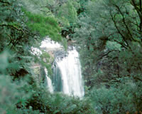
Rises in forested mountains with a high annual rainfall of 2,000 mm. Pine plantations upstream of Hopetoun Falls and native forest downstream to the Great Ocean Road. There is then farmland downstream with 9 km of estuary water. The upper reaches are 6-8 m wide consisting of predominantly shallow water with no pools.
Rubble, boulder, gravel and sand substrate. Has good habitat for macroinvertebrates, small-sized fish and spawning grounds for brown trout. The middle reaches are 18-26 m wide, with pools to 160 cm deep and rock and sand substrate. There is dense riparian vegetation of Myrtle Beech, Nothofagus cunninghamii. Access is restricted and difficult due to distance from roads, steep gradients and dense vegetation. There are a limited number of sites for tent camping at Aire Crossing. Contains brown trout to 2 kg, with numerous large brown trout 30-50 cm in length, estuary perch, Australian grayling, short-finned eel and river blackfish.
Also common galaxias, mountain galaxias, trout galaxias, climbing galaxias, congoli, Australian smelt, flathead gudgeon, pouch lamprey, shorthead lamprey, rainbow trout, occasional tench and Tasmanian mudfish. Platypus are abundant in the middle and lower reaches. Fly fishing and wading is possible in the upper reaches. Minnow style lures and wet flies are also successful in the pools. The estuary contains the usual species such as black bream, mullet, Australian salmon, and flounder. Access available for boat and bank fishing at the mouth and for bank fishing at the highway bridge. There is a substantial camping area around the estuary with adequate access for caravans.
Allen Reservoir, Lorne
Not shown on map.
4 ha. 220 ML. Also called Allenvale Reservoir.
This water storage is managed by Barwon Water. Recreational fishing is not permitted.
Anglesea River, Anglesea
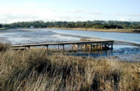
A small river flowing from forested mountains to farmland. Rock substrate upstream and mud downstream. Very limited value for freshwater fishing with only common galaxias, short-finned eel, trout galaxias, southern pygmy perch and congoli. The estuary provides some good fishing for black bream to 1 kg. Other species present are estuary perch, silver trevally and luderick.
Barham River, Apollo Bay
A rock-ramp fishway has been constructed on the East Branch at the Paradise Gauge and two culverts on the same waterway needing fishways are being evaluated.
Small, shallow, fast-flowing creek but considered to be one of the best brown trout streams in the Otways. Rises in forest, then flows through farmland. The west branch flows in relatively undisturbed forest. It is 2-6 m wide with extensive shallow water mostly less than 60 cm deep. Substrate is rubble and gravel. Contains small brown trout (av. less than 140 g). The east branch is more accessible with a larger channel and deeper pools, rock and mud substrate.
Angling fish include brown trout to 700 g, short-finned eel, congoli and estuary perch. Other freshwater species present are common galaxias, flathead gudgeon, Australian smelt, trout galaxias, climbing galaxias, shorthead lamprey and eastern gambusia. The freshwater section can have low summer flows and fishing is best at higher flows. The estuary contains black bream, mullet, Australian salmon and flounder. As part of the River Health Program, work has been carried out to stabilize and revegetate the banks, 500 m of the estuary has been re-snagged to provide habitat for estuary perch and fishing platforms have been constructed. This work has been funded by Recreational Fishing Licence revenue.
Bream Creek
See Thompsons Creek
Carisbrook Creek, Wye River
A culvert on the old road crossing has been removed to allow fish passage.
A small creek flowing from forested mountains then in farmland. Has rapids and cascades near the coast and some good pools just upstream of the highway. It has a small estuary with occasional mullet and Australian salmon. Contains brown trout in the pools, also Australian grayling, common galaxias, short-finned eel, pouch lamprey, trout galaxias, congoli and climbing galaxias.
Carlisle River, Gellibrand
This is a short tributary of the Gellibrand River rising in forested mountains upstream of Arkins Creek then flowing through farmland with willows or replanted native riparian vegetation. Channel width downstream of Arkins Creek is up to 6 m with sand and mud substrate. Pool depth varies from 80-150 cm. Access is difficult because of private property. Not a recognized angling water but contains river blackfish, short-finned eel, brown trout, shorthead lamprey, trout galaxias and common galaxias.
Cobden Lake, Cobden
1 ha., Family Fishing Lake, picnic facilities.
A small lake in the town, managed as a Family Fishing Lake and stocked with advanced yearling rainbow trout when conditions are suitable (See Introduction).
Cumberland River, Lorne
A rock-ramp fishway has been constructed at a gauge site and a road crossing culvert has been modified for fish passage.
Flows from the Otway Ranges to south of Lorne. Small creek 5 m wide, carrying a self-sustaining population of small brown trout max. 800 g, which provides some angling. Other fish are Australian grayling, common galaxias, short-finned eel, pouch lamprey, trout galaxias, congoli, and climbing galaxias. Successful fishing methods include fly fishing and drifting baits. A very shallow estuary provides little angling.
Curdies River, Peterborough
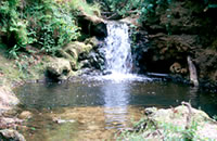
A long river draining Lake Purrumbete. Flows through flat farmland of volcanic and finely textured unconsolidated soils. Substrate is mud and sand with some rubble in some riffles. Bank restoration works have been carried out and a fishway has been constructed as part of the River Health Program. Channel varies from shallow sections choked with aquatic vegetation and willows to quite extensive pools with widths of 10 m and water depths up to 2 m. Although most of the river is in poor environmental condition, the lower reaches around Timboon have good fish habitat with shelter for fish along the bank and in the deeper water. Freshwater angling species include brown trout to 2 kg, short-finned eel, redfin, congoli and estuary perch. Scrubworms, woodgrubs and mudeyes presented under a bubble float are preferred baits. Also contains common galaxias, Australian smelt, trout galaxias, and southern pygmy perch.
Best fishing is in the extensive estuary (16 km upstream from Peterborough to Curdie Vale). Regarded as a good black bream fishery with fish to 2 kg but also contains other estuary species such as estuary perch, Australian salmon to 300 g, luderick, flounder and small silver trevally. A variety of baits (podworm, black crabs, whitebait, prawn, pipis) are successful. A boat is necessary for best fishing access. Launching ramps are at Curdie Vale, upstream of the bridge, and on the northern side of Peterborough. Line should be less than 3 kg, with a heavier shock leader, pea-size sinkers and hook sizes 4 to 1.
Elingamite Lake, Cobden
320 ha. 19,700 ML.
Located in a volcanic crater, peat bottom. Wading is dangerous. Water level has been receding for some years and the lake is becoming increasingly weedy. Small, shallow-draft boats can be launched from an earthen ramp, but this is difficult when water levels are low and the shoreline is muddy. Fish can be infested with red worm (Eustrongyloides) which is not harmful to humans. Contains redfin (av. 350 g), maximum 1.6 kg, brown trout and rainbow trout to 1.7 kg, goldfish and short-finned eel. Normally brown trout can be taken on mudeyes and worms. Trolling with lures is also successful, but can be difficult because of the extensive weed beds and shallow water.
Erskine River, Lorne
Small creek flowing in forested mountains. Channel width varies from 2 to 8 m. Substrate is boulders and rock. Water consists of small pools 40-60 cm deep, separated by rapids and cascades. Not a recognised angling water. Contains trout galaxias, brown trout, Australian grayling, short-finned eel, abundant climbing galaxias, common galaxias, flathead gudgeon, and pouch lamprey. A small estuary contains congoli, estuary perch, mullet, flounder, black bream and Australian salmon.
Ford River, Glenaire
Flows from forested mountains and then through farmland. Substrate is boulder and mud. Limited access. Not a popular angling water. Contains brown trout, short-finned eel, river blackfish, trout galaxias, common galaxias, pouch lamprey, shorthead lamprey and mountain galaxias. Has a small estuary with black bream, flounder, mullet and small Australian salmon.
Gellibrand River, Gellibrand
A rock-ramp fishway has been installed at a water supply offtake.
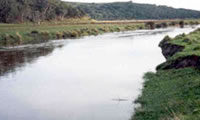
Rises in forested mountains upstream of Gellibrand then flows through farmland to Princetown. The river is of extremely high conservation and recreational value because of its river blackfish population. It is still in a natural condition in the middle reaches with areas of native riparian vegetation and good instream channel structure. It has a reliable and almost natural flow regime. Willows are actively being replaced with native species as part of the River Health Program.
The channel is of a uniform size and shape in its middle and lower reaches being 10-13 m wide with steep banks and a sand substrate. Maximum water depth is 3 m and debris and aquatic vegetation are common. Pools form 60% of the river in the middle reaches and 89% in the lower reaches. The deep water, debris and dark coloured water provide excellent cover and habitat for biota. There is an extensive estuary 7 km long which provides some limited angling. Access to the river is available from a parallel road and numerous cross tracks. Please ask permission if crossing private property.
The Gellibrand River is considered the best river blackfish water in Victoria in terms of both number and size of fish. The largest river blackfish taken in DSE surveys is 850g but blackfish to 2.7 kg have been reported by anglers. Also contains brown trout (trophy size), abundant short-finned eel and congoli. Other species are trout galaxias, Australian grayling, climbing galaxias, common galaxias, flathead gudgeon, pouch lamprey, shorthead lamprey, mountain galaxias, southern pygmy perch, Australian smelt, and occasional redfin reported. Popular fishing methods for catching river blackfish include bait fishing with scrubworms on running sinkers or unweighted lines. The estuary carries predominantly yellow eye mullet but Australian salmon, brown trout, short-finned eel, a few black bream and estuary perch can be taken at times.
Mulloway occasionally enter the estuary but are not abundant and are difficult to locate. Boats can be launched at Princetown. In the early 1980's a departmental creel census found that the main estuarine species targeted was yellow eye mullet and the estuary was not a popular fishing water for other species. A fishing platform has been constructed by the Catchment Management Authority.
Kennett River, Kennett River
A small creek flowing in forested mountains, boulder substrate. Contains small brown trout av. 350 g. Other fish are common galaxias, short-finned eel, trout galaxias, climbing galaxias, flathead gudgeon and Australian grayling. The small estuary sometimes has flounder, yellow eye mullet, congoli, black bream and Australian salmon.
Painkalac Creek, Aireys Inlet
Flows from forested mountains then through farmland. Small creek around 2 m wide, clay and mud substrate with patches of sand and gravel. Upper reaches are deeply entrenched with native riparian vegetation, debris in the channel and excellent fish habitat. Riffles are 10-40 cm deep, with pools to 60 cm.
Lower reaches flow through open farmland, becoming a series of small pools 80-200 cm deep, with very few riffles and low flow during summer. However considerable habitat is still retained in the pools. Contains short-finned eel, pouch lamprey, flathead gudgeon, common galaxias, climbing galaxias, and trout galaxias. There is a narrow estuary which has estuary perch, black bream, mullet, flounder and luderick at times. Not considered a freshwater angling stream.
Parker River, Apollo Bay
Flows in forested mountains and access is difficult. Contains congoli, trout galaxias, short-finned eel, climbing galaxias, common galaxias, mountain galaxias and flathead gudgeon. The river mouth can be fished, with black bream and mullet taken on occasions. Not considered a freshwater fishery.
Purrumbete Lake, Camperdown
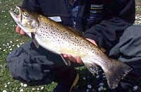
585 ha. 120,000 ML. Boat ramp, caravan park, picnic and camping facilities. Gazetted Wildlife Reserve but this does not affect fishing.
A deep (67 m) volcanic lake surrounded by farmland, mud and rock bottom. The lake is surrounded by private property and public access to the lake is restricted to the shallow, southwestern corner, where there is a launching ramp and camping area. Abundant aquatic weed makes bank fishing difficult in this area. There is public shoreline access at Hoses Rocks, on the western shore, and through the quarry on the eastern side. A boat is necessary for best results and all areas of the lake and shoreline are then accessible. The current low level of the lake has made the boat ramp un-useable, and a temporary boat ramp has been constructed to provide boat access to deep water.
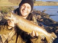
Contains brown trout and rainbow trout to 4.5 kg, Chinook salmon to 3.5 kg, abundant redfin and a few tench. Also present are short-finned eel, southern pygmy perch and abundant common galaxias. Provides excellent fishing at times, although the better fish are usually taken by the more experienced anglers. Best fishing methods are mudeyes or minnows fished under a bubble float, or whitebait fished just off the bottom. Actively casting soft plastics around the shore is a very productive for trout.
Lures trolled at various depths can also be productive, but often catch a smaller size range of fish. Wet flies fished in the shallows can also be very successful. As with many lakes, trout and salmon fishing is at its peak in the spring and autumn and redfin are most active in the summer. The lake stratifies at about 20 m during the warmer months (January-April) and we recommend that you fish just above the thermocline during this period.
The redfin population continues to expand in both numbers and total weight of fish. Stocked regularly with brown trout and rainbow trout. Chinook salmon are stocked annually if available.
St. George River, Lorne
Flows through forested mountains, boulder, rubble and sand substrate. Allen Reservoir is located in the lower reaches. A wide river (4-9 m) with a series of pools (120 cm deep) separated by shallow riffles. Good native riparian vegetation. Most of the river is upstream of the reservoir and has a natural flow regime. The 1.5 km of river between the reservoir and the junction of Cora Lynne Creek, has very low, sometimes zero flows. The riffles can be dry and water in the pools may have poor water quality. Contains short-finned eel, shorthead lamprey, common galaxias, trout galaxias, climbing galaxias, brown trout and eastern gambusia. Australian grayling were present pre-1951 and pouch lamprey occur in Cora Lynne Creek. Fishing is not very productive but brown trout to 2 kg can be taken. There is an estuary which contains the usual estuarine species with reported catches of black bream and luderick.
Scotts Creek, Timboon
Flows for 30 km in farmland. Scattered riparian vegetation of eucalypts, blackwood wattle, tea tree and blackberry. The upper reaches of the creek are choked with aquatic vegetation in places as a result of low flows and clearing of riparian vegetation. The channel is up to 7 m wide in the lower reaches with extensive pools over 100 cm deep. Sand and mud substrate. Water is discoloured after rain. Flows into the Curdies River north of Timboon. It has areas of good fish habitat but is not recommended as an angling water. Contains short-finned eel, brown trout, pouch lamprey, common galaxias and southern pygmy perch.
Sherbrook River, Port Campbell
There is a very small freshwater section containing common galaxias, trout galaxias, and flathead gudgeon. Has a small estuary with some fishing for Australian salmon, mullet, flounder and black bream.
Skenes Creek, Apollo Bay
Small creek flowing in forested mountains, boulder substrate. Contains brown trout to 400 g, Australian grayling, short-finned eel, common galaxias, pouch lamprey and southern pygmy perch. Some mullet and flounder are taken in the small estuary.
Smythe Creek, Apollo Bay
Small creek flowing in forested mountains, boulder substrate. Contains some brown trout, short-finned eel, common galaxias, trout galaxias and climbing galaxias.
Spring Creek, Torquay
Very small creek 3 m wide rising in forest but flowing mostly in farmland. Usually dry except after rain. It has small isolated pools and is only fishable in the lower 1.5 km estuary section, the mouth of which is frequently closed. Contains yellow eye mullet, flounder, flathead gudgeon and black bream and occasional Australian salmon. Not recommended for a fishing trip.
Thompsons Creek, Breamlea
Also called Bream Creek. Flows through farmland, mud substrate. Fresh water contains European carp, southern pygmy perch, short-finned eel and redfin. There is 5 km of estuary, which provides good fishing most of the time. Most common fish are estuary perch, black bream, Australian salmon and yellow eye mullet.
Wild Dog Creek, Apollo Bay
Flows from forested mountains to farmland, boulder substrate. Contains brown trout to 750 g, short-finned eel, congoli, Australian grayling, climbing galaxias, trout galaxias, common galaxias, pouch lamprey and flathead gudgeon. Considered to be a good brown trout water.
Wye River, Wye River
A very small creek, flowing from forested mountains to open river flats, rock substrate. Contains small brown trout to 250 g, short-finned eel, congoli, Australian grayling, trout galaxias, common galaxias, Tasmanian mudfish and flathead gudgeon. Has a small estuary with mullet and black bream at times and a fishing platform has been constructed by the Catchment Management Authority.
