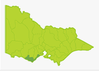
Otway
- Aire River
- Allen Reservoir
- Anglesea River
- Barham River
- Bream Creek
- Carisbrook Creek
- Carlisle River
- Cobden Lake
- Cumberland River
- Curdies River
- Elingamite Lake
- Erskine River
- Ford River
- Gellibrand River
- Kennett River
- Painkalac Creek
- Parker River
- Purrumbete Lake
- St George River
- Scotts Creek
- Sherbrook River
- Skenes Creek
- Smythe Creek
- Spring Creek
- Thompsons Creek
- Wild Dog Creek
- Wye River
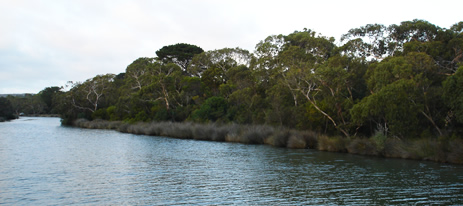
This Basin has a large central/southern area of moderate to steep forested-hills of the Otway Ranges, with all the larger streams draining from its southern slopes into the sea, east and west of Cape Otway. The remainder of the Basin is all cleared farmland. Soils are sedimentary in origin except for small areas of volcanic rock north of Torquay and around Lake Purrumbete. Annual rainfall is 1,000 to 2,000 mm in the Otway Ranges.
The remainder of the basin receives 700-1,000 mm except around Torquay which receives 500-700 mm. There are two large rivers, the Gellibrand and the Curdies. Other waterways are small streams flowing a short distance from forested hills to the sea. They have high gradients and are characterized by cascades and rapids, with coarse substrates and small estuaries. The high rainfall in the forested areas ensures a reliable flow regime in most waterways and particularly in the Gellibrand River. The streams flowing through native forest carry self-sustaining populations of brown trout and provide very scenic fishing environments. Some waters in this Basin are commercially fished for short-finned eel.
Freshwater Fish in the Basin
Native Species
- (Large fish): Australian grayling, estuary perch, river blackfish, and short-finned eel.
- (Small fish): Tasmanian mudfish, Australian smelt, climbing galaxias, common galaxias, congoli, flathead gudgeon, mountain galaxias, pouch lamprey, trout galaxias and southern pigmy perch.
Introduced species
- Atlantic salmon, brown trout, chinook salmon, eastern gambusia, European carp, goldfish, rainbow trout, redfin and tench.
Native species in bold are protected in this Basin. Introduced species in bold are declared noxious.
Short-finned eel is the most widespread species. Three species of galaxias are abundant with many creeks containing all three. The only other Basin where this occurs in is the Bunyip Basin, in creeks on the Mornington Peninsula. Australian grayling are quite widespread but never in large numbers. It is interesting that the fauna of the short coastal streams differs from that of the adjacent Barwon or Gellibrand River systems. For example river blackfish, Australian smelt, mountain galaxias and southern pygmy perch are not found in any coastal creeks from Anglesea to Cape Otway. Instead the fish fauna in these streams resembles that in the eastern coastal streams of Mornington Peninsula and in Tasmania.
Rivers in the Otway region contain a valuable assemblage of mainly native freshwater fish. Communities of three species of galaxias are uncommon and of high conservation value. There is only one widespread introduced fish, the brown trout. Large numbers of brown trout of good angling size were present at 52 sites in comprehensive surveys in this Basin from 1983 to 1988. For this reason only two waters are now regularly stocked.
Management
See Introduction for information on Management Agencies and Programs.
The Victorian Fisheries Authority
- manages stocking, fisheries policy, compliance with fisheries regulations and contact with anglers.
- Fisheries Management Plan (FMP) (a recent project that provides recreational anglers, government agencies and other stakeholders with clear guidance on fisheries management issues with a regional area over a five year period).
A FMP for waters within this Basin has been completed and was declared in November 2008. It can be viewed on the website. Fisheries Victoria Report Series. Corangamite FisheryManagement Plan. No. 59. November 2008. - Stocking Program (stocking plans for desirable species are based on an approved Victorian Fisheries Authority stocking policy and are reviewed annually via Vic Fish Stock). In this Basin, all the rivers have self sustaining populations and Lake Purrumbete and Lake Elingamite are the only waters normally stocked. Stocking has been suspended in the latter water due to the impact of the drought.
Up-to-date information on numbers and size of each species stocked can be found under Fish Stocking in the Fisheries and Aquaculture section of this website or in the annual Vic Fish Stock Report published by the department. - Family Fishing Lakes Program (an ongoing project of stocking small waters within urban areas with larger trout, for junior and disabled anglers – see Introduction for further information). Cobden Lake is the only water in this Basin.
- Victorian Stream Classification (a project that was completed in November 2010, which classifies each water as a native, salmonid or mixed fishery). Classifications relevant to this basin are:
- Trout- Lake Elingamite and Lake Purrumbete. Although these lakes are classified as 'Trout', this does not preclude stocking of other salmonid species such as Chinook or Atlantic salmon where other conditions are met.
- Native- Barwon Heads Road to Erskine River and Gellibrand and Carlisle tributaries including Chapple, Sandy, Boggy, Cole, Bryant and Kennedys creeks.
- Mixed- Gellibrand and Carlisle rivers and Lardners Creek and all other waters. Aire, Gellibrand and Ford rivers – downstream of the Great Ocean Road Bridge.
Corangamite Catchment Management Authority
- is responsible for catchment management and the River Health Program.
- Victorian River Health Program (an on-going State Government initiative to achieve healthy rivers, streams and floodplains). Major activities are erosion control, bed and bank stabilization, willow and weed removal, fencing and replanting banks on most waters in the basin; and restoring fish passage and habitat and improving angler access in selected waters. Work has taken place in the Barham, Curdies, Gellibrand and Wye Rivers.
Gippsland and Southern Rural Water
- manages rural water diversion for irrigation/stock use and the development of Stream Flow Management Plans.
- Stream Flow Management Plans (an ongoing project in which various agencies and water user's develop a flow sharing arrangement which ensures an adequate environmental flow allocation for each river in Victoria). No streamflow management plans are currently being developed for this Basin.
Barwon Water and Wannon Water
- manage urban water.
Best Fishing Waters
| Water | Target Species |
|---|---|
| Purrumbete Lake | Salmonids, redfin |
| Gellibrand River | Trophy-size river blackfish |
Special Values
Representative Rivers
Kennedy Creek a tributary of the Gellibrand River has been listed as a Representative River of dissected coastal plains, volcanic plains. The Gellibrand River upstream of Carlisle has been listed as a Representative River for Otway Ranges, dissected plains.
Threatened fish Species
The Australian grayling and Tasmanian mudfish are listed as threatened species in Victoria. (Department of Sustainability and Environment [DSE] Dec. 2007). A list of Victorian threatened species together with scientific names of species and a definition of the terms used and their national status is available on the DSE web site.
Species in bold type are also listed under the Flora & Fauna GuaranteeAct 1988. These species cannot be taken or kept within Victoria without an appropriate written order, licence or permit.