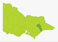
Mitchell
- Clifton Creek
- Crooked River
- Dargo River
- Humffray River
- Mitchell River
- Moroka River
- Prospect Creek
- Victoria Lake
- Wentworth River
- Wongungarra River
- Wonnangatta River
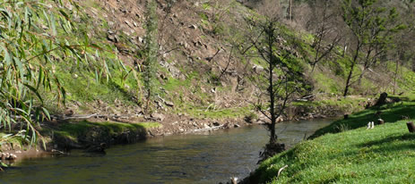
Most of the Basin is steep mountains or hills covered in dense native forest, except for a small coastal area of flat farmland south of Lindenow.There is only one main river in the Basin, (Mitchell) but its upper tributaries are quite large waterways. The Mitchell River is the largest, un-regulated river in Victoria, free of barriers and with its natural flow regime unchanged.
Mean annual rainfall in the upper reaches exceeds 1,400 mm but much of the central area has less than 1,000 mm with less than 700 mm in the lower Mitchell River and around Bairnsdale.
The headwater tributaries such as the Wonnangatta and Wongungarra Rivers are large waterways with usually a reliable and high annual flow. The forests vary from tall mixed species in the far north to mixed species of predominantly low forest in the south. There is conventional vehicle access to the Lower Mitchell River, and the lower Wonnangatta and Dargo Rivers from the Bairnsdale/Dargo Road.
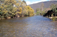
There are gravel roads to the Crooked and Wentworth Rivers and most other waters can only be reached by 4WD vehicles. Brown trout are the main angling species with occasional fish to 2.5 kg. Eels and river blackfish are the other freshwater angling species. Australian bass are an important angling species in the mid- lower reaches. Some waters in this Basin are commercially fished for eels.
There has been some concern over algal blooms in the Gippsland Lakes in recent years. The predominant blue green algal species at present is Synechococcus which, unlike the Nodularia which has occurred in the past, is non toxic. While this new alga persists for a longer time making the blooms much more noticeable, because it is non-toxic, it is not necessary for the lakes to be closed to fishing and other activities to protect the public. There is, however, potential for the longer lasting blooms to adversely affect sea grass beds through shading.
Freshwater Fish in the Basin
Native species
- (Large fish): Australian bass, Australian grayling, estuary perch, long-finned eel, river blackfish and short-finned eel;
- (Small fish): Australian smelt, climbing galaxias, common galaxias, congoli, flathead gudgeon, mountain galaxias, shorthead lamprey and southern pygmy perch.
Introduced species
- Brown trout, European carp, goldfish and rainbow trout.
Native species in bold are protected in this Basin. Introduced species in bold are declared noxious
Rivers in this Basin are generally noted for the predominance of native fish species. Usually brown trout is the only introduced fish present. European carp are restricted to the lower Mitchell River. There is a very large population of Australian grayling in the Mitchell River, which has a very high conservation value. Australian grayling occur in most of the tributary rivers.
Management
See Introduction for information on Management Agencies and Programs.
Victorian Fisheries Authority
- manages stocking, fisheries policy compliance with fisheries regulations and contact with anglers.
- Fisheries Management Plan (FMP) (a recent project that provides recreational anglers, government agencies and other stakeholders with clear guidance on fisheries management issues with a regional area over a five year period).
Victorian Fisheries Authority has recently (2009) started to develop an East Gippsland Fishery Management Plan. This new plan will provide for sustainable management of recreational fisheries in the rivers, lakes and impoundments located within the boundaries of the East Gippsland Catchment Management Authority for at least the next five years. This plan is expected to be completed in 2010. - Stocking Program (stocking of desirable species is based on an approved Victorian Fisheries Authority stocking policy and is reviewed annually via Vic Fish Stock) No waters in this basin are currently stocked. A number of rivers were historically stocked with brown trout but all have proved to be either self-sustaining or marginal for this species.
Up to date and detailed information on numbers and size of each species stocked throughout Victoria can be found under Fish Stocking in the Fisheries and Aquaculture section of this website or in the annual Vic Fish Stock Report published by the department. - Family Fishing Lakes Program (an ongoing project of stocking small waters within urban areas with larger trout, for junior and disabled anglers – see Introduction for further information). None are established in this Basin.
- Victorian Stream Classification (a project that was completed in November 2010, which classifies each water as a native, salmonid or mixed fishery). Classifications relevant to this basin are:
- Trout - Wonnangatta, Wongungarra, Humffray, Dargo and Wentworth rivers and tributaries upstream of the junction with the Mitchell River.
- Native - Mitchell River downstream of the junctions with Wongungarra, Dargo and Wentworth rivers.
East Gippsland Catchment Management Authority
- responsible for catchment management and the Victorian River Health Program
- River Health Program (an on-going State Government initiative to achieve healthy rivers, streams and floodplains.) Major activities are willow control, re-vegetation and protection of banks and establishing fih habitat and facilities for anglers. Work has been carried out in the Dargo, Mitchell, Wentworth and Wonnangatta Rivers.
Gippsland & Southern Rural Water
- manages farm and irrigation water diversion and the development of Stream Flow Management Plans
- Stream Flow Management Plans (an ongoing project in which various agencies and water user's develop a flow sharing arrangement which ensures an adequate environmental flow allocation for each river in Victoria.) A stream flow management plan is being prepared for the Mitchell River.
East Gippsland Water
- manages urban water diversion.
Special Values
Heritage River and Natural Catchment Areas
The Wonnangatta River and the Mitchell River (Wonnangatta headwaters to Lake King) have been listed as Heritage Rivers.
Natural Catchment Areas
Small areas of Pinnacle, Blue Rag Creek and Punchen Creeks and the Wongungarra River headwaters.
Ramsar Sites
(wetlands of international significance - Convention on Wetlands, Ramsar, Iran 1971).
The Gippsland Lakes, which are the receiving body for all water flowing out of this Basin.
Threatened Fish Species
The Australian grayling is listed as a threatened species in Victoria. (Department of Sustainability and Environment [DSE] Dec. 2007). A list of Victorian threatened species together with scientific names of species, a definition of the terms used and their national status is available on the DSE web site.
Species in bold type are also listed under the Flora & Fauna Guarantee Act 1988. These species cannot be taken or kept within Victoria without an appropriate written order, license or permit.
Register of the National Estate
The Mitchell River Silt Jetties are listed on this register and are considered a geomorphologic feature of international significance.
Best Fishing Waters
There are no outstanding waters in this basin but under the right conditions, (cooler, wet summers which provide good growth rates) most rivers can provide good fishing.