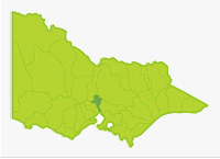
Maribyrnong
- Barringo Creek
- Bolinda Creek
- Boyd Creek
- Deep Creek
- Emu Creek
- Gisborne Creek
- Jacksons Creek
- Maribyrnong River
- Riddells Creek
- Rosslyne Reservoir
- Spavin Lake
- Taylors Lakes
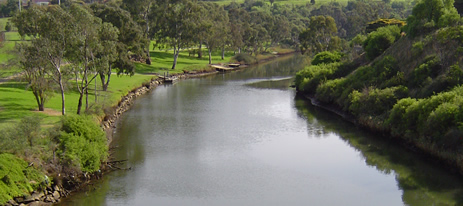
Most of the basin (area 1,450 km²) consists of dissected, upland volcanic plains, with deeply entrenched waterways. However the northern edge and a strip running down Deep Creek consist of sedimentary rocks with areas of granite and gneiss. Annual rainfall in the north of the Basin varies between 700-1,500 mm. However, rainfall is only 600-700 mm in the central and southern section, decreasing to 500-600 mm at Keilor. About 80% of the basin is cleared for grazing and broad acre cropping with the remainder being remnant, low, mixed-species forest in the Macedon, Cobaw and Blackwood Ranges. The lower 15 km of the Maribyrnong River flows through urban areas.
Flow in Deep Creek is unregulated but is usually quite low during January and February. Flow in Jacksons Creek and to some extent the lower Maribrynong River is regulated because of Rosslyne Reservoir and is normally also low during summer. Despite these flow constraints, fishing is available all year in Deep, Jacksons and Emu Creeks because of the presence of extensive areas of deep pools and permanent fish habitat. Most waterways flow through private property, and, due to settlement largely taking place before Crown Land Frontage was implemented, ownership often extends to the top of the bank or even mid stream.
There is access without permission through parks and at road crossings, however the best fishing locations will require access through private property. It is essential to ask permission before entering fenced property and walking to or along most waterways. Brown trout are present throughout the system with the better areas being Riddells, Emu, and Jacksons Creeks. Catches are not large but fish are of a reasonable size. Fishing requires some effort to get to various good fishing areas and perseverance to get to know the best fishing spots.
Freshwater Fish in the Basin
Native species
- (Large Fish): Australian grayling and short-finned eel.
- (Small fish): Australian smelt, climbing galaxias, common galaxias, congoli, flathead gudgeon, mountain galaxias, pouch lamprey, shorthead lamprey, trout galaxias, southern pigmy perch, and Yarra pygmy perch.
Introduced species
- Brown trout, eastern gambusia,goldfish, European carp, rainbow trout, redfin, roach and tench.
Native species in boldare protected in this Basin. Introduced species in bold are declared noxious.
The most widespread angling species are brown trout and short-finned eel which occur in most waters. Redfin and tench are also widespread.
Management
See Introduction for information on Management Agencies and Programs.
The Victorian Fisheries Authority
- manages stocking, fisheries policy, compliance with fisheries regulations and contact with anglers.
- Fisheries Management Plan (FMP) (a recent project that provides recreational anglers, government agencies and other stakeholders with clear guidance on fisheries management issues with a regional area over a five year period).
A FMP for waters within this Basin has been completed and was declared in November 2009. It can be viewed on the website. Fisheries Victoria Management Report Series.Port Phillip and Western Port Management Plan. No. 69. November 2009. - Stocking Program (stocking plans for desirable species are based on an approved Victorian Fisheries Authority stocking policy and are reviewed annually via Vic Fish Stock). In this Basin, all the rivers carry self-sustaining populations of fish and stocking is not considered necessary.
Up-to-date information on numbers and size of each species stocked can be found under Fish Stocking in the Fisheries and Aquaculture section of this website or in the annual Vic Fish Stock Report published by the department. - Family Fishing Lakes Program (an ongoing project of stocking small waters within urban areas with larger trout, for junior and disabled anglers – see Introduction for further information). The only water within this basin is Spavan Lake at Sunbury.
- Victorian Stream Classification (a project that was completed in November 2010, which classifies each water as a native, salmonid or mixed fishery). Classifications relevant to this basin are:
- Native- Maribyrnong downstream of Bulla.
- Mixed- Jacksons Creek upstream of Gisbourne, streams between Bulla and Clarkfield.
- Trout- all other waters.
Port Phillip and Westernport Catchment Management Authority
- is responsible for catchment management.
Melbourne Water
- manages drainage, waterways, floodplains, and urban water supply and the River Health Program.
- Victorian River Health Program (an on-going State Government initiative to achieve healthy rivers, streams and floodplains). Major activities are erosion control, bed and bank stabilization, willow and weed removal, fencing and replanting banks and provision of fish passage.
Gippsland and Southern Rural Water
- manages rural water diversion for irrigation/stock use and the development of Stream Flow Management Plans.
- Stream Flow Management Plans (an ongoing project in which various agencies and water user's develop a flow sharing arrangement which ensures an adequate environmental flow allocation for each river in Victoria). In this Basin a streamflow management plan is being developed for the Upper Maribyrnong River (Deep Creek).
Melbourne Water & Western Water
- manage urban water.
Best Fishing Waters
| Water | Target Species |
|---|---|
| Jacksons Creek downstream of Riddells Creek junction | Brown trout, redfin, roach, tench and eels |
| Estuarine section of the Maribyrnong River downstream of Solomons Ford | Black bream, mullet and other estuarine species |
Special Values
Threatened Fish Species
The Australian grayling and Yarra pygmy perch are listed as threatened species in Victoria. (Department of Sustainability and Environment [DSE] Dec. 2007). A list of Victorian threatened species together with scientific names of species and a definition of the terms used and their national status is available on the DSE web site.
Species in bold type are also listed under the Flora & Fauna Guarantee Act 1988. These species cannot be taken or kept within Victoria without an appropriate written order, licence or permit.