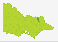
Kiewa
- Allans Flat Dredge Hole
- Clover Dam
- Guy Lake
- Kiewa River
- Mountain Creek
- Mount Beauty Pondage
- Murray River (NSW)
- Pretty Valley Creek
- Pretty Valley Pondage
- Rocky Valley Storage
- Sumption Garden
- Wodonga Wetlands
- Yackandandah Creek
Kiewa River
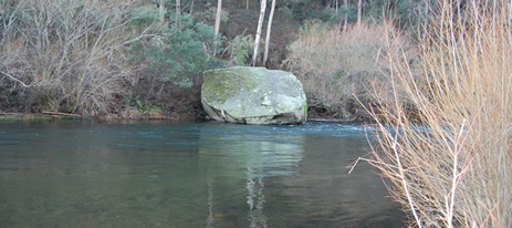
There is only one main waterway (Kiewa River) in this long (100 km) and narrow (20 km) Basin. The river rises in forest in the Alpine National Park (Bogong High Plains) as the east and west branches, which join on the narrow flood plain at Mount Beauty township. The river then flows through farmland with the valley widening in the lower reaches until the river flows into the Murray River, downstream of Lake Hume. Fifty percent of the Basin is forested or with alpine vegetation. Rivers in these areas have excellent instream habitat. This includes all rivers upstream of Mount Beauty.
The hills along the sides of the Basin are densely forested. Most of the Basin receives over 700 mm mean annual rainfall with higher falls to 2,430 mm on the Bogong High Plains. Snow falls above 1,400 m. Highest river flows are during August to October with only 7% of annual flow occurring during January to March. However the natural flow regime of the lower Kiewa River has been modified by hydroelectric generation.
Rocky Valley Storage is the largest and the main storage of this hydroelectric scheme with two power stations on the east branch and one on the west branch. All water eventually reaches the lower Kiewa River some via a regulating storage, Mount Beauty Pondage.
The Victorian State Government has committed $3.2 million over four years to improve recreational fishing facilities and infrastructure, as well as promote opportunities for fishing as a family activity. Recognising that recreational fishing is a major social and economic contributor to Victorian communities, the Government aims to boost this popular past-time activity.
To cater for developing and experienced anglers, the Kiewa River downstream of Mount Beauty Pondage has been selected to be developed and promoted as a Premier River under the Go Fishing in Victoria initiative. This Premier River will be developed over the life of the project in conjunction with local stakeholders. It was selected in consideration of the accessibility for anglers, the quality of the fishing experience, the ability of the habitat to handle visitation pressure and the species of fish that anglers are likely to catch. For more information visit www.agriculture.vic.gov.au/gofishing
Fishing Opportunities and Access Maps
Freshwater Fish in the Basin
Native species
- (Large fish): Murray cod, golden perch and Murray spiny crayfish.
- (Small fish): Blackfish mountain galaxias and alpine spiny crayfish.
Introduced species
- Brown trout, rainbow trout, redfin and European carp.
Native species in bold are protected in this Basin. Introduced species in bold are declared noxious.
There have been few surveys carried out except in the Kiewa River below Mt. Beauty Pondage. However it appears that brown trout and rainbow trout are the predominant fish species with perhaps small blackfish being the most numerous native fish in the upper reaches. Murray cod are restricted to the lower reaches of the Kiewa River possibly because of the cold water released from the Pondage. European carp also prefer to remain downstream in areas of slower-water and sand and mud substrate.
Management
See Introduction for information on management agencies and programs.
The Victorian Fisheries Authority
- manages stocking, fisheries policy, compliance with fisheries regulations and angler contact.
- Fisheries Management Plan (FMP) (a recent project that provides recreational anglers, government agencies and other stakeholders with clear guidance on fisheries management issues with a regional area over a five year period).
A FMP has been declared for waters within this Basin. Fisheries Victoria Management Report Series. North East Fishery Management Plan. No 48. August 2007. - Stocking Program (stocking plans for desirable species are based on an approved Victorian Fisheries Authority stocking policy and are reviewed annually via Vic Fish Stock). Mount Beauty Pondage is stocked with brown trout and rainbow trout, Allans Flat Dredge Hole is stocked with salmonids and golden perch; the lower Kiewa is stocked with Murray cod. Stocking of Wodonga Wetlands with salmonids and golden perch and Sumption Gardens with golden perch is under consideration. All other rivers carry self-sustaining populations of fish. See details in the Angling Waters.
Up to date information on numbers and size of each species stocked can be found under Fish Stocking in the Fisheries and Aquaculture site of this website or in the annual Vic Fish Stock Report published by the department. - Family Fishing Lakes Program (an ongoing project of stocking small waters within urban areas with larger trout, for junior and disabled anglers. See Introduction for further information). Allans Flat Dredge Hole has been designated as a Family Fishing Lake and is stocked with rainbow trout and golden perch. See details in angling waters.
- Premier River - Three river sections in Victoria have been selected as Premier Rivers. They have been selected for their existing high recreational fisheries values and will be provided with improved access and other facilities to assist anglers. Information packages will be developed for each river to increase awareness of the fishing opportunities and facilities available (also see Introduction). The Premier River in this Basin is the Kiewa River from Mount Beauty to Wodonga.
- Victorian Stream Classification (a project that was completed in November 2010, which classifies each water as a native, salmonid or mixed fishery). Classifications relevant to this basin are:
- Trout - Kiewa River and all tributaries upstream of Mongans Bridge, Yackandandah Creek upstream of Osbournes Flat Road. Running Creek and tributaries.
- Mixed - Kiewa River from Mongans Bridge to Gundowring Bridge.
- Native - Kiewa River downstream of Gundowring Bridge. Wodonga, Middle, Huon and House creeks.
North East Catchment Management Authority
- is responsible for catchment management and the Victorian River Health Program.
- Victorian River Health Program (an on-going state government initiative to achieve healthy rivers, streams and floodplains). Projects include determining the sustainable limit of water use in the catchment and negotiating an environmental flow for the Kiewa River. River improvement works in the Kiewa River and Yackandandah Creek are continuing.
Goulburn Murray Rural Water
- manages irrigation, domestic and stock, and some bulk water supply services; also development of Stream Flow Management Plans.
- Stream Flow Management Plans (an ongoing project in which various agencies and water user's develop a flow sharing arrangement which ensures an adequate environmental flow allocation for each river in Victoria). A draft SFMP has been prepared for the Kiewa River but requires Ministerial approval.
North East Water
- manages urban water demand.
Best Fishing Waters
| Water | Species |
|---|---|
| Kiewa River below Mt Beauty Pondage to Dederang | Brown trout |
| Kiewa River downstream of Dederang to the Murray River | Murray cod |
Special Values
Threatened Species
Two species in this Basin (Murray cod and Murray spiny crayfish) are threatened species in Victoria. The list of Victorian threatened species, with their national conservation value, scientific names and explanation of their conservation status category, is available on the DSE web site (Department of Sustainability and Environment [DSE] Dec 2007.
Species in bold type and the Lowland Riverine Fish Community of the Southern Murray-Darling Basin are also listed under the Flora and Fauna Guarantee Act 1988. ) and cannot be taken or kept without an order, licence or permit. Such an order by the Governor in Council allows anglers to take Murray cod and Murray spiny crayfish.