East Gippsland - Angling Waters
View East Gippsland Basin in a larger map (opens new window).
The above map is provided by Google. The department accepts no responsibility for its accuracy or content.
Barracouta Lake, Mallacoota
242 ha. 16,200 ML. Also called Freshwater Lake.
A shallow lake surrounded by forest and only 400 m from the beach, mud and sand bottom. Access is difficult and local knowledge and a 4WD is required. Contains very large sea mullet to 2.4 kg, longfin eel, congoli, Australian bass to 1.9 kg, estuary perch, flathead gudgeon, Australian smelt and common galaxias. Seldom fished.
Bemm River, Bemm River
Flows through dense forest, with a few small cleared areas, mostly sand substrate. Channel width is 15 m. It has extensive runs to 100 cm deep and pools to 2.5 m. The lower reaches are heavily silted, with sand being deposited into the pools. Work is being undertaken as part of the River Health Program to stabilize and revegetate banks and control willows and other weeds. Accessible only from the Club Terrace Road. Contains some brown trout to 1.4 kg, (av. 400 g), short-finned eel and long-finned eel, some Australian bass (although much of their habitat has been reduced), Gippsland spiny crayfish, numerous river blackfish, Australian grayling and occasional rainbow trout. Other species are congoli, southern pygmy perch, abundant shorthead lamprey, common galaxias and Australian smelt. The estuary section,below the rocks carries good numbers of black bream and estuary perch.
Betka River, Mallacoota
A rock-ramp fishway has been installed at the pump weir.
Flows through forest and tea-tree. Width is 2-11 m with narrow riffles 25-50 cm deep, and pools to 110 cm. The substrate is mostly soft, unstable sand with deeper gutters in the riffles, associated with woody habitat, and some exposed bedrock. Boulders, aquatic vegetation and abundant habitat provide fish habitat.
Accessible at various places through Crown Land and from the Aerodrome Road which crosses the river 3 km west of Mallacoota. Freshwater fish are short-finned eel, long-finned eel, flathead gudgeon, Australian smelt, common galaxias, congoli, climbing galaxias, shorthead lamprey, southern pygmy perch, Cox's gudgeon and striped gudgeon. Most fishing occurs in the estuary.
This has a gravel and sand substrate and a depth of 220-350 cm. Sedimentation is occurring resulting in some areas becoming shallower. Contains both species of eel, black bream to 1 kg, (av. 400 g), yellowfin bream, abundant sea mullet to 1.4 kg, abundant estuary perch, yellow eye mullet, silver trevally, luderick to 800 g and dusky flathead to 700 g, although there are larger fish at times. Best fishing is from late winter to early spring.
Cann River, Cann River
A wide, (9-16 m) shallow river, flowing through forest in the upper reaches and farmland downstream, sand bottom. Riffle depths are 20-95 cm with pools to 110 cm. Severe bank erosion and sedimentation in some stream sections, particularly downstream, have resulted in very extensive areas of shallow water over a soft, unstable, sand substrate with little habitat present. At other locations fallen timber is the predominant type of fish cover. Willows have been controlled and banks fenced and revegetated as part of the River Health Program.
Carries Australian bass, short-finned eel and long-finned eel, Australian smelt, common galaxias, mountain galaxias, goldfish, some Australian grayling, and very occasional brown trout to 500 g. The estuary is 200-600 cm deep where it flows into Tamboon Inlet. Mud substrate. It contains black bream, luderick, estuary perch and mullet.
Combienbar River, Errinundra
Flows through forest and grazing land, mostly gravel and rubble substrate with some sand. Width varies from 2-10 m. Water is a mixture of pools and riffles. Although there is low flow during summer, with average water depths of 20-30 cm, there are numerous deep pools to 2 m. There has been a need for work on willows and riparian vegetation as part of the River Health Program.
Carries predominantly small brown trout average 200 g, (max. 600 g), short-finned eel, long-finned eel, river blackfish, Australian grayling, Australian smelt, common galaxias, congoli and abundant shorthead lamprey. No accommodation and only limited camping sites along the river. A lightly fished trout stream, best fished in late summer and autumn by spinning, bait casting and floating live baits such as grasshoppers and crickets.
Errinundra River, Errinundra
Flows mostly through forest. Gravel, rubble and some rock and sand substrate. Width is from 10-18 m. Water is mostly riffles and runs (20-50 cm deep) with some pools to 2 m deep. Low summer flow, but some deep pools persist. Carries few fish for such a pristine water. Contains abundant river blackfish, short-finned eel, some brown trout to 600 g, congoli, abundant shorthead lamprey, and common galaxias. No accommodation and few places to camp by the river. Best angling in late summer to early autumn using floating baits. As part of the River Health Program, there has been some fencing and revegetation of banks and willow control.
Genoa River, Mallacoota
Flows mainly through dense forest, rock and sand bed, heavily silted in lower reaches. Joins the Wallagaraugh River above Gipsy Point. Access is difficult. Contains long-finned eel, short-finned eel, abundant Australian bass, congoli, flathead gudgeon, luderick, Australian smelt, abundant common galaxias, shorthead lamprey, Australian grayling, Cox's gudgeon and striped gudgeon. The estuary has black bream to 800 g, estuary perch to 600 g and abundant sea mullet in the lower reaches downstream of the Princes Highway. Willows have been controlled and banks fenced and revegetated as part of the River Health Program.
Goolengook River, Club Terrace
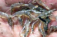
Tributary of the Bemm River. A small creek (2 m wide) with a gravel/sand/mud bottom. Maximum water depth is 40 cm. Contains some river blackfish, congoli, short-finned eel, long-finned eel, Australian smelt, pouch lamprey, shorthead lamprey, Gippsland spiny crayfish and a reasonable number of small-sized brown trout. The East Gippsland spiny crayfish occurs in some small tributaries.
Little River, Sydenham Inlet
A small creek flowing through dense forest. Access is very difficult. Contains black bream and estuary perch in the lower reaches.
Mallacoota Inlet, Mallacoota
2,500 ha. Accommodation, caravan, camping, jetties, boat launching.
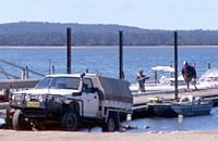
A large estuary surrounded by forest, mud and sand bottom. Consists of a smaller Top Lake joined to a much larger Bottom Lake by The Narrows, a narrow section of drowned river bed. A popular angling and tourist resort with camping facilities and accommodation. Boat launching at Gipsy Point into the river, or at Mallacoota into the Bottom Lake.
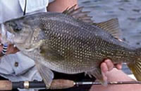
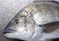
Most of the perimeter of both lakes is a National Park but there are landing places with toilets and fireplaces (some of these places are also home to goannas which can check out picnic parties for food scraps). Three pontoons for land-based fishing have been constructed using Recreational Fishing Licence revenue. Contains black bream, flathead (some very big fish), yellowfin bream, luderick, mullet, trevally, sand whiting, estuary perch, garfish, tailor and mulloway in some years.
Eastern king prawns usually enter the inlet in February. Fish can be caught throughout the year but June to November is best for black bream and November to March for flathead. The Top Lake is a good spot for larger black bream. The Bottom Lake produces some good sized flathead. However fishing methods, conditions and success vary considerably and local advice is worth obtaining. All commercial fishing, licences for Mallacoota Inlet have been bought out through the voluntary buy-back scheme funded by Recreational Fishing Licence revenue.
Maramingo Creek, Mallacoota
The small estuary section contains black bream, luderick, estuary perch, and sea mullet. The small in-flowing waterway has short-finned eel and long-finned eel, flathead gudgeon, Australian smelt, common galaxias, climbing galaxias, southern pygmy perch, and striped gudgeon.
Mueller River, Point Hicks
A small coastal stream (6-8 m wide) flowing through forest and tea tree, mud and sand bed. Pools to 100 cm deep. Fish cover provided by woody habitat and abundant submerged aquatic vegetation. Access is via the Tamboon and Point Hicks Roads and the Bald Hills Track (turn-off approximately 43 km south from Cann River township). The roads can be subject to wet weather closures and the last 3 km are rough, narrow and steep and not recommended for caravans. There is a small camping area and boat ramp. This area is only a relatively short drive from the Thurra River camping area which is larger and easier to get to.
The river contains short-finned eel, long-finned eel, flathead gudgeon, Australian smelt, common galaxias, climbing galaxias, congoli, spotted galaxias, and pouch lamprey. There are angler reports of some Australian bass being taken. The estuary is 120-550 cm deep and the substrate is sand and mud. A sand bar is often present during summer with only a trickle-flow to the sea. Contains black bream, yellow eye mullet, sea mullet, luderick, abundant estuary perch and a variety of other estuary species. It is a relatively pristine area and, despite access limitations, is popular during the holiday season. Small boats can be launched from the bank.
Swan Lake, Sydenham Inlet
162 ha. 1,970 ML.
A small deep (100-450 cm) lake with mud substrate, sand beaches and submerged aquatic vegetation. Contains black bream, long-finned eel, yellow eye mullet, luderick, abundant estuary perch, sea mullet, congoli, yellowfin bream, common galaxias and flathead gudgeon. Accessible by the Swan Lake Track but is reported to not provide the best fishing opportunities.
Sydenham Inlet, Bemm River
930 ha. Accommodation, caravan, camping, a jetty and boat launching facilities.
A shallow estuary (50 to 260 cm deep at low tide) surrounded by forest and tea tree, mud and sand bottom. There is a good sealed access road from the Princes Highway. Entrance to the sea closes at times, resulting in a considerable rise in water level. Carries black bream to 1.6 kg, abundant estuary perch to 1.2 kg, abundant yellow eye mullet, tailor, luderick, congoli and various other estuarine fish species. An occasional brown trout to 1 kg but usually much smaller, is taken below the falls which is the limit of freshwater in the system.
Estuary perch are common and the weed beds in the lower channel often provide good results for these fish. Best taken with live bait. The fish species present and their number and size varies widely with water conditions. A large number of small-sized black bream are often a nuisance requiring a move to a new fishing location. Local bait is usually available, as is local information. Both are recommended.
Tamboon Inlet, South of Cann River
1,155 ha.
An estuary surrounded by forest and tea-tree, mud and sand bottom. Water depth varies from 1.5-10 m with a sand substrate. Accessible via the Tamboon Road from Cann River township. There is a boat ramp at Furnells Landing and a basic camping area at the end of Fishermans Track, off the Point Hicks Road.
Small boats can be launched from the camping area. Camping is possible at a number of sites around the inlet (north of Pelican Point, south of Old Man Point on the south-western shore and near Peters Rocks on the south-eastern shore of the Inlet) but there are no facilities at these places. Carries black bream to 2 kg, estuary perch to 1.5 kg in the river, trevally, luderick, flathead, yellow eye mullet, sea mullet, yellowfin bream, sole and occasionally snapper.
The entrance closes periodically resulting in an increase in water level and changes in the composition of the fish population. Bait can be difficult to obtain and local knowledge is needed to find the best fishing areas. Commercial fishing licences in this inlet have been bought out through the recent voluntary buy-back scheme funded by Recreational Fishing Licence revenue.
Thurra River, Point Hicks
Flows through dense forest, predominantly sand bottom. River width is from 7-16 m. Riffles average 53 cm deep and pools are 110 cm deep. Fish cover provided from woody habitat and bank vegetation. The estuary is very small and only 40-110 cm deep and can be silted up. Substrate is sand.
Accessible via the Tamboon Road (15 km) and Point Hicks Road (24 km) from Cann River township. Roads are narrow, winding and unsealed and can be closed after rain. There is an extensive basic camping area near the mouth of the river, which is often used as a base by those fishing the Mueller River. Carries short-finned eel, long-finned eel, flathead gudgeon, Australian smelt, climbing galaxias, common galaxias, congoli, shorthead lamprey, Australian grayling and pouch lamprey. Australian bass are reported to occur in the Thurra Swamp 15 km upstream from the entrance but Departmental surveys have taken no Australian bass in the river. Willows have been controlled and banks fenced and revegetated as part of the River Health Program.
Tonghi Creek, Club Terrace
Tributary of Cann River.
A small shallow stream with a sand bottom and good bank vegetation. Accessible from the Princess Highway and the Old Coast Road. Contains long-finned eel, congoli, Australian smelt, common galaxias, shorthead lamprey and goldfish.
Wallagaraugh River, Mallacoota
Flows from New South Wales through dense forest to join the Genoa River just above Gipsy Point. Sand and mud substrate. Road access is via a turn-off from the Princes Highway near the NSW border and there is boat access from Mallacoota Inlet.
There are extensive sand and silt banks and care needs to be taken at times of low flow. Carries good black bream to 700 g at the Rocks, which under normal conditions is the upstream limit for access by boats. Several small sand banks in the area provide opportunities for bank fishing. Black bream fishing is patchy but there are usually some fish to be taken on live baits. There are also numerous estuary perch, luderick, and sea mullet in the upper river. The freshwater section contains short-finned eel, long-finned eel, flathead gudgeon, Australian smelt, common galaxias, Australian bass, striped gudgeon, and Cox's gudgeon. Willows have been controlled and banks fenced and revegetated as part of the River Health Program.
Wau Wauka Lake, Mallacoota
240 ha. 5,150 ML.
An extremely isolated lake surrounded by forest. Accessible by a 19km walking track. Contains southern shortfin eel and longfin eel, sea mullet, congoli, and is reported to contain Australian bass.
Wingan Inlet, 26km SW of Mallacoota
80 ha. Camping is permitted but there is no other accommodation. Availability of camping sites should be checked with the Parks Victoria Office at Mallacoota. Only small boats can be launched at the inlet.
Estuary surrounded by forest and tea-tree, mud and sand bottom with abundant submerged aquatic vegetation. Water depths of 120-340 cm. Permanently open to the sea. Accessible via a narrow, rough unsealed road branching off the Princes Highway 24 km east of Cann River. The road is not suitable for caravans.
The inlet is in the Croajingalong National Park. The river above the estuary can be reached by boat. The fish population is diverse and varies with season and conditions, but can include luderick, estuary perch, sea mullet, tailor, trevally, black bream, yellow eye mullet, Australian salmon, flathead, both species of eels, whiting, yellowfin bream and occasional snapper. The upper reaches of the estuary carry abundant luderick and yellow eye mullet.
Wingan River, 26 km SW of Mallacoota
Flows through forested country and rainforest into Wingan Inlet, mud and boulder bottom. Deep pools upstream of the estuary. Accessible at the Princes Highway, via a few walking tracks, or by small boat from Wingan Inlet. Only a small area of easily fishable water. In spite of its general inaccessibility, there has still been a need for willow control and work on riparian vegetation. Carries Australian bass, both species of eel, Australian grayling, eastern gambusia and a very occasional brown trout.