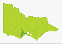
Barwon
- Ballarat Water Storages
- Barwon River
- Connewarre Lake
- Drysdale Lake
- Esmond Lake
- Gong Gong Reservoir
- Haddon Reserve Lake
- Leigh River
- Lorne Lake
- Modewarre Lake
- Murdeduke Lake
- Seagull Paddock Lake
- St Augustines Water Hole
- Wendouree Lake
- West Barwon Reservoir
- Williamson Creek
- Wurdiboluc Reservoir
- Yarrowee River
- Victoria Lakes
The Basin extends 130 km north to south and comprises the Bellarine Peninsula and sections of the Otway and Brisbane Ranges. The Barwon River, which flows for 160 km in the southern end of the Basin, then through Geelong is the major river. It rises in steep, forested mountains in the Otway Ranges upstream of Forrest. Most of the river, however, flows through the flat farmland of the western basalt plain with soils derived from thick tertiary sediments resulting in unstable banks and a sand, mud or clay substrate.
There are outcrops of basalt rock particularly around Inverleigh, Pollocksford and at Buckleys Falls creating rapids and cascades. Annual rainfall is 700-1,000 mm at Forrest but decreases to 500-600 mm at Geelong. Storage of water in the West Barwon Reservoir and low rainfall in the middle and lower reaches result in extended periods of very low flow during summer and autumn. There are numerous deep pools, particularly in the lower reaches of the Barwon River, which provide permanent habitat supporting good fish populations.
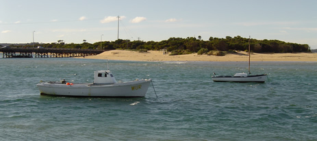
Salinity is the major water quality problem. Much occurs naturally from volcanic soils and saline springs and soaks, but saline water also enters from Lakes Colac and Corangamite. Most of the Barwon River has little riparian vegetation except for some sections with river red gums and willows, but rushes and sedges are abundant in most localities. The river downstream of Buckleys Falls is a popular fishing area with target species being redfin, European carp, short-finned eel and brown trout. The lower estuarine section is also popular with anglers.
There are three major lakes (Modewarre. Murdeduke and Wendouree) providing good trout fishing when water levels are suitable for stocking. Other lakes are domestic water storages and some are open to fishing by permit. Some waters in this Basin are commercially fished for short-finned eel.
Freshwater Fish in the Basin
Native species
- (Large fish): Australian grayling, river blackfish, short-finned eel.
- (Small fish): Australian smelt, climbing galaxias, common galaxias, congoli, flathead gudgeon, mountain galaxias, pouch lamprey, smallmouth hardyhead, trout galaxias and southern pigmy perch
Introduced species
- Brown trout, chinook salmon, eastern gambusia, European carp, goldfish, rainbow trout, redfin and roach.
Native species in bold are protected in this Basin. Introduced species in bold are declared noxious.
Management
See Introduction for information on Management Agencies and Programs.
The Victorian Fisheries Authority
- manages stocking, fisheries policy, compliance with fisheries regulations and contact with anglers.
- Fisheries Management Plan (FMP) (a recent project that provides recreational anglers, government agencies and other stakeholders with clear guidance on fisheries management issues with a regional area over a five year period).
A FMP for waters within this Basin has been completed and was declared in November 2008. It can be viewed on the website. Fisheries Victoria Management Report Series. Corangamite FisheryManagement Plan. No. 59. November 2008. - Stocking Program (stocking plans for desirable species are based on an approved Victorian Fisheries Authority stocking policy and are reviewed annually via Vic Fish Stock). In this Basin, Lakes Modewarre, Murdeduke and Wendouree and the West Barwon and Wurdiboluc Reservoirs are regularly stocked in normal years. The rivers carry self-sustaining populations of fish.
Up-to-date information on numbers and size of each species stocked can be found under Fish Stocking in the Fisheries and Aquaculture section of this website or in the annual Vic Fish Stock Report published by the department. - Family Fishing Lakes Program (an ongoing project of stocking small waters within urban areas with larger trout, for junior and disabled anglers – see Introduction for further information). The waters in this basin are Esmond Lake, Haddon Reserve Lake, Seagull Lake and St Augustines Water Hole.
- Victorian Stream Classification (a project that was completed in November 2010, which classifies each water as a native, salmonid or mixed fishery). Classifications relevant to this basin are:
- Trout- Wurdee Boluc, Modewarre, Wendouree and Murdeduke lakes, Gong Gong and West Barwon reservoirs and the Family Fishing lakes.
- Native- below Lake Connewarre.
- Mixed- all other waters.
Corangamite Catchment Management Authority
- is responsible for catchment management and the River Health Program.
- Victorian River Health Program (an on-going State Government initiative to achieve healthy rivers, streams and floodplains). Major activities are erosion control, bed and bank stabilization, willow and weed removal, fencing and replanting banks and facilitating fish passage, with most activities being on the Barwon River.
Gippsland and Southern Rural Water
- manages rural water diversion for irrigation/stock use and the development of Stream Flow Management Plans.
- Stream Flow Management Plans (an ongoing project in which various agencies and water user's develop a flow sharing arrangement which ensures an adequate environmental flow allocation for each river in Victoria. A streamflow management plan is being developed for the Barwon River
Barwon Water & Central Highlands Water
- manage urban water.
Best Fishing Waters
| Water | Target Species |
|---|---|
| Lake Modewarre | Large brown trout and rainbow trout |
| Barwon River lower freshwater reaches | European carp, redfin |
| Barwon River estuary | Estuarine species |
| Lake Wendouree | Brown trout, rainbow trout, redfin |
Lakes Murdeduke and Wendouree provide good fishing at times for brown trout and rainbow trout. Fish are usually free of the redworm ( Eustrongyloides) but angling success fluctuates.
Special Values
Ramsar Sites
(wetlands of international significance - Convention on Wetlands, Ramsar, Iran 1971).
Lake Murdeduke, Lake Connewarre, parts of the shoreline of the Bellarine Peninsula and associated wetlands.
Threatened Fish Species
The Australian grayling is listed as a threatened species in Victoria. (Department of Sustainability and Environment [DSE] Dec. 2007). A list of Victorian threatened species together with scientific names of species and a definition of the terms used and their national status is available on the DSE web site.
Species in bold type are also listed under the Flora & Fauna Guarantee Act 1988. These species cannot be taken or kept within Victoria without an appropriate written order, licence or permit.