Dargo
Dargo is home to one of Victoria's most remote communities, nestled in the foothills of the legendary Dargo High Plains. The town of Dargo, with a population of approximately 150, is an entry point for the Alpine National Park, Avon Wilderness Park and Mitchell River National Park. It is true wilderness country and the launching point for several famous 4WD tracks that will take you to smaller and remote wild trout rivers.
Dargo River
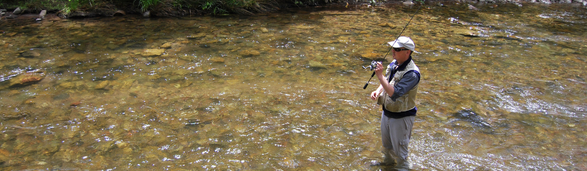
The Dargo is a relatively narrow river with a very steep gradient, flowing from forested mountain country to farmland with mostly shallow riffles/runs and modest pools. Access is good in the lower reaches, where the gradient is lower, but is more challenging further upstream where a 4WD is essential. The river carries a good population of mostly wild brown trout. The Dargo fishes well for Fly Fishers and finesse bait fishers. Upper Dargo Road runs close to the river for 20 kilometres upstream to the north of the town and provides good access to that stretch.
Wonnangatta River
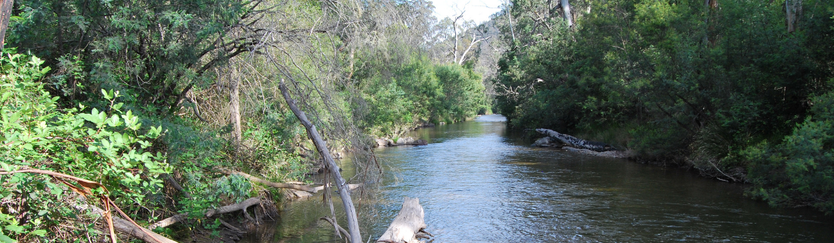
The famous and beautiful Wonnangatta River rises in forested mountainous country that is only accessible by 4WD during the drier months as seasonal track closures apply except for the lower reaches. The river flows through a forested gorge with cleared river-flats in the middle reaches near Talbotville. Average width is approximately 10 metres with shallow pools. In summer during dryer years, it can have low water flow and become very shallow however the river is abundant with small brown trout. From the Wonnangatta River junction to Lindenow the river flows for 60 kilometres through forested mountains, with most of this length in a wide, steep-sided valley, then through the Mitchell River Gorge. There are extensive deep pools separated by long riffles. Submerged logs and deep pools provide instream habitat. In the gorge, there is a series of rapids and pools, with boulder and rock bottom and fast-flowing water. Accessible by conventional vehicle to Tabberabbera and the Mitchell River National Park, where there are walking tracks to the river. Access along the river is difficult upstream from Glenaladale. In these middle reaches the brown trout are larger with some good rainbow trout. All fishing methods, fly fishing, lure casting and bait fishing are suitable.
Moroka River
The Moroka River flows through forested mountains. A small stream that is relatively remote and not heavily fished, it’s again mostly accessible by 4WD vehicles. The Moroka carries small wild brown trout. Fly fishing and finesse bait fishing is the best method to approach this smaller water. Horseyard Flat is a remote, but stunning campsite that’s regarded as one of the best places to camp.
Crooked River
The Crooked River has a boulder, rubble and rock bottom. During summer much of the rubble riverbed is exposed along its edges allowing good walking and wading access to predominantly shallow runs. Accessible from the Dargo High Plains Road via the historic remnants of the Grant township, then along McMillans Track down to Talbotville. The Crooked River contains good numbers of small wild brown trout and is again best suited to finesse techniques.
Wongungarra River
The Wongungarra flows in forested mountains, with a boulder and rock bottom and numerous deep pools. It varies from 10 to 20 metres wide and can flow hard after rain, making it tough to wade safely. Accessible in its upper reaches only by 4WD, it carries wild brown trout and can be fished by all methods.