Yarra
- Albert Park Lake
- Armstrong Creek
- Badger Creek
- Big Pats Creek
- Belgrave Lake
- Blackburn Lake
- Brittania Creek
- Caulfield Racecourse Lake
- Coburg Lake
- Cockatoo Creek
- Diamond Creek
- Don Lake
- Don River
- Edwardes Park Lake
- Emerald Lake
- Grace Burn Creek
- Healesville Showgrounds Lake
- Jack Roper Reserve
- Hotties
- Lillydale Lake
- Little Yarra River
- Macclesfield Creek
- Maroondah Reservoir
- McMahons Creek
- New Chum Creek
- Newport Power Station Channel
- Olinda Creek
- O'Shannassy River
- Plenty River
- Ringwood Lake
- Roxburgh Park Lakes
- Sheepstation Creek
- Silvan Reservoir
- Starvation Creek
- Sugarloaf Reservoir
- Toorourong Reservoir
- Upper Yarra Reservoir
- Watts River
- Whittlesea Botanical Gardens
- Woori Yallock Creek
- Yan Yean Reservoir
- Yarrambat Park Lake
- Yarra River
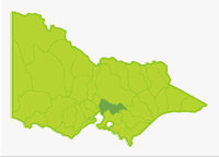
The Basin extends 120 km from forested mountains in the east to the City of Melbourne with its northern boundary formed by the Great Dividing Range. The Yarra River originates upstream of the Upper Yarra Reservoir in steep forest, with an annual rainfall more than 1,400 mm. This section is a declared water catchment and is closed to fishing. Downstream the river flows for 110 km through a variety of terrain with rainfall decreasing from 1,000 mm at East Warburton to 700 mm in the middle reaches near Yarra Glen and then to 600-700 mm in the lower reaches through Melbourne City.
Much of the terrain is forested upstream of Warburton and there are numerous small tributaries providing some fishing for small-sized fish. Flow in the Yarra and some tributaries is highly regulated because of large urban water storages. Six of these, Maroondah, O'Shannassy, Silvan, Toorourong, Upper Yarra and Yan Yean Reservoirs are closed to fishing. Sugarloaf (Winneke Reservoir) at Christmas Hills is open to fishing with some restrictions. Flow at Warrandyte is now about half the natural flow regime. Total Basin area is 4,096 km2, 42% is forested, 14% urbanised and 44% agricultural land.
Freshwater Fish in the Basin
Native species
- (Large fish): Australian bass, Australian grayling, #freshwater catfish, #golden perch, #Macquarie perch, #Murray cod, river blackfish, short-finned eel and Yarra spiny crayfish.
- (Small fish): Australian smelt, bluespot goby, climbing galaxias, common galaxias, congoli, eastern dwarf galaxias, flathead gudgeon, mountain galaxias, pouch lamprey, shorthead lamprey, smallmouth hardyhead, trout galaxias, southern pigmy perch, #Tasmanian mudfishand #*Yarra pygmy perch.
The spiny crayfish Euastacus wolwuru which has no common name is also present.
Introduced species
- Brown trout, European carp, goldfish, eastern gambusia, oriental weatherloach, rainbow trout, redfin and roach.
Native species in bold are protected in this Basin. Introduced species in bold are declared noxious.
# These are introduced native fish, indigenous to the Murray River system.
* Yarra pygmy perch were last recorded in 1872.
The Yarra Basin contains the largest variety of fish species occurring in any Basin in Victoria.
Management
See Introduction for information on Management Agencies and Programs.
The Victorian Fisheries Authority
- manages stocking, fisheries policy, compliance with fisheries regulations and contact with anglers.
- Fisheries Management Plan (FMP) (a recent project that provides recreational anglers, government agencies and other stakeholders with clear guidance on fisheries management issues with a regional area over a five year period).
A FMP for waters within this Basin has been completed and was declared in November 2009. It can be viewed on the website.Fisheries Victoria Management Report Series. Port Phillip and Western Port Management Plan. No. 69. November 2009. - Stocking Program (stocking plans for desirable species are based on an approved Victorian Fisheries Authority stocking policy and are reviewed annually via Vic Fish Stock). In this Basin, all the rivers carry self-sustaining populations of fish and, with the exception of the Family Fishing Lakes, stocking is not considered necessary.
Up-to-date information on numbers and size of each species stocked can be found under Fish Stocking in the Fisheries and Aquaculture section of this website or in the annual Vic Fish Stock Report published by the department. - Family Fishing Lakes Program (an ongoing project of stocking small waters within urban areas with larger trout, for junior and disabled anglers – see Introduction for further information). The waters within this basin are Caulfield Racecourse Dam, Emerald Lake, Jack Roper Reserve, Roxburgh Park and Yarrambat Park Lake.
- Premier Lakes Program (five Family Fishing Lakes in the State have been selected as Premier Lakes. They will have access for all anglers and be provided with facilities such as toilets, BBQs, picnic tables and playground equipment to encourage families and new anglers to go fishing. They will be stocked with large {>1kg} rainbow trout – see Introduction for further information) The Premier Lake in this Basin is Lillydale Lake.
- Victorian Stream Classification (a project that was completed in November 2010, which classifies each water as a native, salmonid or mixed fishery). Classifications relevant to this basin are:
- Trout - Yarra and tributaries upstream of Launching Place including Don, Hoddles and Dee creeks and Little Yarra and tributaries from Yarra Junction.
- Mixed - Yarra and tributaries from Melba Highway Warburton including Woori Yallock, McCrae, Shepphard, New Chum and Paul creeks.
- Native - Yarra and tributaries from estuary to Melba Highway. Maroondah Reservoir and Badger Creek area around Healesville.
Port Phillip and Westernport Catchment Management Authority
- is responsible for catchment management
Melbourne Water
- manage drainage, waterways, and floodplains, urban water supply for most of the Basin and the River Health Program.
- Victorian River Health Program (an on-going State Government initiative to achieve healthy rivers, streams and floodplains). Major activities are erosion control, bed and bank stabilization, willow and other weed control, restoration of native vegetation, re-establishing fish habitat and improving fish movement. These have been carried out on the Plenty, Watts and Yarra Rivers and the Diamond, Olinda and Woori Yallock Creeks.
Melbourne Water & Gippsland and Southern Rural Water
- manage urban and rural water respectively and the development of Stream Flow Management Plans.
- Stream Flow Management Plans (an ongoing project in which various agencies and water users develop a flow sharing arrangement which ensures an adequate environmental flow allocation for each river in Victoria). In this Basin, streamflow management plans have been developed for Diamond Creek, Hoddles Creek, Olinda Creek, Stringy Bark Creek, Pauls Creek, Steels Creek, Dixon Creek. A plan for the Plenty River has been approved and plans have been drafted for the Woori Yallock and Little Yarra Rivers.
Best Fishing Waters
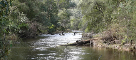
The Yarra River provides almost all the best angling in the Basin; for river blackfish above Warburton, and for brown trout from Warburton to Launching Place. There are several small lakes within the Melbourne area which provide angling, particularly for European Carp, roach and redfin.
Several of these (listed in the Family Fishing Lakes section above) are stocked with trout. They provide an excellent opportunity to introduce children to fishing, with a good chance of catching a fish. Use bread or corn for bait for the European carp and roach. The Yarra River around Eltham is also a good area for beginners to learn to fish.
Macquarie perch and Murray cod are readily caught in the Warrandyte area. Both species were introduced into the Yarra Basin at various times since Edward Wilson arranged the first translocation from the King Parrot Creek to the Plenty River in 1857.
Special Values
Heritagen River Areas
The Yarra River from Warburton to Templestowe is listed as a Heritage River Area.
Natural Catchment Areas
The upper reaches of the O'Shannassy River.
Threatened Fish Species
The Tasmanian mudfish, Australian grayling, eastern dwarf galaxias Macquarie perch, Murray cod and Yarra pygmy perch are listed as threatened species in Victoria. (Department of Sustainability and Environment [DSE] Dec. 2007). A list of Victorian threatened species together with scientific names of species and a definition of the terms used and their national status is available on the DSE web site.
Species in bold type are also listed under the Flora & Fauna Guarantee Act 1988. These species cannot be taken or kept within Victoria without an appropriate written order, licence or permit. Such an order has been made to allow anglers to take Macquarie perch and Murray cod within the Yarra Basin.