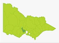
Moorabool
- Bannockburn Lagoon
- Bolwarrah Reservoir
- Bostock Reservoir
- Bungal Dam
- Hovell Creek
- Hunts Reservoir
- Korweinguboora Reservoir
- Lal Lal Reservoir
- Lethbridge Lake
- Little River
- Moorabool Reservoir
- Moorabool River
- Stony Creek Reservoirs
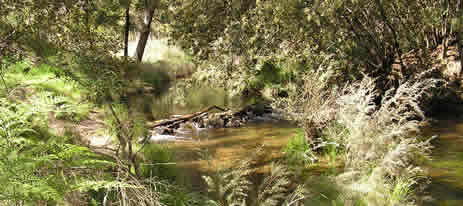
This is a small basin with one major river (the Moorabool) and a number of reservoirs with restricted access. The Moorabool River rises as two major tributaries on the southern slopes of the Great Dividing Range near Ballan and flows in a southeast direction joining the Barwon River near Geelong. There is intensive, irrigated cropping in the headwaters, but most of the river flows through open farmland used for grazing and broad acre cropping.
There are three quite large areas of low, mixed species forest in the middle reaches of the Moorabool River. The upper half of the river flows through gentle to moderate hills derived from granites and sedimentary rock. The lower half, downstream of Meredith, flows through flat terrain composed of volcanic rocks and finely textured unconsolidated soils. Annual rainfall decreases from 700-1,000 mm in the headwaters to 500-600 mm in the middle/lower reaches.
Flow in the Moorabool River is controlled by releases from Lal Lal Reservoir (Bungal Dam) and Bostock Reservoir. These reservoirs, located in the upper reaches, together with the low rainfall in the northern area of the Basin result in low flow in the southern streams during summer and autumn. Some waters in this Basin are commercially fished for short-finned eel.
Freshwater Fish in the Basin
Native species
- (Large fish): Australian grayling, river blackfish and southern shortfin eel.
- (Small fish): Australian smelt, bluespot goby, common galaxias, congoli, flathead gudgeon, mountain galaxias, smallmouth hardyhead, trout galaxias and southern pigmy perch.
Introduced species
- Brown trout, eastern gambusia, European carp, goldfish, rainbow trout, redfin and roach.
Native species in bold are protected in this Basin. Introduced species in bold are declared noxious.
Management
See Introduction for information on Management Agencies and Programs.
The Victorian Fisheries Authority
- manages stocking, fisheries policy, compliance with fisheries regulations and contact with anglers.
- Fisheries Management Plan (FMP) (a recent project that provides recreational anglers, government agencies and other stakeholders with clear guidance on fisheries management issues with a regional area over a five year period).
A FMP for waters within this Basin has been completed and was declared in November 2009. It can be viewed on the website. Fisheries Victoria Management Report Series.Port Phillip and Western Port Management Plan. No. 69. November 2009. - Stocking Program (stocking plans for desirable species are based on an approved Victorian Fisheries Authority stocking policy and are reviewed annually via Vic Fish Stock). Bostock Reservoir is the only water regularly stocked; all other waters carrying self-sustaining populations of fish, and stocking is not considered necessary.
Up-to-date information on numbers and size of each species stocked can be found under Fish Stocking in the Fisheries and Aquaculture section of this website or in the annual Vic Fish Stock Report published by the department. - Family Fishing Lakes Program (an ongoing project of stocking small waters within urban areas with larger trout, for junior and disabled anglers – see Introduction for further information). The waters in this basin are Bannockburn Lagoon and Lethbridge Lake.
- Victorian Stream Classification (a project that was completed in November 2010, which classifies each water as a native, salmonid or mixed fishery). Classifications relevant to this basin are:
- Mixed- all waters.
Corangamite Catchment Management Authority
- is responsible for catchment management and the River Health Program.
- Victorian River Health Program (an on-going State Government initiative to achieve healthy rivers, streams and floodplains).Major activities are erosion control, bed and bank stabilization, willow and weed removal, fencing and replanting banks; with activities mainly on the Moorabool River.
Gippsland and Southern Rural Water
- manages rural water diversion for irrigation/stock use and the development of Stream Flow Management Plans.
- Stream Flow Management Plans (an ongoing project in which various agencies and water user's develop a flow sharing arrangement which ensures an adequate environmental flow allocation for each river in Victoria). A streamflow management plan is being developed for the Moorabool River.
Barwon Water & Central Highlands Water
- manage urban water.
Best Fishing Waters
| Water | Target Species |
|---|---|
| Bostock Reservoir | Trout, redfin, European carp |
| Moorabool Reservoir | Trout |
| Moorabool River between Morrisons & Sheoaks | Brown trout |
Special Values
Representative Rivers
The east branch of the Moorabool River has been listed as a Representative River of volcanic plains, west Victorian dissected uplands.
Ramsar Sites
(wetlands of international significance, Convention on Wetlands, Ramsar, Iran 1971).
Parts of the western shore of Port Phillip and associated wetlands.
Threatened Fish Species
The Australian grayling is listed as a threatened species in Victoria. (Department of Sustainability and Environment [DSE] Dec. 2007). A list of Victorian threatened species together with scientific names of species and a definition of the terms used and their national status is available on the DSE web site.
Species in bold type are also listed under the Flora & Fauna Guarantee Act 1988. These species cannot be taken or kept within Victoria without an appropriate written order, licence or permit.