Corangamite - Angling Waters
View Corangamite Basin in a larger map (opens in new window).
The above map is provided by Google. The department accepts no responsibility for its accuracy or content.
Bullen Merri Lake, Camperdown

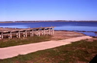
490 h. 276,500 ML. Boat ramps, toilets and picnic area at the South Beach Reserve, disabled fishing, excellent bank fishing.
A very deep, brackish lake enclosed in a volcanic crater. The water level has been gradually receding for the past 150 years. The lake is zoned for a range of boating activities.
There is vehicle access to the south and north beaches and an unsealed road around the western and northeastern sides of the lake. Access along the eastern shore is only by foot. Bank restoration works have been carried out as part of the River Health Program. A floating fishing platform is to be installed at the southern end funded by Recreational Fishing Licence revenue. The high nutrient levels and high pH (alkalinity) of the water have led to the lake having a long history of fish deaths, particularly during spells of hot, dry, still weather.
Historically, the lake was stocked with rainbow trout and Chinook salmon and in years when fish deaths did not occur, growth rates were spectacular with rainbow trout to 7 kg and Chinook salmon to 12 kg.
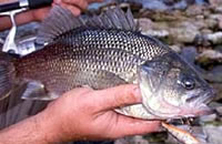
Golden perch and silver perch were stocked in the late 1990's with little success. A trial with Australian bass is currently in progress. They have survived but growth rates have been slow, with fish taking over 4 years to reach the legal minimum size of 27 cm. Brown trout and rainbow trout are stocked annually.

Chinook salmon are released when they are available and Atlantic salmon has sometimes been used as an alternative. The last release of Atlantic salmon was in 2005. The lake fishes well from the bank in the early morning and from boats at any time. The salmonids (trout and salmon) are usually taken near the shore only during the cooler times of the year and generally under low light conditions.
Common baits are mudeye and minnows for the trout species and whitebait and minnow for the salmon. The trout move into deeper and cooler water during the hotter times of the year making them difficult to reach with standard fishing tackle and a down-rigger and a good depth sounder are valuable tools for locating and reaching the fish.
The lake usually stratifies at about 20 m during the warmer months (January-April) and we recommend that you fish just above the thermocline. A wide range of lures are successful at slow trolling speeds. Contains brown trout to 4 kg, (av. 2 kg), rainbow trout to 2.5 kg, (av. 1-1.5 kg), Chinook salmon and a few Australian bass averaging over 1 kg. Also contains flathead gudgeon and common galaxias.
Colac Lake, Colac
2,425 ha. 70,250 ML. Boat ramp at the southern end.
A large shallow lake surrounded mainly by farmland and bordered by the city of Colac on its southern shore, mud and sand bottom with basalt outcrops. River Health Program works have been undertaken to restore banks. High summer water temperatures. Meredith Park is a popular fishing area.
When conditions were suitable, it contained abundant redfin to 2 kg, (av. 400 g), short-finned eel, European carp, tench, goldfish, common galaxias, flathead gudgeon and Australian smelt. It was a very popular lake for redfin fishing. A good fishing method for redfin was to fish on the bottom with Australian smelt or common galaxias as bait. These fish could be caught in the lake with a recreational bait net.
Colongulac Lake, Camperdown
1,415 ha. 32,000 ML. Ramsar listed.
A shallow lake surrounded by grazing land, scoria bottom. Water is often turbid. Small boats can be launched at the northern end. Contains short-finned eel and common galaxias. Surveys in 2000 failed to catch any brown trout and rainbow trout from earlier releases.
Coragulac Lake, Colac
36 ha. 1,100 ML.
A very shallow lake in a volcanic crater. High summer water temperatures and carries no fish.
Corangamite Lake, Colac
23,300 ha. 710,000 ML. Ramsar listed.
A very large saline lake lying in a basalt depression formed when a lava flow blocked the drainage system, surrounded by flat farmland. Contains short-finned eel, common galaxias, flathead gudgeon and smallmouth hardyhead. The best area for netting bait is around Wool Wool. The small inflowing creeks such as Gnarkeet Creek contain eastern gambusia, Australian smelt, southern pygmy perch, common galaxias and Yarra pygmy perch.
Ettrick Lake
See Tooliorook Lake
Gnarpurt Lake, Lismore
2,200 ha. 70,300 ML. Ramsar listed.
A shallow saline lake surrounded by grazing land. Very turbid water with fine, grey volcanic mud bottom. Carries short-finned eel and common galaxias. Rainbow trout sometimes enter the northwest corner of the lake via the channel that takes the overflow from Lake Tooliorook in wet years. The lake was completely dry in 2008.
Jubilee Dam, Newtown
1 ha.
A shallow dam surrounded by forest and contains small redfin. Bank fishing only permitted. Two fishing platforms have been funded from Recreational Fishing Licence revenue.
Lismore Golf Course Dam, Lismore
2 ha.
An old domestic water storage situated at the western end of the town, just north of the highway (turn at the concrete water tower). Bank fishing only permitted. Contains redfin to 450 g and some short-finned eel. Was previously stocked with a small number of rainbow trout each year. Has not been stocked since 2000.
Tooliorook Lake, Lismore

40 ha. 14,600 ML. Also called Ettrick Lake. Boat launching ramp.
Surrounded by farmland, sand bottom and abundant aquatic weed. The water is often turbid because of wave action on the banks. A very popular water with locals and becoming increasingly popular with touring anglers. Contains redfin to 1.8 kg, (av. 500 g), brown trout and rainbow trout to 2-3 kg, (av. 600 g), short-finned eel, Australian smelt and flathead gudgeon. Many of the fish are infested with a red worm (Eustrongyloides) which is not harmful to humans.
The connecting channel to Lake Gnarpurt can carry good trout when the lake overflows. Fishing success varies greatly with the weather and water conditions but is generally good. Best baits are worms and mudeye.
Tooliorook Lake filled rapidly after the abundant rain in 2010. As a result stocking was resumed with 10,000 rainbow trout in November 2010.
Woady Yaloak River, Cressy
Rises in forested hills then flows through flat farmland. Some riparian trees in the upper section and the Catchment Management Authority has been controlling willows, protecting banks and replanting with native species. Substrate is mud, sand and gravel. The water is turbid from bank erosion. Sedimentation and low summer flows have resulted in dense aquatic vegetation. Access is difficult because of private property. The best fishing is upstream of Cressy. Contains brown trout (small in the headwaters but up to 2 kg around Cressy), redfin to 750 g, short-finned eel, abundant river blackfish to 400 g, tench, goldfish, mountain galaxias, Australian smelt, common galaxias, eastern gambusia, flathead gudgeon and Yarra pygmy perch.
