Locations
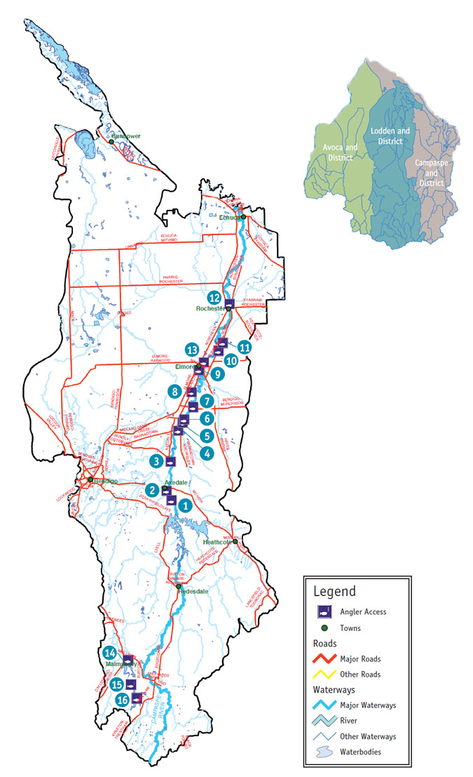
1. Doakes Reserve
The road to, and parking at this site is good and can be accessed in a 2WD in any weather conditions. The bank slope is steep and access to the water is moderate. Picnic tables are available at the site. The turn off is located 20km East of Bendigo off the Mc Ivor Highway. Follow Mitchell Street (Axedale) for 1km, followed by the Kimbolton-Axedale Road for 3km and an unnamed road for 600m to access this site.
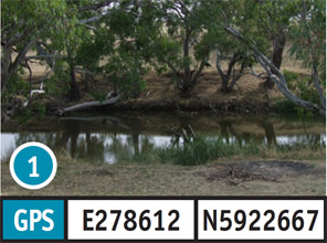
2. Axedale Reserve
The road to, and parking at this site is good and can be accessed in a 2WD in any weather conditions. The bank slope and access to the water is moderate. Picnic tables are available at the site. The turn off to this site is located 23km East of Bendigo along the McIvor Highway. Turn into William Street (Axedale) for 400m to access this site.
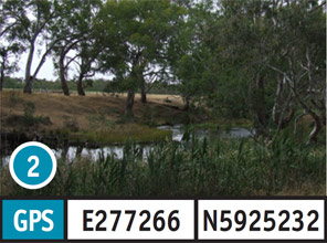
3. Russells Bridge
The road to, and parking at this site is good and can be accessed in a 2WD in any weather conditions. The bank slope is steep and access to the bank water is moderate. The turn off to this site is located 21km East of Bendigo along Mc Ivor Highway. Take the Axedale-Goornong Road for 7.5km then River Road for 500m to access this site.
4. Barnadown Bridge
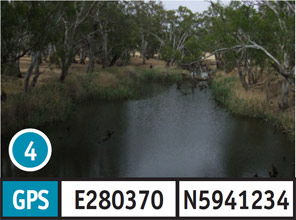
The road to, and parking at this site is good and can be accessed in a 2WD in any weather conditions. The bank slope is moderate to steep and access to the water is moderate. Camping is permitted. The turn off to this site is located 21km East of Bendigo along the Mc Ivor Highway. Take the Axedale-Goornong Road for 15.5km, followed by Sandy Creek-Barnadown Road for 1.7km, and the Barnadown Knowsley Road for 300m to access this site.
5. Rocky Crossing
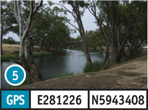
The road to, and parking at this site is good and can be accessed in a 2WD in any weather conditions. The bank slope is steep and access to the water is moderate. Camping is available. The turn off to this site is located 21km East of Bendigo along the Mc Ivor Highway. Take the Axedale-Goornong Road for 15.5km, followed by Sandy Creek-Barnadown Road for 1.7km, Elmore-Barnadown Road for 2km, and Rocky Crossing Road for 1km to access this site.
6. Englishs Bridge
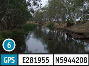
The road to, and parking at this site is good and can be accessed in a 2WD in any weather conditions. The bank slope is flat and access to the water is moderate. Picnic tables and a fireplace/BBQ are available. Camping is permitted. The turn off to this site is located 21km East of Bendigo along the Mc Ivor Highway. Take the Axedale-Goornong Road for 15.5km, followed by Sandy Creek-Barnadown Road for 1.7km, Elmore-Barnadown Road for 3km, and English Bridge Road for 1.6km to access this site.
7. Runnymede
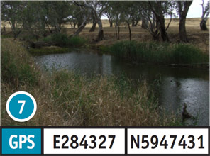
The road to this site can be accessed in a 2WD vehicle in any weather conditions. Access and parking at this site in a 2WD vehicle in dry weather only. The bank slope and access to the water is moderate. There are no facilities available at this site. The turn off to this site is located 35km North-East of Bendigo along the Midland Highway. Take the Bendigo-Murchison Road for 4km to access this site.
8. Avonmore Reserve
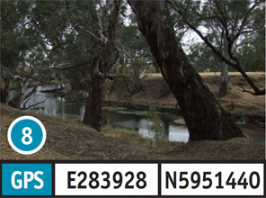
The road to, and parking at this site should only be attempted in a 2WD vehicle in dry weather conditions. The bank slope and access to the water is moderate. Camping is available at this site. The turn off to this site is located 35km North-East of Bendigo along the Midland Highway. Take the Bendigo Murchison Road for 1.3km, followed by Elmore Barnadown Road for 4.2km, then an unnamed road for 300m to access this site.
9. Elmore Reserve
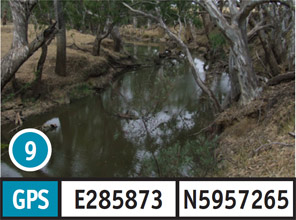
The road to, and parking at this site should only be attempted in a 2WD vehicle in dry weather conditions. The bank slope and access to the water is moderate. Camping is available at this site. The turn off to this site is located 35km North-East of Bendigo along the Midland Highway. Take the Bendigo Murchison Road for 1.3km, followed by Elmore Barnadown Road for 10.3km, then Potters Lane for 1km to access this site.
10. Aysons Reserve
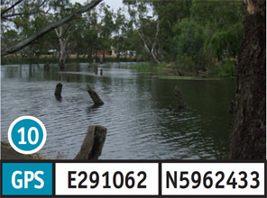
The road to, and parking at this site is good and can be accessed in a 2WD in any weather conditions. The bank slope is flat and access to the water is moderate. The facilities available are toilets, picnic tables and fireplace/BBQ. Camping is permitted. The turn off is located 51km North-East of Bendigo along the Midland Highway. Take the Burnewang Road for 3.5km to access this site.
11. Elmore Weir
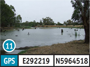
The road to this site can be complete in a 2WD vehicle in any weather conditions. The access and parking at this site should only be done in a 2WD vehicle in dry weather conditions. The gravel boat ramp should only be attempted in a 4WD vehicle. The bank slope and access to the water is moderate. There are no facilities available. The turn off is located 51km North-East of Bendigo along the Midland Highway. Take the Burnewang Road for 4.3km, followed by Bonn Road for 1.8km and Speers Road for 3.0km to access this site.
12. Rochester Boat Ramp
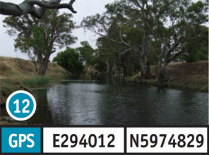
The road to, and parking at this site is good and can be accessed in a 2WD in any weather conditions. There is a dirt boat ramp that can be accessed in a 2WD vehicle in any weather conditions. The bank slope and access to the water is moderate. There are no facilities available. The turn off is located 46.4km North-East of Bendigo along the Midland Highway. Take the Northern Highway for 17.4km, and then Ramsay Street for 1.2km to access this site.
13. Elmore Boat Ramp
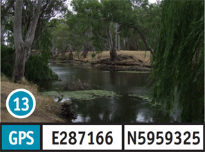
The road to this site can be undertaken in a 2WD vehicle in all weather conditions. Access and parking is suitable for a 2WD vehicle in dry weather conditions. The dirt boat ramp should only be accessed in a 2WD vehicle in dry weather conditions. The bank and access to the water is moderate. There are no facilities available. The turn off to this site is located 46.4km North East of Bendigo along the Midland Highway. Take the Northern Highway for 1.3km, followed by Burnewang Street for 900m to access this site.
14. Malmsbury Reserve
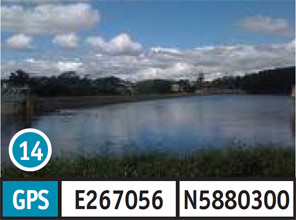
The road to, and parking at this site is good and can be accessed in a 2WD vehicle in any weather conditions. The bank slope and access to the water is moderate. Toilets, picnic tables and fireplace/ BBQ are available. The turn off is located 53km South of Bendigo along the Calder Highway. Take the Daylesford Road for 400m, followed by Sullivan Street for 250m, and an unnamed Road for 300m to access this site.
15. Lauriston Reserve
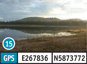
The road to, and parking at this site is good and can be completed in a 2WD vehicle in any weather conditions. The bank slope is flat to moderate and access to the water is moderate. Toilets, picnic tables and fireplace/BBQ are availabe. The turn off to this site is located 59km South of Bendigo along the Calder Highway. Take Burton Avenue for 2km, followed by Lauriston Road for 2.6km, Keegan Road for 1.6km, and an unnamed Road for 1km to access this site.
16. Upper Coliban
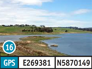
The road to, and parking at this site is good and can be completed in a 2WD vehicle in any weather conditions. The bank slope is moderate to steep and access to the water is moderate. Picnic tables are provided. The turn off to this site is located 59km South of Bendigo along the Calder Highway. Take Burton Avenue for 2km, followed by Harts Lane for 3.2km, and Kyneton-Springhill Road for 4.0km to access this site.